Justin CowartMay 07, 2018

Refreshing the Viking Orbiter views of Mars

A few years ago, I ran across a copy of NASA Special Publication 441, Viking Orbiter Views of Mars, at the Prairie Archives in Springfield, IL. This book was originally published in 1978 to highlight the discoveries that the Viking program was in the process of making. As I flipped through the pages, I saw hundreds of spectacular images ranging from birds’ eye views of the entire planet, to the weather, and to the seasonal heartbeat of the polar ice caps. And I wondered to myself – why hadn’t many of these images been reprocessed? They were fuzzy, grainy and oversaturated. Mosaics, painstakingly and lovingly constructed with paper and scissors, showed seams that often made interpretation of details difficult. These were postcards from the Solar System – a tourist’s idea of what other planets were like, but clearly not the experience of being there.

I am fond of the Viking missions. Their orbits took them far above Mars (as far as 56,000 kilometers from the surface), giving them the ability to take sweeping images of entire hemispheres. Modern missions mostly don’t stray so far from Mars’ surface, and can’t fully capture the same sweeping vistas captured by the Viking Orbiters. (Mars Express, which rises a little over 10,000 km from the surface at the highest point in its orbit, can come close, but only Mars Orbiter Mission occasionally gets full-disk views in high resolution.) Also, as reconnaissance spacecraft, the Viking orbiters were designed to study the broader weather and climatological patterns of the Martian atmosphere in a way that the close-up imaging provided by current missions can’t match.

In a way, Viking images are refreshing. They don’t show the topographies of a dead world, but a planet with active weather (even if that weather is tame in comparison to Earth’s). And so, I decided to work on bringing the images in Viking Orbiter Views of Mars into the digital age. I began with the raw data archived by NASA and used Photoshop to rescue some of the beautiful images from obscurity. After a few years of working with Viking imagery, it’s stunning to see how well the analog tube cameras still compare to the digital cameras that modern spacecraft are equipped with. Here’s some of what I’ve found:
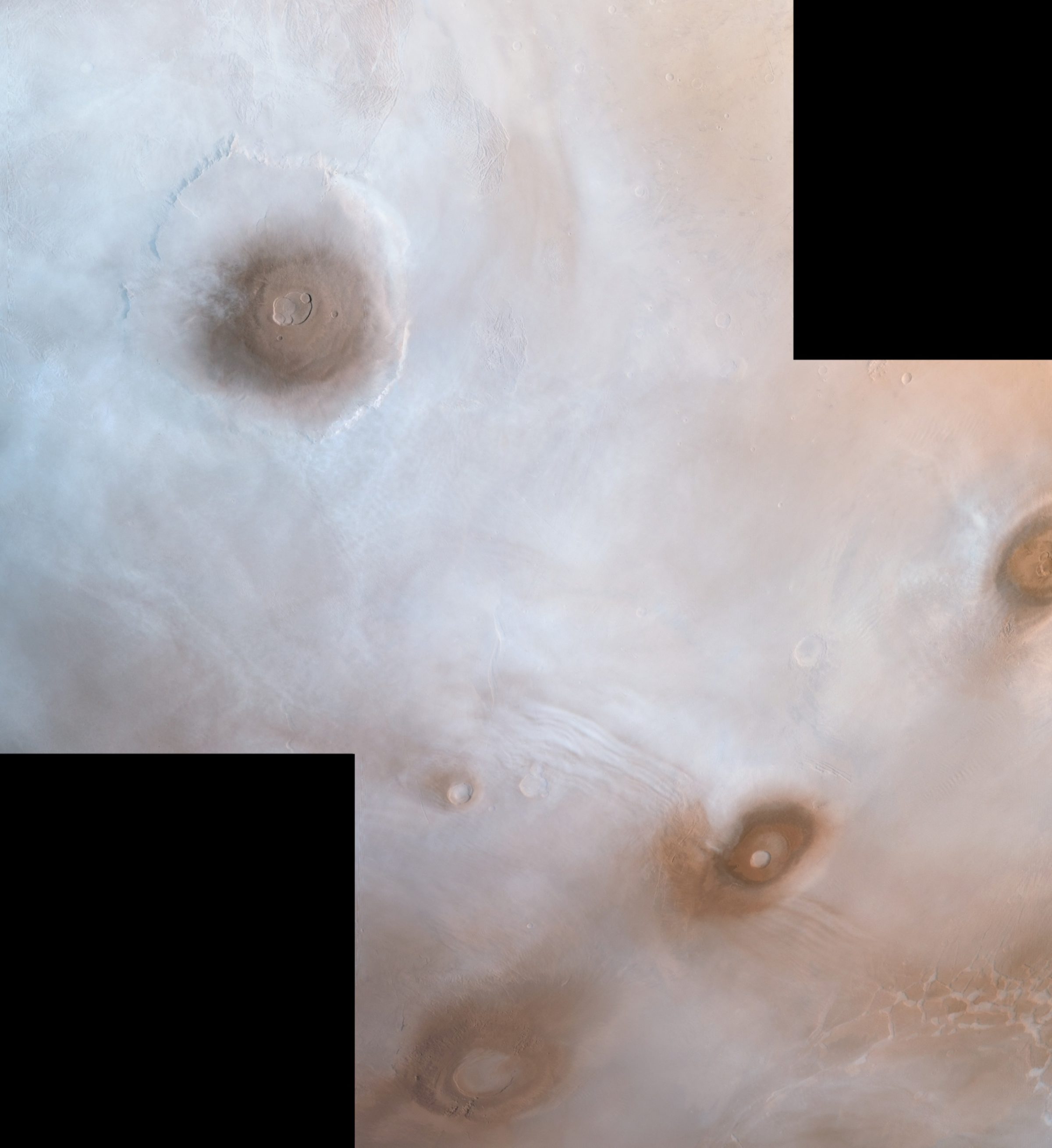
Viking Orbiter view of the northwestern Tharsis plateau
Viking Orbiter view of the northwestern Tharsis plateau Viking Orbiter view of the northwestern Tharsis plateau, with the three Tharsis Montes at bottom left (from top to bottom: Ascraeus Mons, Pavonis Mons, and Arsia Mons) and Olympus Mons at top right. The mountains are shrouded in the aphelion cloud belt, a thin layer of water ice crystals that form over the Tharsis Plateau when Mars is furthest from the Sun. This image was taken near midday, when the clouds had yet to sublimate in the afternoon warmth. This image was taken on June 24, 1978, on Viking Orbiter 1's 735 revolution around Mars.Image: NASA / JPL / USGS / Justin Cowart

This is a lovely shot of the Tharsis Montes (Olympus Mons at upper left, and Ascraeus, Pavonis, and Arsia Mons from top to bottom, respectively, at lower right). This image, taken on June 24, 1978, captures Mars near its furthest point from the Sun. This period, known as aphelion, is accompanied by the formation of thick water ice clouds over the Tharsis region called the aphelion cloud belt. The tops of the mountains are in clear sky because they stand above most of the atmosphere. Their altitude influences the regional wind patterns, leading to standing waves in the clouds around Pavonis Mons, and the formation of lee clouds around the peaks of Ascraeus and Olympus Mons.
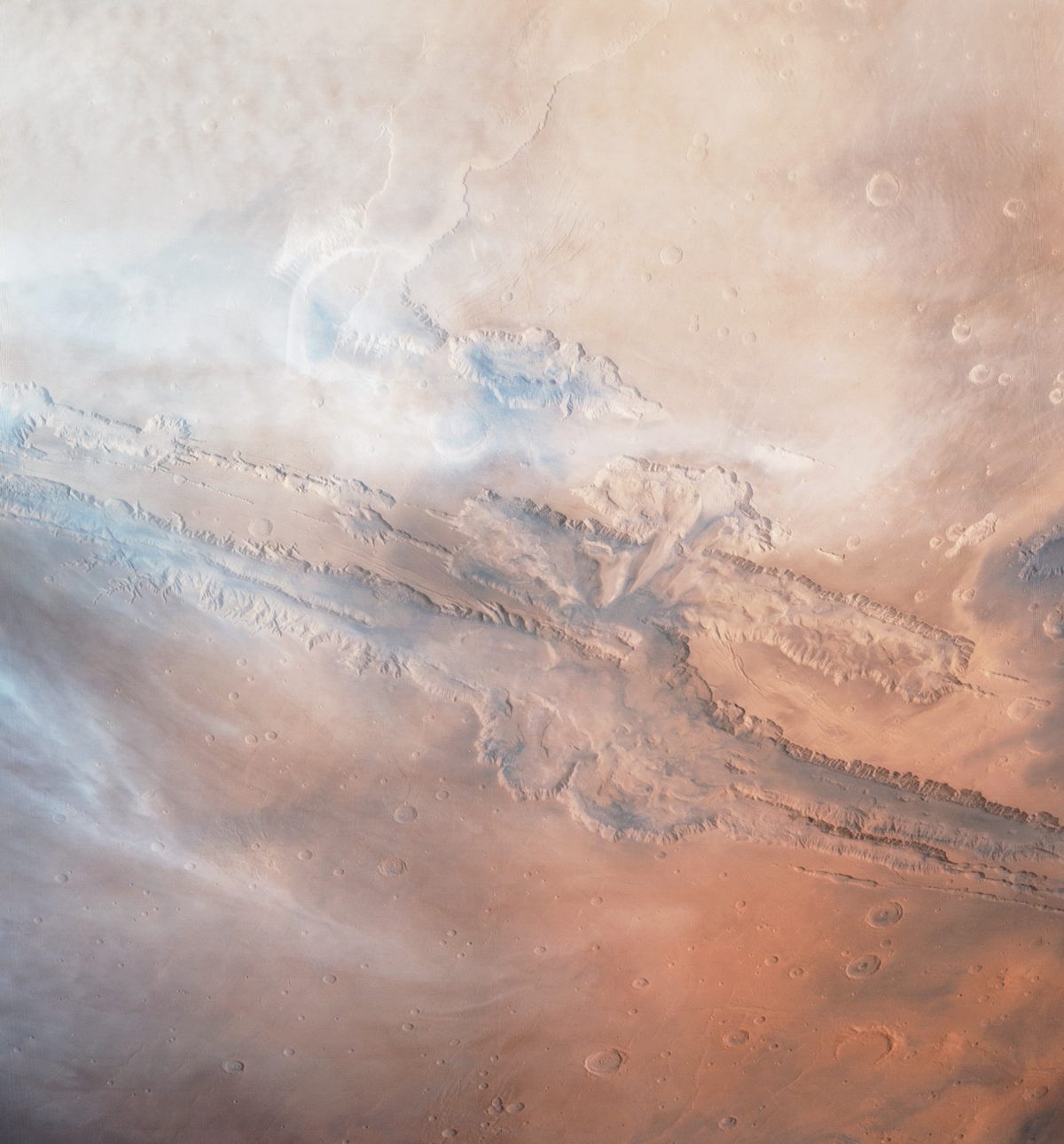
Viking Orbiter 1 - Valles Marineris
Viking Orbiter 1 - Valles Marineris This color image of a cloudy afternoon over the Valles Marineris canyon system was captured by NASA's Viking Orbiter 1 during its 701st orbit of Mars, on Sept. 29, 1979. The image was constructed using pairs of red and violet filter images that were taken by the spacecraft, with the green channel of this image formed by a 40/60 blend of the two images, respectively.Image: NASA / JPL / USGS / Justin Cowart

Here’s a shot of wispy cirrus clouds drifting over the Valles Marineris canyon system. This image, taken on September 29, 1979, was taken shortly after the beginning of northern spring. These water ice clouds are early harbingers of the aphelion cloud belt, which reaches its peak density in the northern mid-summer.
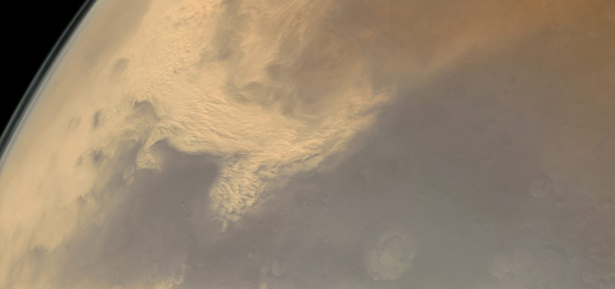
Dust Storm over Thaumasia
Dust Storm over Thaumasia Viking image mosaic of the beginnings of the 1977 Mars global dust storm. In this mosaic, a regional dust storm is sweeping south off the Thaumasia Plateau. This storm began in the polar Acidalia Planitia region and swept south across Valles Marineris towards the Argyre impact basin. Upon reaching the Martian southern highlands it exploded in size. This is a typical storm track for global dust storms. This image was acquired on February 17, 1977, during Viking Orbiter 2's 176th revolution around Mars. The mosaic makes use of three pairs of RED/VIO filter images.Image: NASA / JPL / USGS / Justin Cowart

Dust storms are probably the most famous aspect of Martian weather, and for good reason. These storms frequently shroud the entire planet for months on end, and a storm in 2007 almost spelled the end for the Opportunity mission, which is still trucking along 11 years after its near-death experience! This image, taken on February 17, 1977, captures the beginning of one such global dust storm. The typical storm track for regional dust storms begins in the northern polar plains of Acidalia Planitia, dropping due south along the eastern edge of the Valles Marineris canyons. This storm is moving across the eastern edge of Thaumasia Planum, a region that makes or breaks a global dust storm. Most storms in this region peter out in this high, rugged terrain. Occasionally a storm, such as this one, will manage to survive the traverse and become turbocharged as it descends off the high plateau where Thaumasia Planum is located. Within days of this image, Mars was enshrouded in a thick dust cloud.

Viking also returned a few gorgeous regional images. They don’t show anything of particular interest, but I enjoy these image sets for their birds-eye view of the Martian surface.
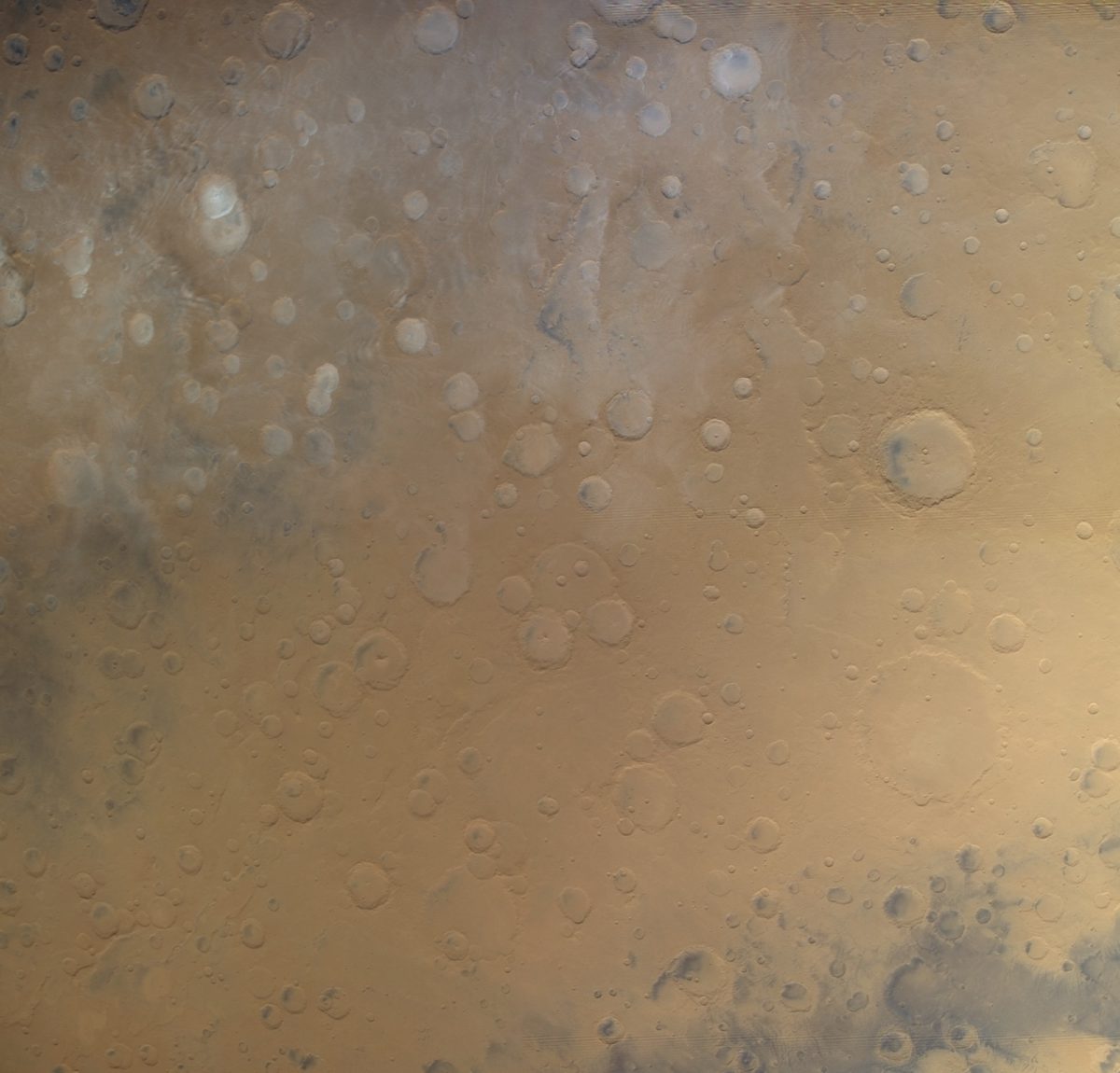
Eastern Noachis Terra - Viking 1
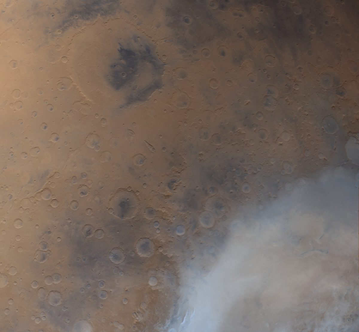
Eastern Noachis Terra - Viking 1 This image of Mars is a 4-frame color mosaic taken by Viking Orbiter 1. This mosaic covers some of the oldest terrain on the Martian surface, eastern Noachis Terra. This image is taken looking south across Noachis Terra. Subtle parallel valleys can be seen at top center. These represent faults that opened up following the Hellas Basin impact. This enormous impact ejected so much material that the crust over 2000 km away slumped inwards to fill the hole. Water ice clouds can also be seen in this picture. A few, especially in the top left corner, form a distinctive wavelike pattern. These are called gravity waves, which form after air is forced to rise over the rims of craters. These wakes form on the lee side of craters, giving us a clue as to the direction of air flow in this region.Image: NASA / JPL / USGS / Justin Cowart
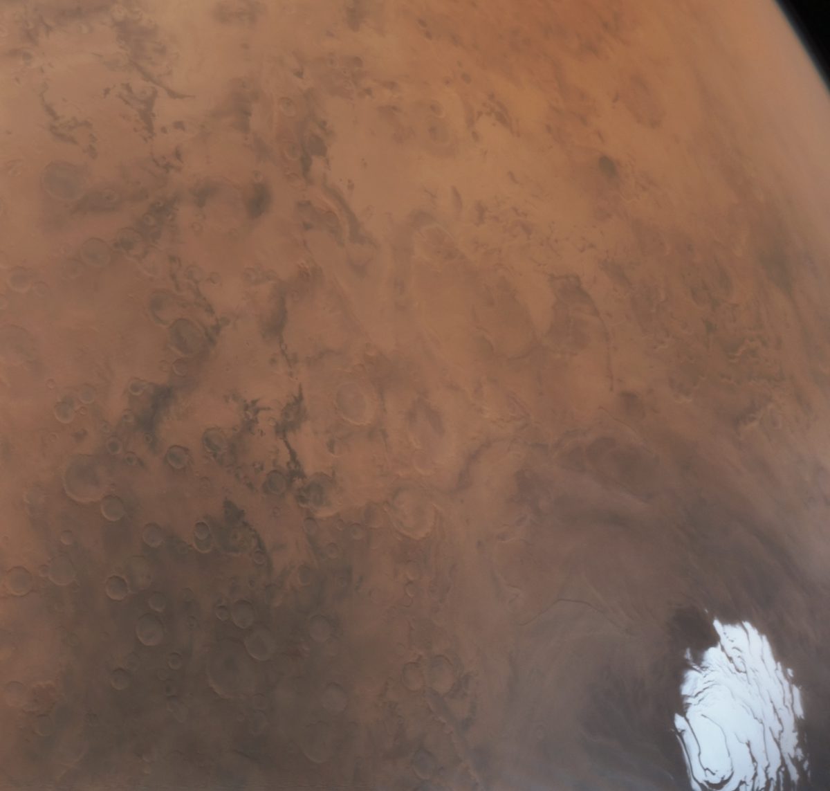
South Polar Monitor - Viking 2
South Polar Monitor - Viking 2 Viking Orbiter 2 image of the southern polar plains and polar ice cap, taken as part of a regular climate monitoring program. This image was taken late in the southern summer, when the polar cap had reached its minimum extent for the year. A faint veil of water ice clouds is visible in the lower right corner over the southern polar icecap. This image was taken by Viking 2 on August 11, 1977, during Viking Orbiter 2's 356th orbit of Mars.Image: NASA / JPL / USGS / Justin Cowart
Viking Orbiter 2 - Southern Hemisphere Monitoring
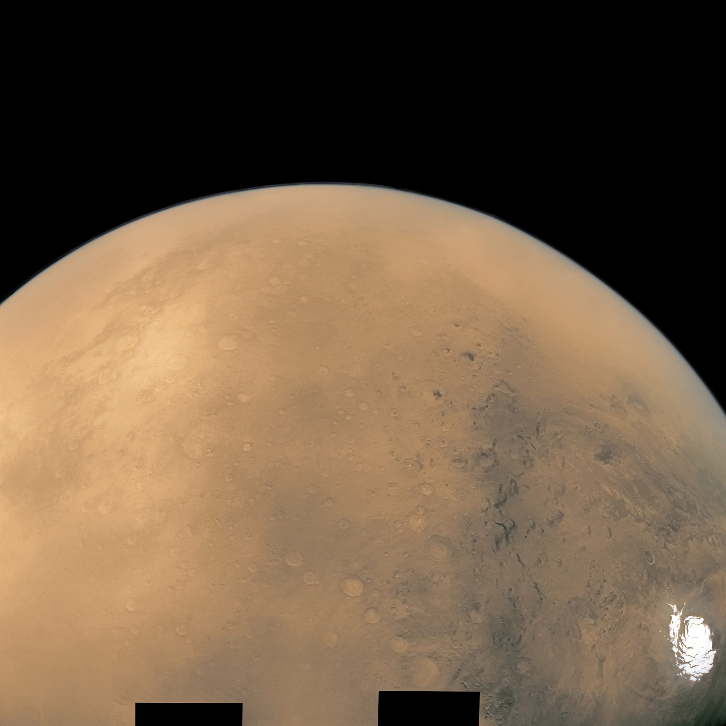
Viking Orbiter 2 - Southern Hemisphere Monitoring 36-frame mosaic of Mars' southern hemisphere, taken on August 8, 1977 from an altitude of approximately 30,000 km. This image is in pseudo-true color, developed from a monochrome RED filter mosaic taken over the span of a few minutes by Viking Orbiter 2. A small patch of missing data along the horizon at upper right has been filled in for aesthetic purposes. The mosaic is centered on Noachis Terra. North is to the left. The dark Terra Sabaea and light southern Arabia Terra are visible at top left. The Hellas Basin, shrouded in dust, is visible along the horizon at top right. Nearing its minimum summer extent is the southern ice cap at bottom right.Image: NASA / JPL / USGS / Justin Cowart
Southern Sabaea Terra - Viking Orbiter 1
Southern Sabaea Terra - Viking Orbiter 1 This image of Mars is a 4 frame color mosaic taken by Viking Orbiter 1. This mosaic covers some of the oldest terrain on the Martian surface, Sabaea Terra. At top left is the 470-kilometer-wide Huygens Crater. At bottom right is the northwestern corner of the Hellas Basin, which is filled with dust and water ice clouds in this image. This image was taken by Viking Orbiter 1 on April 12, 1980, during the spacecraft's 1381st revolution around Mars.Image: NASA / JPL / USGS / Justin Cowart

Take action for space exploration!

Give today to have your gift matched up to $75,000.

Donate