Tanya Harrison • Sep 11, 2015
A Workhorse at Mars
The Mars Reconnaissance Orbiter (MRO) Context Camera (CTX) is almost a silent star at Mars. While its sibling, the High Resolution Imaging Science Experiment (HiRISE) camera has its images plastered all over the internet with its dramatic—and often colour—views, CTX has been quietly mapping away in panchromatic grayscale. A few days ago, NASA released the latest round of MRO data to its Planetary Data System. This release brought the total number of CTX images of Mars to over 70,000, covering well over 90% of the Red Planet at a stunning resolution of 6 meters per pixel.
Let me say that again: Near-global coverage at 6 meters per pixel.
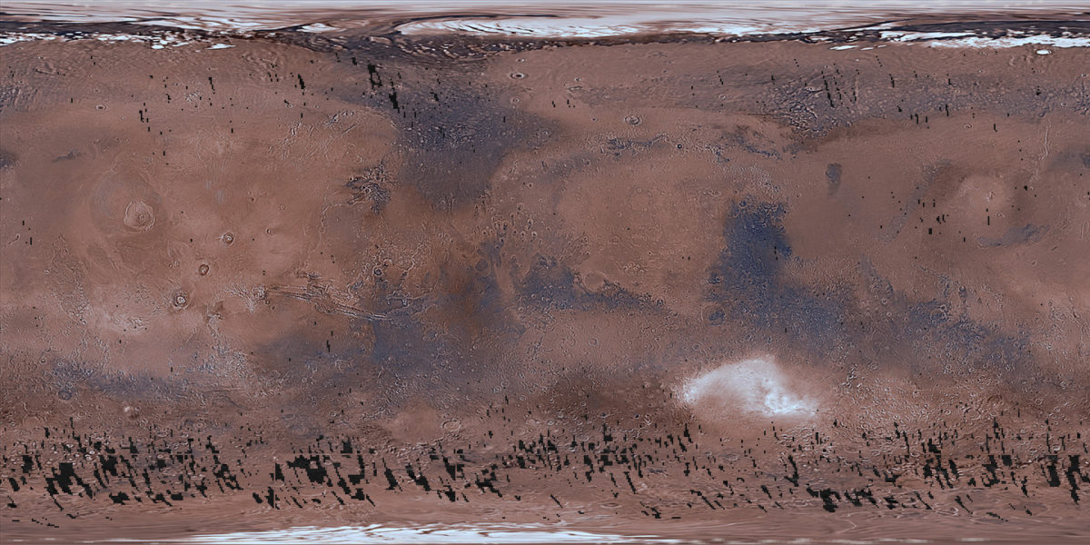
That’s not just good for planetary missions—that’s amazing even compared to our coverage of Earth! The highest resolution publicly available (free) global dataset for Earth is only 250 m resolution. Even the highest resolution commercial global dataset is only 15 m, less than half the resolution of CTX. The commercial datasets also cost $25,000–$35,000 to get the entire planet. CTX images on the other hand (like all images from NASA missions) are free to download.
I first got involved with The Planetary Society a few years ago, when I was on the CTX targeting team at Malin Space Science Systems. I’d often create “pretty pictures” and mosaics from CTX for Emily. Since we specifically targeted CTX to obtain complete coverage of specific regions/landforms, I decided to try my hand at creating large-scale seamless mosaics. This was during the time we were trying to pick a landing site for Curiosity, and so my first two mosaics were two of the candidate landing sites: Eberswalde and Gale craters.
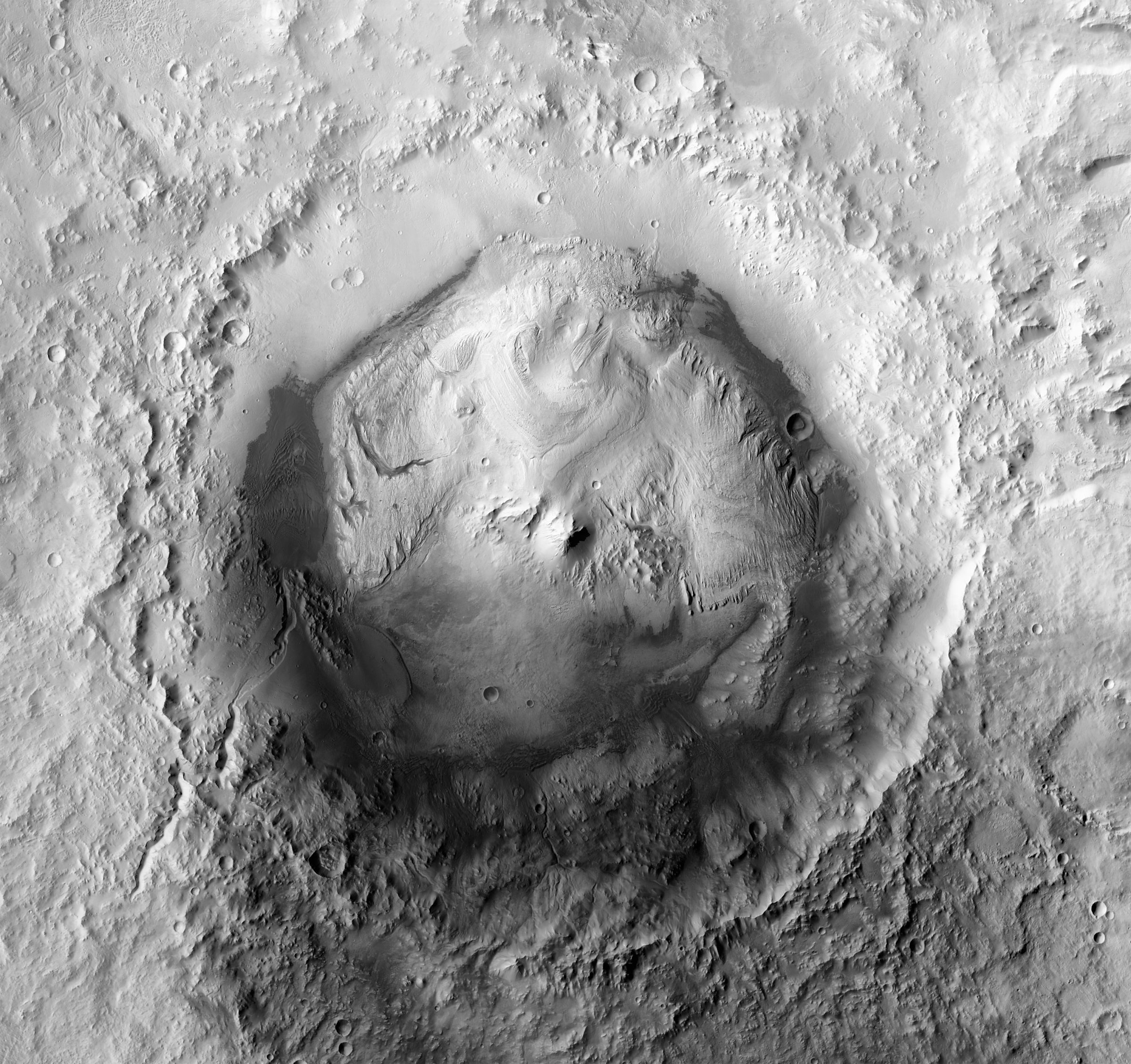
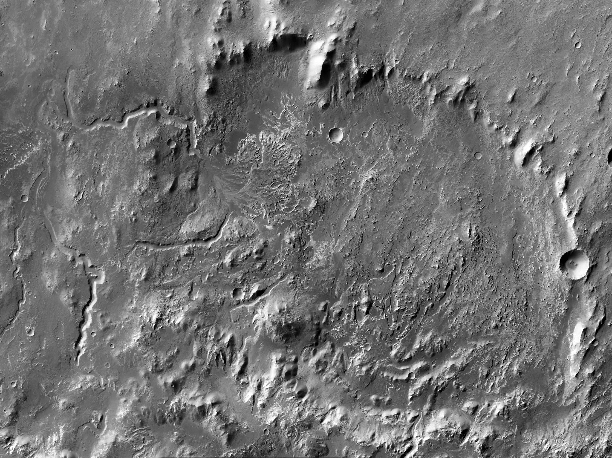
The mosaics above were created using many CTX image strips. For Eberswalde, I used about 15 separate images. Gale on the other hand required over 30 images! While I use different software to process the images initially now that I’m no longer working on the CTX team, the basic process I use to create these mosaics is the same. Emily has asked me to describe the process to you, so I’ll try to do it as briefly as possible!
Creating large seamless mosaics with CTX can be tricky. The key is to find images of your area of interest that were taken under similar illumination (lighting) conditions—that is, where the shadowing will be similar. Obviously flatter places will have fewer changes throughout the year. However, if you’re looking to make a mosaic of, say, the steep-walled West Candor Chasma, the lighting changes will be very pronounced.
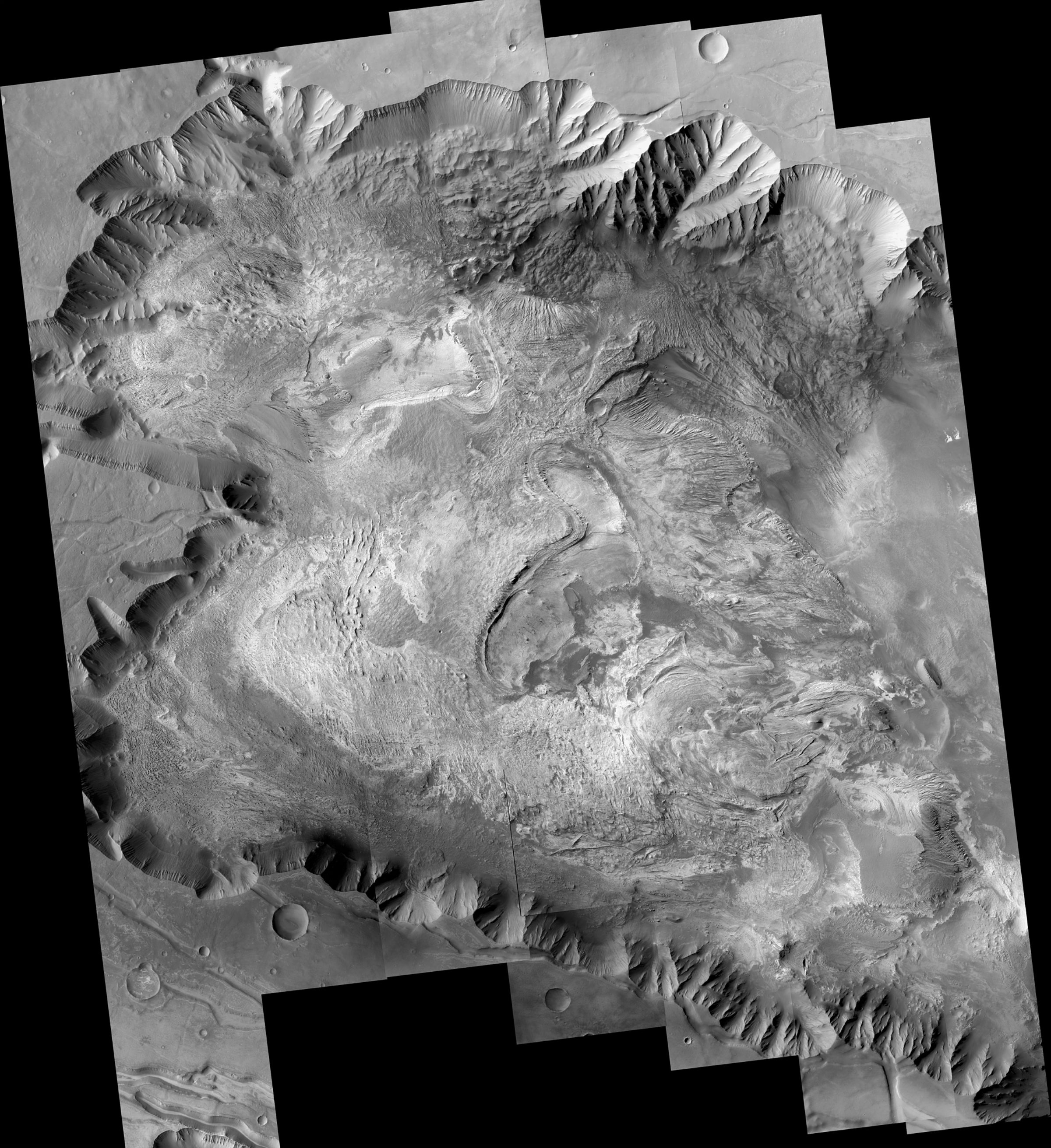
The quickest way to determine if CTX images were taken close in time to each other is by the first three characters in the filename. CTX images have rather long filenames compared to HiRISE. So, let’s tear apart an example:
B19_016924_1387_XN_41S084W
B = Mission phase (from beginning of mission to present: T->P->B->G->D->F)
19 = Month of phase (01–22 or 23)
016924 = Orbit number
1387 = Time along the orbit in seconds
XN = Instrument mode (XN or XI—irrelevant for most purposes)
41S084W = Centre latitude and longitude of the image in west-positive* planetographic coordinates
*This is an important note, as most planetary data you come across these days display coordinates in east-positive planetocentric. This lets it play well in ArcGIS, the software package the majority of mapping geologists use.
You also want to find the best time of year lighting and weather-wise for your area of interest. Some places are really dusty during certain times of the year, and so the images from those time periods don’t look great. Sometimes the shadows may be really deep and hide features you want to be able to see:
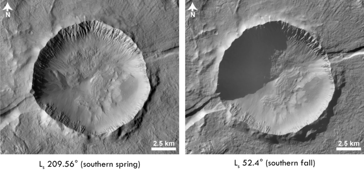
The only way to really determine which time of year is best for your area is to look at multiple images of the area and figure out which ones look best. (Or, you can ask me nicely—I’ve looked at every CTX image that’s ever been taken except the couple thousand that were just released, and it was my job for awhile to determine the best time(s) of year to image certain places.)
So, let’s say I want to make a mosaic of a place and I’ve determined that images taken around the B19 timeframe look the best. I would pick images from perhaps the B17–B22 range, all taken close in time to each other. I can also use 17–22 from any other mission phase [P/G/D/F]; the illumination conditions will be similar. But how do I go about browsing through the images in the first place?
My favourite way to explore the CTX dataset is a tool created by a group at Arizona State University called JMARS—Java Mission-planning and Analysis for Remote Sensing. The name is slightly misleading as it allows you to browse image datasets for many bodies in the solar system, not just Mars. The interface is relatively easy to use, and the JMARS website has many resources and tutorials to help you navigate the program.
I won’t go through how to use JMARS here as that could be an entire post on its own. Long story short, I use it to find the images that I want. Then I go to the USGS Map Projection on the Web (POW) site to download map-projected versions of the images. To minimize distortion, I like to use a sinusoidal map projection with a centre longitude matching that of the image. Conveniently, the CTX image names include that centre longitude, albeit in west-positive coordinates.
The next step is to bring the TIFF images downloaded from POW into Adobe Photoshop and align them. I’ve tried using the built-in Photomerge tool in Photoshop to do this with varied results, so I often end up making the mosaics by hand. Once the images are aligned, hopefully with good overlap on either side, I bust out the eraser tool. Channelling old-school methods of mosaicking, I erase along the seams to blend the images together. You don’t want to do this in a straight line though, or the seam will still be obvious. Erase around different features in the image for better blending.
Once the images are all aligned and blended, I usually add a bit of sharpening and contrast enhancement to help the features in the image stand out a bit more. Contrast enhancement is your friend! By now you should have a great mosaic that Photoshop may or may not choke on trying to produce (doing the Gale crater mosaic at full resolution was trying even on my 8-core Mac Pro tower a few years back).
So, I hope I’ve given you a start down the path of utilizing the amazing CTX dataset to create your own mosaics. If you’d like to see more CTX images, you can follow me on Twitter—I try to post a CTX image every day, but must admit it’s becoming a once every few days thing thanks to travel and research obligations. But, I’ll keep trying to get them out on a semi-regular basis!
Support our core enterprises
Your support powers our mission to explore worlds, find life, and defend Earth. You make all the difference when you make a gift. Give today!
Donate

 Explore Worlds
 Find Life
 Defend Earth

