Emily Lakdawalla • May 24, 2010
The goal of Opportunity's trek
Opportunity's kilometers-long march across the sands of Meridiani Planum is a great story, and the journey is fun to follow; but what could be worth such a long march? The answer: smectite.
Smectite?

It's a worthy goal, really. Smectite is an iron- and magnesium-bearing clay mineral, a type of mineral known as a phyllosilicate. Phyllosilicates are minerals that have a platy crystal structure and frequently form by the alteration of other silicate minerals in the presence of water.
The presence of phyllosilicates on Mars is a relatively recent discovery. Mineralogists have been looking for them for a long time, because of their ubiquity in wet environments on Earth. In fact, if you have water in contact with olivine and pyroxene, some of the more common Martian minerals, for any length of time, it would be hard not to make phyllosilicates. If you want to find possible habitable environments on Mars, you need to be able to find places where there are phyllosilicate minerals. But if all you see is olivine, that's pretty strong evidence that water wasn't ever an important Martian substance.
Olivine and pyroxene are, in fact, all over the place on Mars, while definitive evidence for phyllosilicates proved harder to find. Like any other mineral, they are searched for from orbit based upon their telltale absorptions of certain wavelengths of (mostly infrared) light. As early as the 1960s, researchers performing Earth-based spectroscopy found hints of their presence, but the evidence wasn't definitive and could be explained away. Even when the Thermal Emission Spectrometer on Mars Global Surveyor mapped the entire planet in the late 1990s (revealing, among other things, the hematite hot spot that led NASA to choose Meridiani for Opportunity's landing site), evidence for phyllosilicates was present but not conclusive. However, a few spots were identified, such as Nili Fossae and Mawrth Vallis, where their presence was considered most plausible.

Conclusive evidence was finally unearthed (unMarsed?) in 2005 by the Observatoire pour la Mineralogie, l'Eau, les Glaces, et l'Activité (OMEGA) instrument on Mars Express. The paper explained why the phyllosilicates had been so hard to find: they were only found in special locations, among the oldest rocks of Mars, rocks of so-called "Noachian" age. These rocks are only exposed on the Martian surface in special locations where geologic activity has stripped off overlying, younger rocks or tilted whole blocks of crust to expose the more ancient materials. Previous methods of searching for the phyllosilicates couldn't resolve the spatially limited exposures of these Noachian bits of rock.
Another interesting fact emerged from the early OMEGA results: there were also lots of sulfate rocks on Mars, and virtually nowhere were the phyllosilicates and sulfates found together. The two types of minerals form in different kinds of watery environments; phyllosilicates form under neutral to alkaline chemical conditions, while sulfates form under highly acidic conditions.

By the time that the OMEGA team published their phyllosilicate paper, they had begun to put together their mineral maps with traditional geologic maps that use the law of superposition to establish an order for geologic events and created a story for Mars' history that explained why there were phyllosilicates in some places and sulfates in others. They published the idea in 2006; I summarized it here.
In a nutshell, Mars' history can be divided into three ages based upon what was happening chemically. The first age could have been warm and wet (it was at least wet underground); the second age was volcanically gassy and wet; and the third, the one Mars is in now, is cold, dry, and, well, rather boring. The wet and possibly warm age occurred in the early to mid Noachian period and resulted in the phyllosilicate rocks. Then there was a huge burst of volcanism that filled the atmosphere with gases including sulfur dioxide, resulting in a period of acidic alteration of surface rocks, producing the sulfates. This period extended into the Hesperian age of Mars's history. Finally, the present (Amazonian) age, comprising most of Mars' history, is characterized by slow alteration of surface materials without liquid water.
So where does Opportunity come in? Well, throughout its mission it's been rolling across sulfate rocks formed during that middle, acidic age of Mars. Water is important in the story of these rocks' formation, but due to the highly acidic conditions that they formed in, it's considered unlikely that there was any kind of Martian life in those environments.
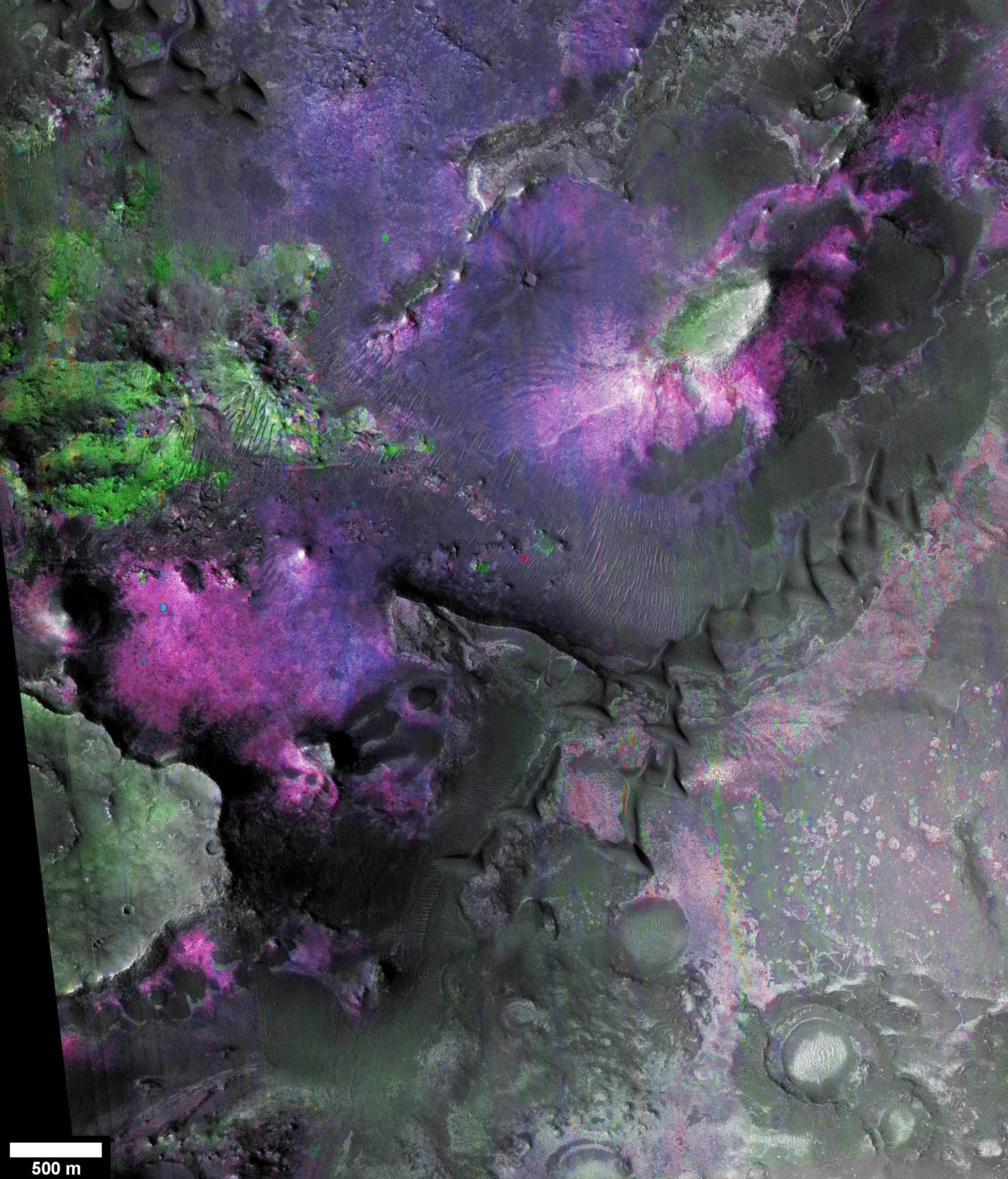
But, off in the distance, in the rocks along the rim of Endeavour crater, there are signs of smectite, one of those elusive phyllosilicates. That's according to a paper by James Wray and seven coauthors from the Mars Reconnaissance Orbiter CRISM team, published last year. (CRISM, like OMEGA, is an imaging spectrometer; it has higher resolution, both spatial and spectral, than OMEGA.)
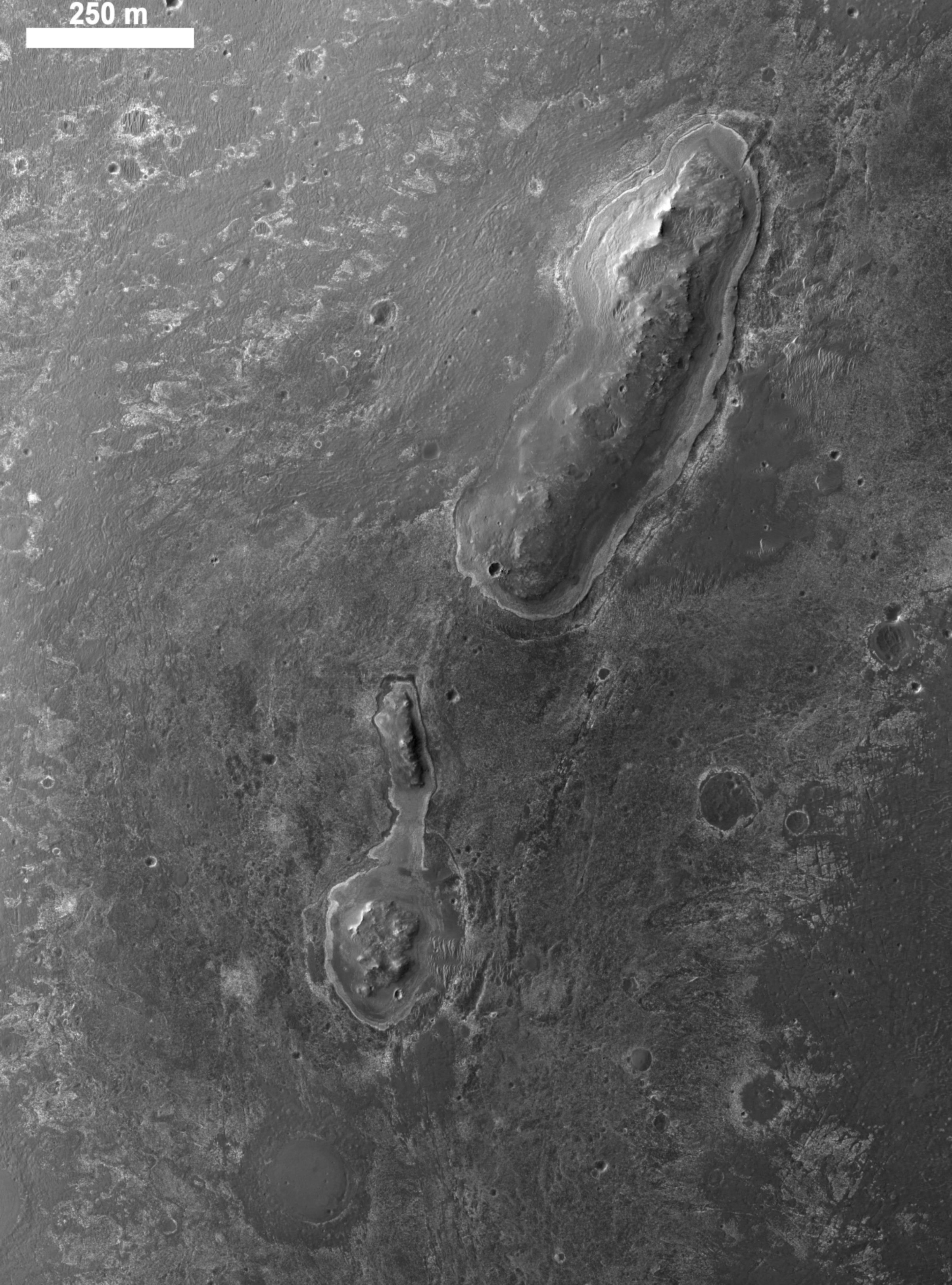
Endeavour crater is older than the sulfate rocks, because the sulfate rocks partially bury the crater and filled some of its interior. But the sulfate sediments couldn't bury all of the crater's rim, parts of which poke up above the plains. Those rim rocks are layered and show up as locations of phyllosilicate minerals in the CRISM mineral maps.


So if Opportunity can complete its drive across Meridiani Planum to the rim of Endeavour, it could potentially sample rocks that formed in watery environments during Mars' wet and possibly warm geologic youth. These kinds of rocks have never ever been sampled by any landed mission. Opportunity's examination of these rocks could test the unifying theory of Mars' geologic history advocated by the OMEGA team. More importantly, though, it would be the first time that a landed mission could directly examine the ancient rocks from environments that might once have provided a habitat for Martian life.
What can Opportunity do, if it gets to Endeavour? Wray and his coauthors say that the Mössbauer spectrometer can confirm the presence of the minerals that are proposed to be visible from orbit. The Mössbauer does rely on a radioactive source that has decayed since landing, so it takes a REALLY long time to perform its measurements, or "integrations." So they will have to be careful about how many spots they choose to do Mössbauer measurements of. They also say that the Mini-TES could confirm the presence of phyllosilicates, but that would be quite a trick, since the Mini-TES on Opportunity was rendered unuseable by dust contamination of the mirror in its periscope during the 2007 dust storm. The APXS can do its usual determinations of major and minor element abundances, and all the camera systems are still working well, so Pancam and Microscopic Imager would yield first-of-their-kind close-up views of these ancient rocks from Mars.
That's the destination -- but what about the journey? One type of rock that lies along the ground in between Opportunity's current location and the rim of Endeavour is hydrated sulfates -- that is, sulfate minerals that contain lots of water molecules in their chemical structure. Now, Opportunity has seen hydrated sulfates before, lots of them. But where Opportunity has seen these minerals, the orbiters have not seen them on the ground where Opportunity has been. The rover will soon be venturing into terrain where orbiters have spied those hydrated sulfates. So Opportunity will soon be gathering data to solve the mystery of why these materials should be visible from orbit in some places but not others where they are proven to exist.
So sit back and enjoy the drive. And enjoy some lovely views of the destination. Here's that nearest bit of crater rim from orbit:

References:
- History of search for phyllosilicates: Meryl McDowell and Vicky Hamilton, "Seeking phyllosilicates in thermal infrared data: A laboratory and Martian data case study," JGR, 2009.
- Early OMEGA results: initial results, with sulfates: Jean-Pierre Bibring et al., "Mars Surface Diversity as Revealed by the OMEGA/Mars Express Observations," Science, 2005; and François Poulet et al., "Phyllosilicates on Mars and implications for early martian climate," Nature, 2005.
- Directional hypothesis for Martian climate chemistry: Bibring et al., "Global mineralogical and aqueous Mars history derived from OMEGA/Mars Express data," Science, 2006.
- Phyllosilicates at Endeavour: James Wray et al., "Phyllosilicates and sulfates at Endeavour Crater, Meridiani Planum, Mars," GRL, 2009
Support our core enterprises
Your support powers our mission to explore worlds, find life, and defend Earth. You make all the difference when you make a gift. Give today!
Donate

 Explore Worlds
 Find Life
 Defend Earth

