Emily Lakdawalla • Oct 12, 2012
Book Review: The International Atlas of Mars Exploration, by Phil Stooke
I've been waiting for the publication of this book for years. Phil Stooke is a planetary cartographer at the University of Western Ontario and a frequent contributor to unmannedspaceflight.com. His International Atlas of Mars Exploration, just published by Cambridge University Press, is an exhaustively awesome labor of love.
It chronicles the first five decades of Mars exploration, from von Braun's 1953 Mars Project to the arrival of Mars Express in 2003, in pictures, maps, and facts. I'm not sure I would have named it an "Atlas" -- it's more like an illustrated encyclopedia. It steps chronologically from one Mars mission to the next, not just the successful ones but also all the failed ones and a great many proposed ones that never even made it off the drawing board. It briefly describes each mission's spacecraft, instrumentation, and purpose, but the main focus of the book is on any aspect of the mission that can be mapped and any event that can be written into a timeline.
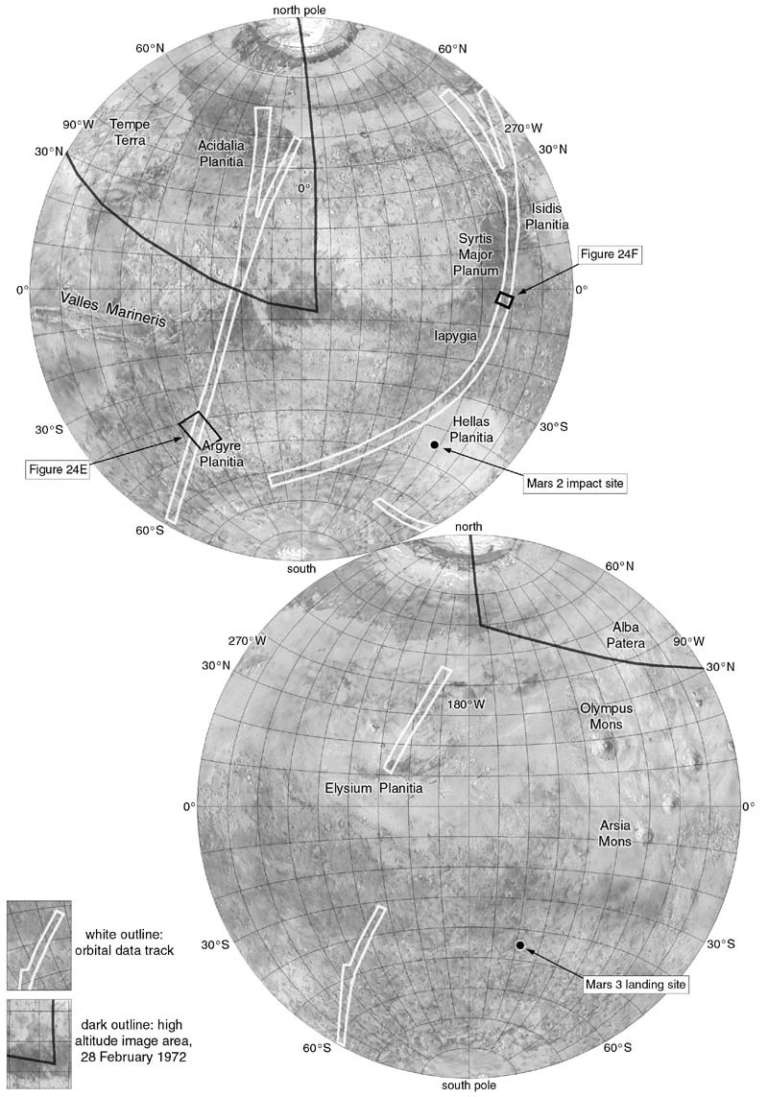
For flyby craft, Phil produces maps that show the areal coverage of imaging and other data like occultation entry and exit points. For orbiters, there are areal coverage maps as well as extensive lists of events like orbit adjustments, with detailed text explaining the reasoning for these. The base maps evolve with time as our collected knowledge improves, from the strikingly antiquated Air Force map (containing canals!), which was actually used for Mariner 4 mission planning, to the stunning detail of HiRISE images of individual landing sites. Some of this information has been published before, a lot of it not. The coverage of Russian Mars exploration is particularly great:

For landers, Phil begins with never-before-published details on the complicated, years-long landing site selection processes. This is true even for proposed missions like the Viking Rovers, Mars Global Network, and Marsokhod, none of which were ever realized.
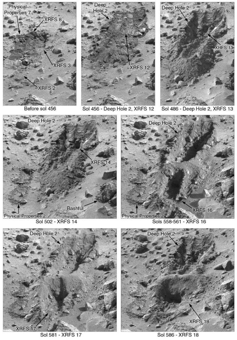
The aspect of this book that I expect will be most useful to me is the annotated imagery that records a play-by-play of the events on the landed missions Viking 1, Viking 2, and Pathfinder. Each trench, each sample acquisition, each named rock, each drive is documented in images and text. Here's an example from Viking:

There will necessarily be a second volume of this work. Phil is wrapping up his work on the Spirit section, but of course Opportunity remains a work in progress, and Curiosity has just begun. Phil is posting his Curiosity route mapping work regularly at unmannedspaceflight.com.
At a list price of $140, it ain't cheap. But I'll definitely be referring to it again and again.
This is the first in what will hopefully be many reviews of books and space-related products I'll be posting over the next month or so. Most of my reviews are positive because I don't waste time writing about things I don't like! You can find past book and product reviews here.
Support our core enterprises
Your support powers our mission to explore worlds, find life, and defend Earth. You make all the difference when you make a gift. Give today!
Donate

 Explore Worlds
 Find Life
 Defend Earth

