Mastcam-Z Team • Jul 27, 2020
Perseverance Rover Scientists Make Plans for Mars
Now that the Mars 2020 science instruments have been mounted and tested on the Perseverance rover and are ready for launch, many members of the team are focusing on detailed strategies for exploring Jezero crater after the rover lands in February of next year. In particular, a number of Mastcam-Z science team members, including the 4 of us, have been participating in the mission’s “strategic science planning” process, along with many other members of the broader Mars 2020 science team.
Perseverance Rover Mastcam-Z Stories
The Planetary Society is an education and outreach partner for the Mastcam-Z instrument on NASA's Perseverance rover. We feature personal stories from the team sending this cutting-edge camera system to Mars.
The first phase of the process involved reviewing previous analyses of the landing area in and around Jezero crater (based on orbital data) and developing hypotheses for the origin and evolution of different geologic units making up the terrain (see the previous Mastcam-Z article about this by several of our colleagues). The mission’s strategic science planning process is now in the second phase, which focuses on how these hypotheses can be tested using the rover science payload and (eventually) samples returned to Earth. Fortunately, much of this work can be done using email and web meetings, so it has not been significantly derailed by the ongoing COVID-19 pandemic. Still, it has been more challenging to keep up with and participate in this process than it would have been without COVID, especially for team members with young children at home or other circumstances where the pandemic has really disrupted the normal day-to-day rhythms of work and life.
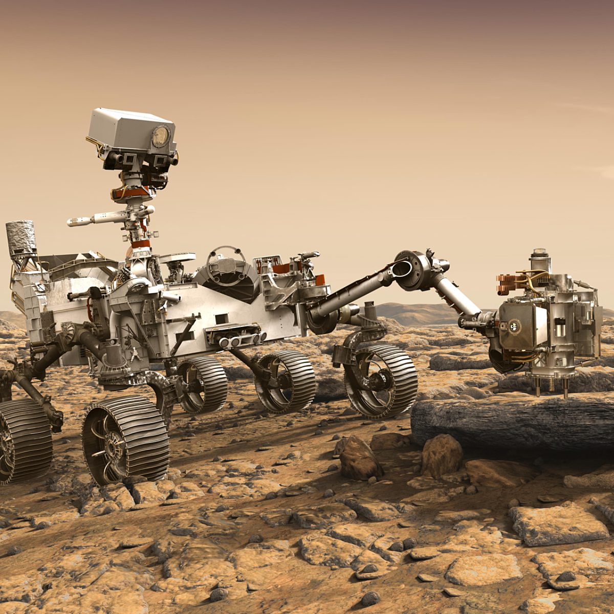
Perseverance, NASA's newest Mars rover
NASA's Perseverance rover is searching for past life on Mars and collecting samples for future return to Earth.
Science Planning on Past Rover Missions
Several members of the Mars 2020 Mastcam-Z camera team have been fortunate to have been involved in the planning for and operations of every rover mission to Mars so far. The previous Sojourner rover on Mars Pathfinder recorded steadily decreasing solar power during its 83-day mission in 1997, from dust falling from the atmosphere onto its solar panels. When the solar-powered Mars Exploration Rovers Spirit and Opportunity landed on Mars in January 2004, we expected them to survive only about 90 days based partly on the rate of sunlight-blocking dust accumulation observed during the Pathfinder mission. But because of the quality of the rover’s engineering systems, and because Martian winds occasionally blew some of the dust off the solar panels, both rovers survived much longer than expected—over 6 years for Spirit and over 14 years for Opportunity.
Once it became clear that Spirit and Opportunity would be able to survive much longer and drive much farther than initially expected, the team put more effort into strategic traverse planning. And especially after the Mars Reconnaissance Orbiter (MRO) began returning high-resolution imaging and mineral data in 2006, more distant juicy targets of interest soon became apparent. For example, when MRO scientists detected clay minerals (known to form when water alters pristine rocks) along the rim of Endeavour crater, eventually getting to that distant location became a long-term goal of the Opportunity mission.

Strategic science planning was much more built into the mission of the Mars Science Laboratory Curiosity rover from the beginning, however. This was because that rover isn’t solar powered, but uses a Radioisotope Thermoelectric Generator, or RTG power system just like those used by the earlier Voyager, Viking, Galileo, and Cassini missions. Thus, the team expected Curiosity to survive for at least several Earth years on the surface of Mars, and so strategic traverse planning would be needed, and would need to begin well before the rover landed in August 2012. MRO scientists had found evidence from orbit for a variety of rocks and minerals of interest in the rover’s landing site in Gale crater, on the flank of Mt. Sharp (officially known as Aeolis Mons), a 5-kilometer-high stack of sediments within the crater that appeared to record major changes in the Martian climate in the distant past. But the most interesting mineral locations were too rough to land the rover on safely, so Curiosity was instead targeted to a safer area nearby, with the expectation that the rover would then drive to the good stuff. As you might expect, the traverse plan has changed a bit since landing, but the early strategic planning has served the mission well as Curiosity continues to explore Mt. Sharp and make new discoveries.
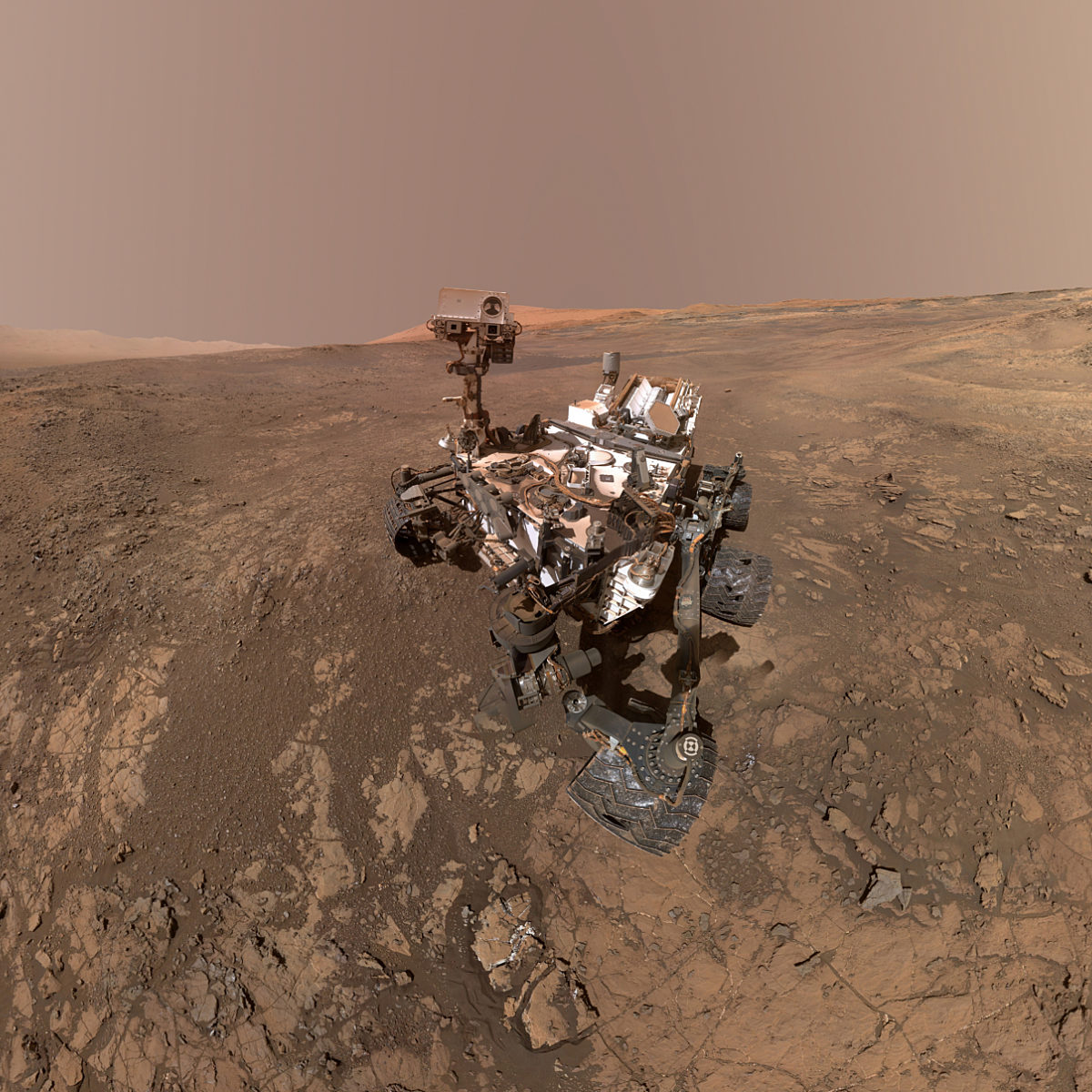
Curiosity, exploring Mars' surface
NASA's Curiosity rover landed on Mars in 2012 to search for evidence that the planet could once have supported Earth-like life.
Science Planning for Jezero
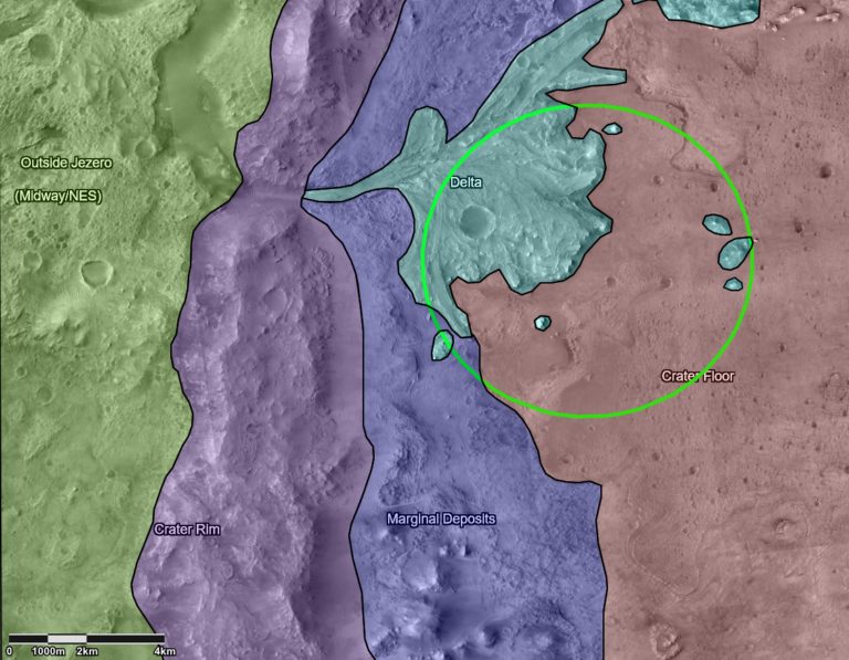
There are a lot of good questions and hypotheses to consider when thinking about where to visit and sample within Jezero crater to most efficiently and completely meet the rover mission’s goals. So to start, the work has been divided among 6 groups of scientists and mission planners, focusing on studies of the atmosphere, characterizations of the crater floor, the spectacular delta on the crater’s western margin, the marginal deposits of rocks and soils seen along the boundary between the crater floor and rim, the crater rim itself, and the generic “outside Jezero” region.
Science team members were asked to volunteer to serve in various capacities in these groups, and the Mastcam-Z team is well represented on all of them, with responsibilities including group lead, long-term planner, and payload expert. As the title implies, long-term planners are tasked with taking a broad view of mission operations and contributing their perspectives to the daily planning process once the rover is on Mars. Payload experts are contributing their knowledge of Mastcam-Z’s (and other instruments’) capabilities to discussions of how the instrument can be used to address specific science questions and to test specific scientific hypotheses related to our mission goals.
After the current phase of this strategic process is completed, each of the groups will identify and prioritize key locations for potential rover campaigns to test the various hypotheses and connect these locations into a series of more strategic, longer-term potential rover traverses. The team will finalize the developing operations plans before landing, to enable efficient decisions about where to drive and what places to sample, once we know exactly where we’ve landed. As we go through this process, we’re all mindful of U.S. President Dwight Eisenhower’s famous quote, “In preparing for battle I have always found that plans are useless, but planning is indispensable.” While we’re not actually going into a battle, planning is still super important to space mission teams like ours. When this process is completed and the results are integrated into the rover’s actual science mission plan, we will be ready to make the most of each precious "sol" (martian day) of mission operations!
Personal Perspectives

I am a Mastcam-Z postdoc collaborator and postdoc at the Niels Bohr Institute of the University of Copenhagen in Denmark. My interest in science and geology comes from a childhood fascination with dinosaurs. Although I never pursued the field of paleontology, it is funny that I still came so close to my childhood dream, becoming a geologist. My first encounter with Mars science came from the many books about Mars and Mars geology, including “The Surface of Mars” by Michael Carr, that my grandmother left behind in my parents bookshelves when she moved to the US back in the early 80s, before I was born. I have come back continuously to those mesmerizing books throughout the years. The photos are old now, and higher-quality ones have become available since then, but to me these Viking mission photos will never be outdated.
I have a Ph.D. in geology and my expertise is impact cratering. Impact cratering is the most extreme geologic process that occurs in nature (in terms of pressures and temperatures) and I think that is why I was drawn to this subject in the first place (aside also from the obvious connection with the demise of the dinosaurs).
For strategic planning for Mars2020, I have joined the “Crater Floor,” “Crater Rim,” and “Outside Jezero” groups. I feel very lucky to be able to participate in the discussions on what, where, and how Perseverance will explore the geologic history of Mars. Will hypotheses that the groups develop and/or gather now be confirmed, or discarded, during the mission, or will all new hypotheses come out of results of analyses from the surface of Mars? I am new to Mars science, but the team has been most welcoming. After so many years studying impact structures on Earth, it is exciting to look at structures on other worlds that actually look like impact craters, not heavily obscured or destroyed by geologic processes such as tectonics and erosion, both of which occur much more rapidly and extensively on Earth relative to Mars. I cannot wait to see what Mars has in store for us this time!

I’m a Mastcam-Z Co-Investigator and a geologist at the USGS Astrogeology Science Center in Flagstaff, Arizona. I’ve been interested in astronomy (the solar system in particular) since I was a child—my great grandmother gave me the “Golden Book of Astronomy” for my birthday in 1965, which I read over and over. At the time, very little was known about the planets, and the book includes a painting showing water-filled canals on Mars. Growing up during the early exploration of the solar system was fascinating, kindling my interest in science and engineering. I was also interested in cameras and photography, supported by my father who let me use his camera. Late in my teens, I also became interested in geology and its application to the study of planetary surfaces, and therefore majored in geology in college.
After earning a doctorate at Caltech, I worked for 9 years at the Jet Propulsion Laboratory (JPL), where all of NASA’s Mars rovers were built. During that time, I worked on the Mars Pathfinder mission, serving as the liaison between the imaging science team and the JPL project. The success of that mission led to my involvement in the Spirit and Opportunity rover missions, as the science lead for the microscopic imagers, and in the ongoing Curiosity rover mission. I have been fortunate to have spent much of my career designing, calibrating, and operating cameras on Mars.
I volunteered to join the “Outside Jezero” strategic planning group to share my experience in planning and analyzing images taken by Mars spacecraft, specifically thinking about how Mastcam-Z images can be used to address key questions about the geologic history of Mars in regions the Perseverance will hopefully explore in the next few years. It may be a while before Perseverance exits Jezero crater and begins exploring the rocks we are studying, but we will be ready when we do!

I am a Mastcam-Z Co-Investigator and an associate professor at the Niels Bohr Institute of the University of Copenhagen in Copenhagen, Denmark. I am one of two group leads for the “Crater Floor” strategic science planning group.
I had my first experience with Mars research as a student during the Spirit and Opportunity rover missions. I worked on those missions for many years as a Pancam Payload Downlink Lead and have studied the motion of airborne dust at the rover landing sites based on observations of the Pancam calibration targets (see the great article about those targets in the Jan/Feb 2004 issue of The Planetary Report). Since then, I have worked also on the camera team for the Curiosity rover and now on the Mastcam-Z team on the Perseverance rover, where I have been leading the design, manufacture and testing of the new calibration targets for the Mastcam-Z cameras.
Although I have extensive experience from previous Mars rover missions, I was trained as an astrophysicist and have focused on instrument issues related to camera calibration and performance for much of my career. I was therefore excited and a little bit apprehensive to be asked to co-lead the “Crater Floor” working group. Although I have contributed to studies of Jezero crater before it was chosen as the landing site, many team members have a much more solid geology background than I do. Luckily the “Crater Floor” group is a strong, qualified, and supportive team, and the role of the group lead is not to be an all-knowing dictator but rather to guide discussion and present group consensus to the wider team.
We began the strategic process by arguing about our name. Originally the term “Crater Floor” was used in the scientific literature about Jezero crater to describe the relatively flat plain in the center and bottom of the crater. As it turns out, though, for experts in terrestrial and planetary impact craters the term “Crater Floor” has a specific technical meaning, describing the material in the bottom of a pristine impact crater shortly after formation. This is not, by fairly general consensus, what we will encounter in the present “floor” deposits of Jezero crater. Jezero is ancient and filled with probably close to a kilometer of material that accumulated in the time since the impact. Eventually we agreed to live with slightly sloppy terminology and keep referring to the “Crater Floor” deposits of Jezero Crater, just keeping in mind that these materials are not the original crater floor.
What exactly, then, is the nature of the deposits on the current crater floor? In short: we do not know. They might be water-transported sediment deposited when Jezero was a lake, or flood deposits laid down during a late reactivation of the river system after the lake had dried out; they might be volcanic ash or lava; they could have originated as wind-blown sand or dust, or maybe it is all or some of the above: the crater floor contains several discernably different layers that may have formed by entirely different processes.
More, perhaps, than any of the other groups, the crater floor group has many hypotheses (some published in the scientific literature and others just speculatively discussed) but few firm conclusions. Although members of the group have opinions and preferences among the various hypotheses, none of the possibilities are likely to be truly ruled out before we land. Luckily, we will most likely land right on the crater floor, and so we may get a lot of answers early in the mission. For now, we do our best to systematically list the many hypotheses, describe the existing orbital observations that support or conflict with each hypothesis, and predict what rover instrument observations can be used to confirm or rule out any of the hypotheses – and where exactly these observations can best be made.
For me, the chance to shape the strategic guidance for the first part of the mission is really exciting, and I truly enjoy the stimulating discussions as the group tries to get a grip on the many hypotheses for the origin and nature of the materials on the Jezero crater floor.

I'm a Co-Investigator with Mastcam-Z and MEDA (Mars Environmental Dynamics Analyzer) on the Mars 2020 mission, working as a researcher at Cornell University in Ithaca, New York. I've been lucky to work on the Galileo mission to Jupiter, Mars Pathfinder, the twin Mars Exploration Rovers Spirit and Opportunity, and the currently active Mars Science Laboratory rover, Curiosity. Time "Earth-side" has included gaining scientific perspectives from experiments in wind tunnels, and from geologic field work in California, New Mexico, Colorado, Washington, Utah, Scotland, and Iceland.
For the Mars 2020 strategic planning exercise, I've participated in the "Atmosphere" group (while trying to follow the deliberations of several of the other groups, as well). Immediately after landing, everyone on the team will feel the pressure to rapidly compile a comprehensive "cache" of sealed samples representing the most significant materials in the Jezero crater region—high enough in science value to justify return to Earth later by a follow-on mission (a pretty high bar to be striving for). The clock will be ticking loudly in our ears, of course, as soon as the rover's six wheels first touch the martian surface.
As might be guessed, the work of the Atmosphere group has been a little different from the other groups, emphasizing fundamental questions that are relevant across much of the martian surface, not just near the Jezero crater landing area. Examples: How strongly must winds blow in the thin martian atmosphere to raise dust into a dust storm, or to blow sand along the surface to form ripples and dunes seen widely across the martian surface? What combination of Perseverance camera observations combined with wind speed measurements could answer these long-standing questions? In fact, other strategic groups have also been doing their work with an eye toward leveraging Jezero science to address broader-scale fundamental questions about Mars. The science community expects this, and so does the public. This is because our neighboring planet is so hard to get to, is visited so infrequently, and our explorations thus far have been extremely limited, all of which makes our coming time on the surface with Perseverance precious for many reasons.
The "caching" of samples might seem at first glance to be a purely geological task, but this is not so. In the Atmosphere strategic group, one challenge has been to remind the rest of the team that the atmospheric environment and how this interacts with the surface currently, and in the past, affects mission efficiency and affects interpretation of surface materials in several ways. For example, a lesson drawn from previous rover experience at the MER Opportunity landing site is that wind can organize the local surface materials conveniently according to composition, and potentially with essential clues to the past role of water: At Opportunity's Meridiani Planum landing site, wind-related processes had concentrated hematite-enriched aqueous concretions together at ripple crests, where their composition could be measured most effectively. These small concretions had once been scattered sparsely within weaker sedimentary materials, now long eroded away, that previously had been saturated with water. It was these humble, yet resistant concretions, concentrated by the wind at ripple crests, that turned out to be the source of the hematite signature sensed from orbit that drew the Mars Exploration Rover mission to the Meridiani Planum landing site to begin with.
At Jezero crater, a prime target of the Perseverance rover will be materials carried by water that once poured into the crater, forming delta deposits that have since been partly eroded away and re-worked by the wind. What erosionally-resistant materials—perhaps originating from outside Jezero crater—might have been swept onto the crater floor area by a delta-forming river, then reworked by the wind and concentrated for convenient and efficient inspection at the crests of large ripples? Are these possibilities worth inspecting at some point along our traverse? This is one example of the many diverse ideas that the Atmosphere strategic group has been evaluating to increase the effectiveness and value of rover operations after landing.
Support our core enterprises
Your support powers our mission to explore worlds, find life, and defend Earth. You make all the difference when you make a gift. Give today!
Donate

 Explore Worlds
 Find Life
 Defend Earth


