Bruce Betts • Oct 02, 2018
NASA Then & Now
This year, NASA is celebrating 60 amazing years of space exploration. Over those years, NASA worked to rapidly improve its spacecraft and imaging technology which continue to shape our perspective of the cosmos and our place within it. Using the arrow sliders on the images below, you can take a journey through time and learn more about the missions that helped bring our solar system into focus.
Left Image:
On April 1, 1960, NASA launched the world’s first successful weather satellite, TIROS-1 — the first in a series of Television Infra-Red Observation Satellite missions. Using two television cameras and two video recorders, the satellite sent back a total of 19,389 images that would provide the first-ever view of cloud formations as they developed around our globe. The black and white photo on the left is one of the first pictures it beamed back to us. The series of TIROS missions inspired the formation of NOAA (National Oceanic and Atmospheric Administration) just ten years after we snapped this photo of Earth, launching us into a new age of weather forecasting.
Right Image:
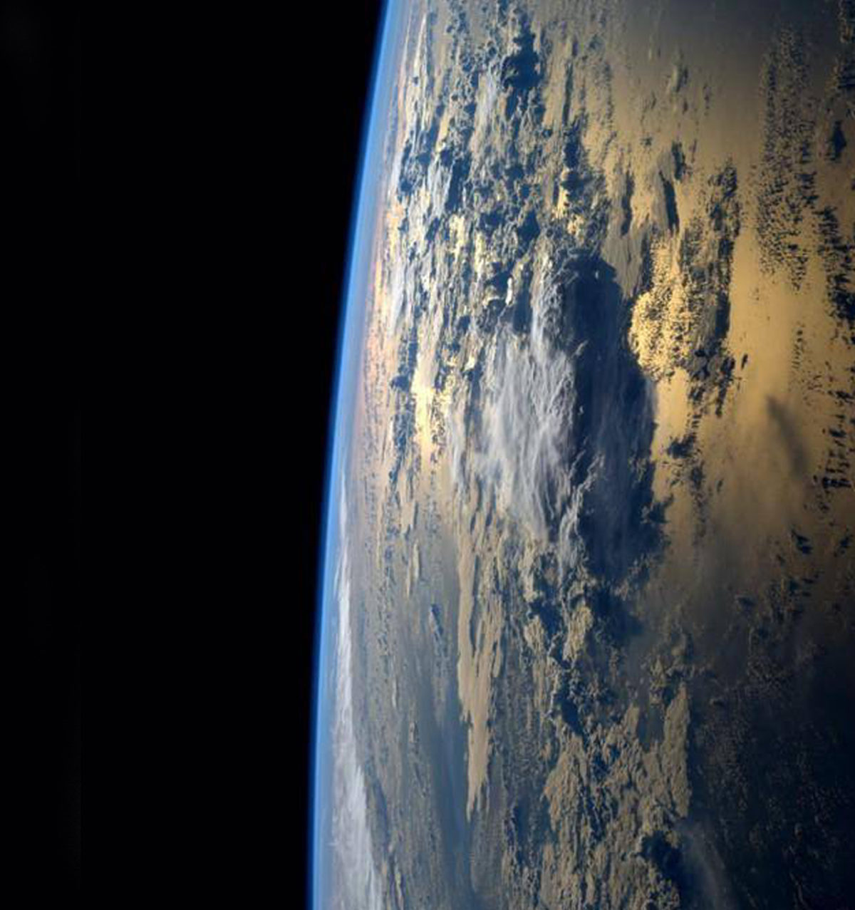
On September 2, 2014, NASA astronaut Reid Wiseman tweeted this photo from aboard the International Space Station, proving just how far we’ve come in only 54 years. He wrote,
“My favorite views from #space – just past #sunrise over the ocean.” - Reid Wiseman, NASA Astronaut
This set the tone for his debut spaceflight, during which he shared his excitement through personal social media posts detailing his life aboard the space station.
Left image:
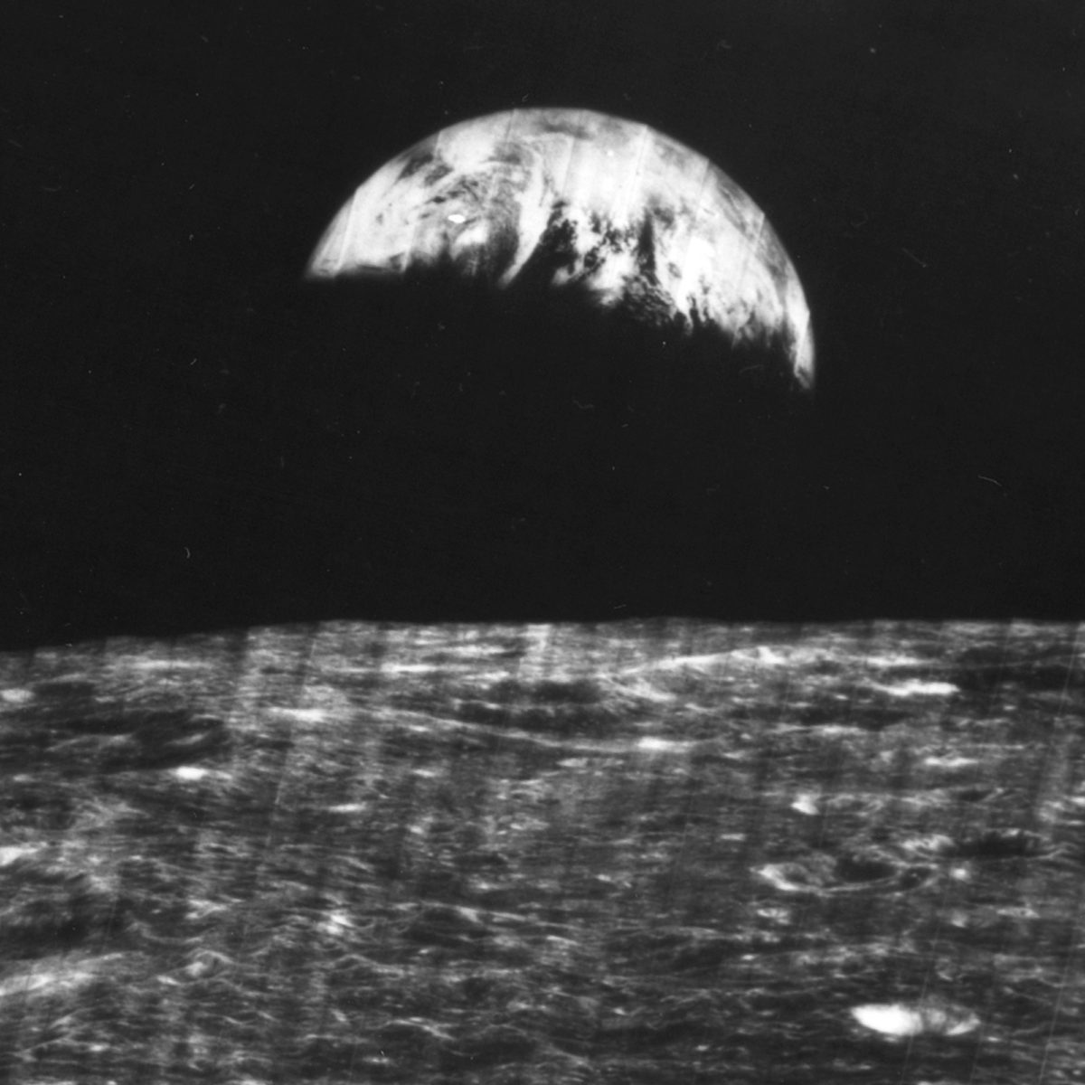
On August 23, 1966, Lunar Orbiter 1, the first American spacecraft to orbit the Moon, took the first photo of Earth as seen from lunar orbit. The primary mission of this robotic spacecraft was to select safe landing sites for the Surveyor and Apollo missions that would eventually lead humans to the surface of the Moon. In 2008, this earthrise image was revived and restored by the Lunar Orbiter Image Recovery Project at NASA Ames Research Center. You can view the updated image here.
Right image:
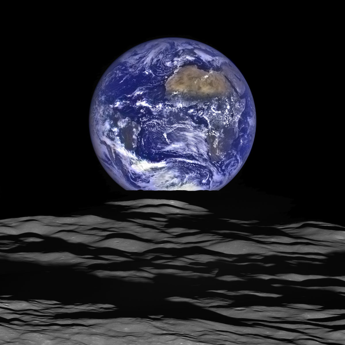
On October 12, 2015, the Lunar Reconnaissance Orbiter (LRO) captured a series of 12 photos that were processed to create this stunning image of Earth. In the foreground, we get a glimpse of the Moon’s crater, Compton, located on the far side of the Moon. At the time of capturing this image, the spacecraft was about 134 kilometers (83 miles) above the crater, traveling faster than 1,600 meters per second (3,580 miles per hour) relative to the lunar surface below.
Though it experiences 12 earth rises every day, LRO’s primary mission requires the spacecraft to focus on imaging the lunar surface. It rarely has the opportunity to snap a photo of Earth such as this one. Occasionally, LRO moves its camera to observe the extremely thin lunar atmosphere and perform calibration measurements. During these movements, sometimes Earth passes through the camera's field of view and produces images like this.
Left image
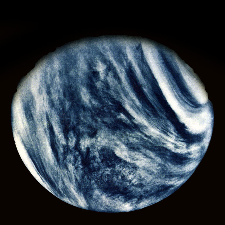
On Feb. 5, 1974, NASA's Mariner 10 spacecraft took the first-ever close-up photo of Venus during its mission to study the atmospheric, surface, and physical characteristics of Venus and Mercury. This image was taken using an ultraviolet filter, then color-enhanced to display Venus’ cloudy atmosphere as the human eye would see it. It was the first spacecraft to visit two planets and the first to use gravity assist to boost its speed. In fact, it snapped this photo as it flew by Venus during a gravity assist that changed its speed and trajectory, shooting it toward our innermost planet, Mercury.
Right Image:
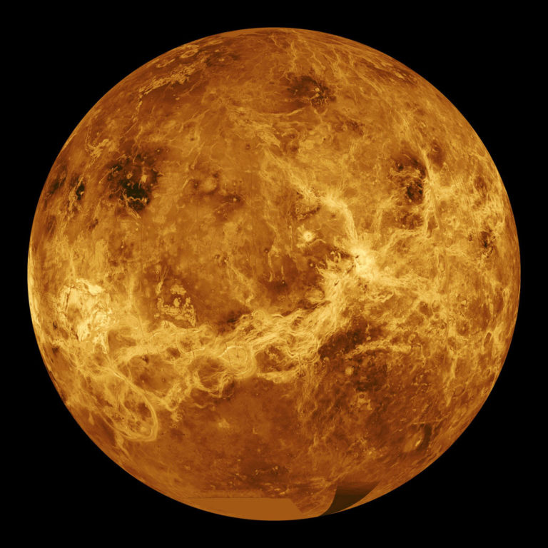
The Magellan spacecraft launched on May 4, 1989, entering orbit around Venus on August 10, 1990. During its orbit around Venus, it made quality radar maps of 98 percent of Venus’ surface. Using radar technology, it was able to peer through Venus’ thick clouds to the topography below, revealing a geologically active and tantalizing world. The radar mosaics were then mapped onto a computer-simulated globe. The remaining gaps were filled in with data from several other missions (the Soviet Venera 15 and 16 radar and Pioneer Venus Orbiter altimetry) as well as data from the Earth-based Arecibo radio telescope. It was produced by the Solar System Visualization Project and the Magellan Science team at the Jet Propulsion Laboratory Multimission Image Processing Laboratory.
Left image:
On July 15, 1965, Mariner 4 transmitted this image of the Martian surface to Earth during its Mars flyby encounter. This photo was one of a series of 22 pictures taken with Mariner 4’s television camera. The photos were initially stored on a 4-track tape recorder, then transmitted to Earth over a period of 4 days. The spacecraft continued its solar orbit for three years, conducting studies of the solar wind environment and making coordinated measurements with its sister ship, Mariner 5, which launched to Venus in 1967.
Right image:
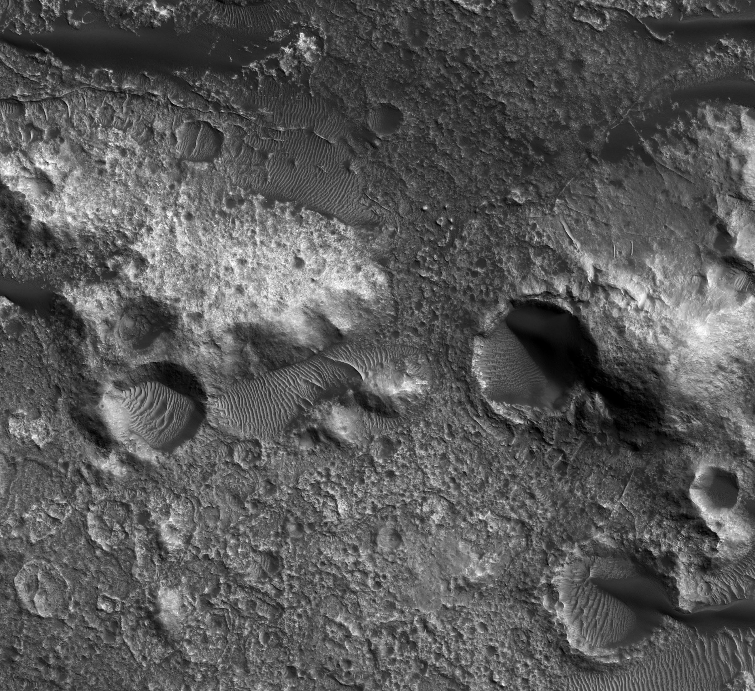
In September of 2018, NASA’S Mars Reconnaissance Orbiter (MRO) took this photo of a different region of Mars using its High Resolution Imaging Science Experiment (HiRISE) camera. HiRISE is a reflecting telescope and the largest ever to have launched on a deep space mission. It snapped this photo of northwest Terra Cimmeria, revealing the bedrock exposures on the crater floor. We are studying Terra Cimmeria because it contains gullies that could have been formed by recently flowing water. MRO launched on August 12, 2005, and arrived at Mars on March 10, 2006. It continues to explore Mars from orbit using its suite of science instruments to analyze minerals, hunt for subsurface water, study the atmosphere, and monitor global weather.
Left Image:
The Mariner 6 and 7 spacecraft launched in 1969. Together, the twin spacecraft completed the first successful dual mission to Mars. During their flybys, they collected atmospheric science data and over 200 combined images, completely changing our perspective and understanding of the Martian surface. The images at the top half of this globe were taken by Mariner 6 and the images on the bottom half of the globe were taken by Mariner 7.
Right Image:
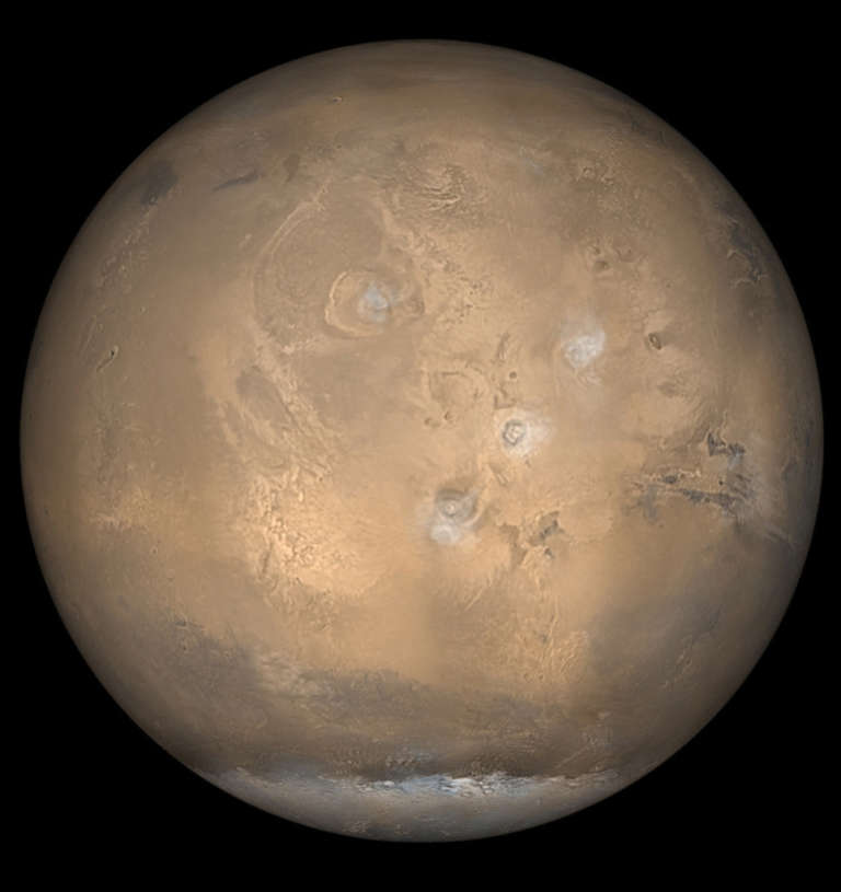
NASA’s Mars Global Surveyor (MGS) spacecraft launched on Nov. 7, 1996, and arrived at Mars on Sept. 12, 1997. At the time of taking this photo in 2002, it had collected more information about the red planet than all previous missions combined. Its findings provided a far better understanding of the Martian atmosphere and surface and discovered the existence of the Martian crustal magnetic field. During its mission, the spacecraft orbited Mars from pole to pole 12 times a day, taking a series of pictures that were assembled to create a daily global map. This picture showcases Mars’ south polar cap and its clouds of water ice crystals over the four largest volcanoes in the Tharsis region.
Left image:
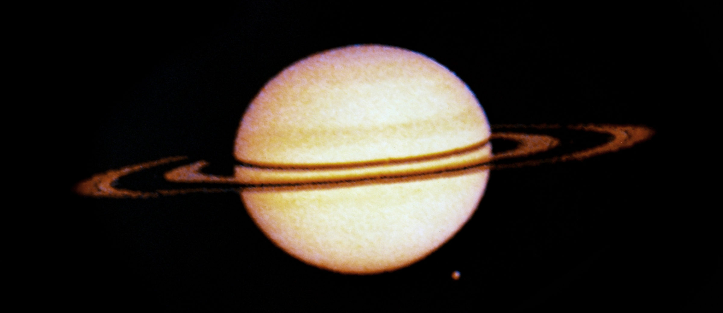
Pioneer 11, the first robotic space probe to encounter Saturn, took two pictures of the ringed planet on August 29, 1979. Those images were then combined and synthesized to produce the image you see here. Pioneer 11 launched on April 6, 1973, with a mission to study the solar wind, cosmic rays, the asteroid belt, and the environment around Jupiter and Saturn. It successfully completed its mission and transmitted its last bit of science data to NASA in 1995. Now, it continues on its trajectory into interstellar space following after its predecessor, Pioneer 10. Led by Carl Sagan, NASA approved a project to affix a message to the exteriors of the Pioneer 10 and 11 spacecraft: the famed Pioneer Plaques. These golden plaques serve as a greeting and invitation for extraterrestrial beings who may eventually come across these spacecraft as they sail through their solar systems.
Right image:
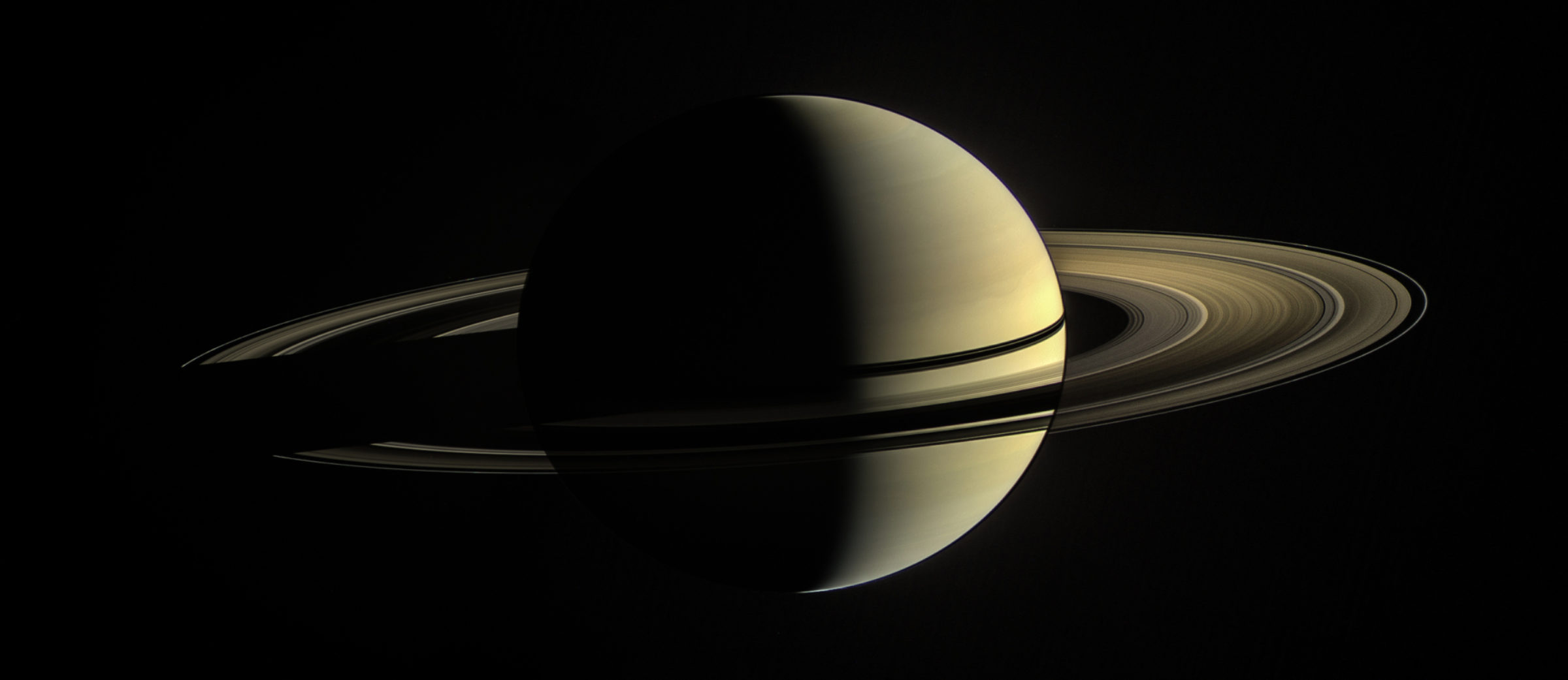
The Cassini spacecraft snapped this beautiful photo of Saturn on January 2, 2010. This natural-color view is a composite of images taken in visible light with the spacecraft's camera. The image was then processed to brighten the rings on the night side of the planet to more clearly reveal their features.
On Sept. 15, 2017, the Cassini spacecraft plunged into Saturn’s atmosphere, breaking up and becoming part of the planet itself. This self-destructive maneuver was used to keep the spacecraft from contaminating Saturn’s moons, some of which seem to harbor ingredients for life. The Cassini mission is a cooperative project of NASA, ESA (the European Space Agency), and the Italian Space Agency — all of which are plowing through the mountain of data that was collected during the spacecraft’s 13 years in orbit around the planet.
Left image:
This image of Pluto was created in February of 2010 using multiple photos taken by the Hubble Space Telescope. While Hubble allows us to see individual stars in distant galaxies with breathtaking quality, it still can’t make out details on this very small and distant world within our own solar system. At the time, and for several years thereafter, this was our best image of Pluto.
Right image:
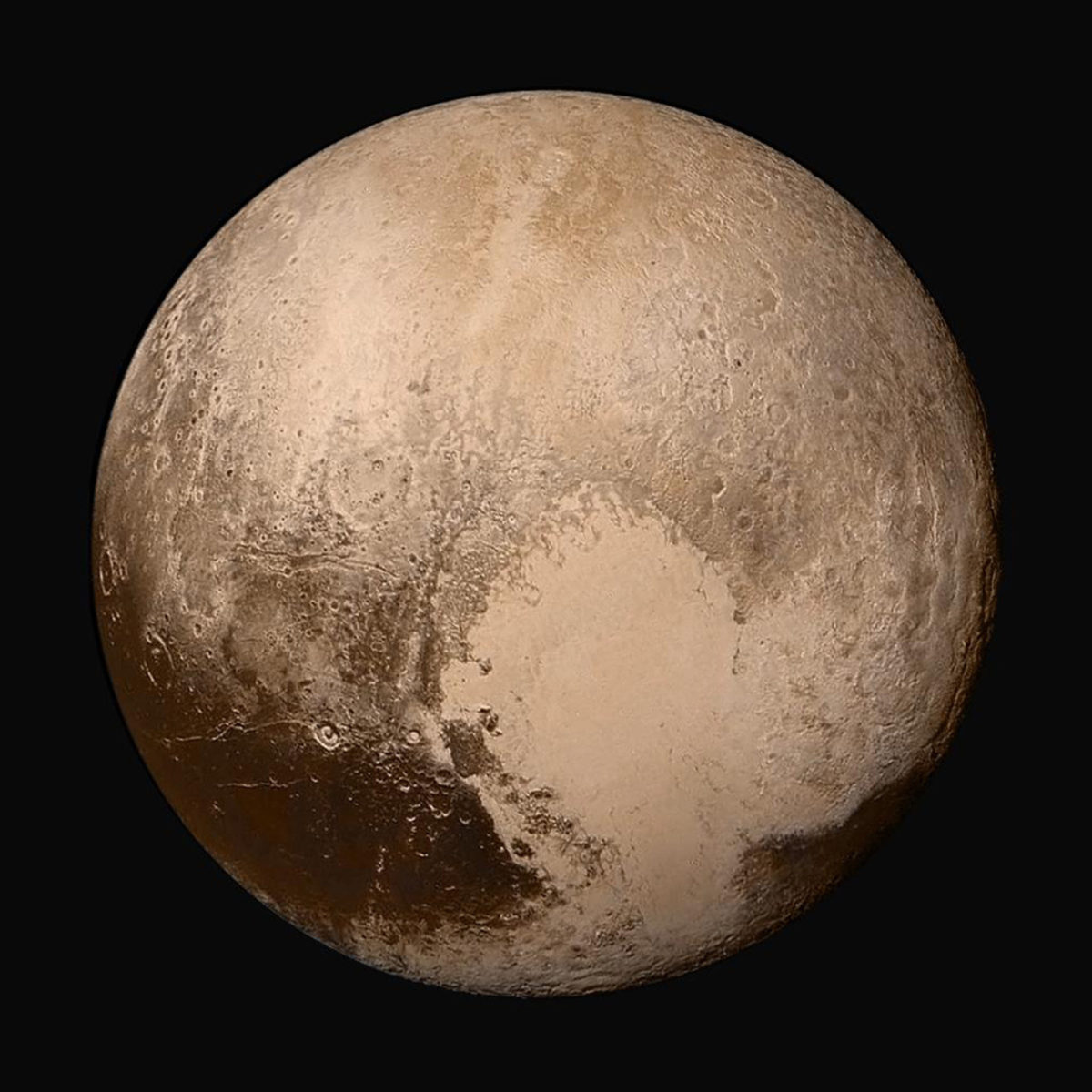
This true color mosaic image of Pluto was composed by combining four images taken by New Horizons’ Long Range Reconnaissance Imager (LORRI) and processed with color data from its Ralph instrument. The original images were taken in 2015.
New Horizons is the first and only mission sent to study the Pluto system and Kuiper Belt. The astonishing data it returned revealed that Pluto is larger and less dense than we previously thought, with mountain ranges made of ice and diverse geology between the ranges. It revealed evidence of tectonics, glacial flow, and possible cryovolcanoes on Pluto and its moon, Charon. On January 1, 2019, New Horizons will make a historic encounter with the tiny, icy Kuiper Belt object, 2014 MU69.
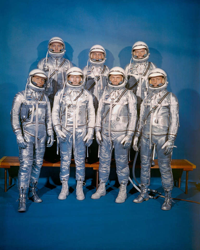
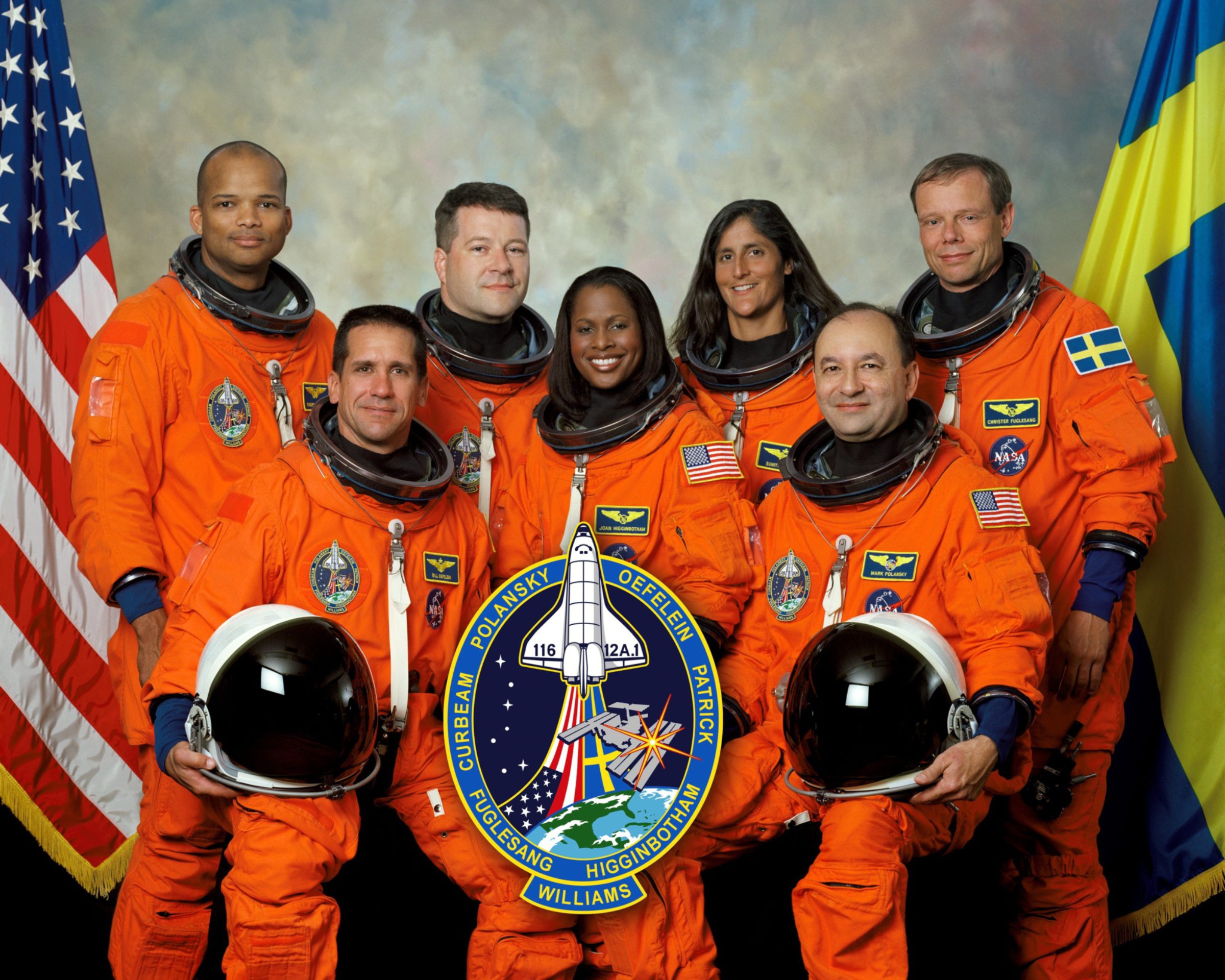
At NASA’s inception, the cultural climate in the United States was very different and the opportunities for astronauts were available to only a select few. Over the years, NASA helped lead the way as the nation’s culture progressed. Today, NASA is proud to employ a diverse roster of astronauts, scientists, engineers, communicators, and more.
On March 26, 1958, in an attempt garner support for the creation of a United States space program, President Dwight D. Eisenhower disbursed a letter written by his Science Advisory Committee, entitled Introduction to Outer Space. Here is an excerpt from his passionate introduction:
“(There are) many aspects of space and space technology... which can be helpful to all people as the United States proceeds with its peaceful program in space science and exploration. Every person has the opportunity to share through understanding in the adventures which lie ahead.” -President Dwight D. Eisenhower, March 26, 1958
Just a few short months later, he signed the act responsible for the creation of NASA and on October 1st, 1958, NASA began its first day of operation. Today, it is clear that NASA has continued to deliver on its mission to benefit all humankind.
Support our core enterprises
Your support powers our mission to explore worlds, find life, and defend Earth. You make all the difference when you make a gift. Give today!
Donate

 Explore Worlds
 Find Life
 Defend Earth


