Emily Lakdawalla • Jul 12, 2013
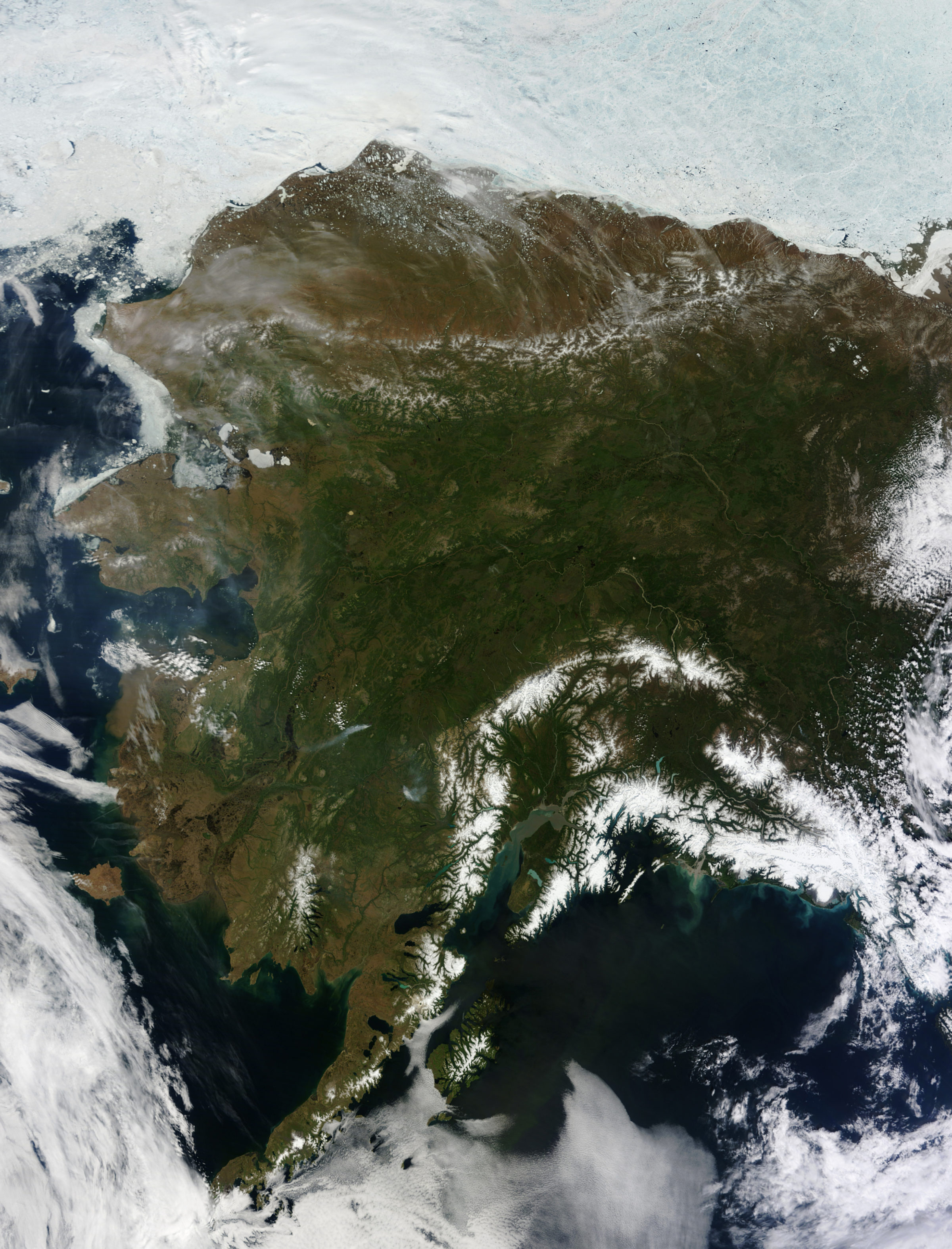
A rare clear day in Alaska
NASA recently shared a gloriously detailed image of an unusual clear day in Alaska as seen from the Terra satellite, one of the pair that provides the United States with regular, frequent, detailed satellite photos of areas all over Earth. Terra and its sister Aqua help us with land use monitoring and disaster response because of their reliable, repeatable photo coverage. But they can't see through clouds, and when you're talking about Alaska, that severely limits what we can see. Well, on June 17, it was a rare clear day, and you can see the relatively undeveloped Arctic state in all its forested, mountained, snow-capped, running-river glory. Check out the meandering river channels, and the plumes of sediment where they empty into the ocean. Look at the decaying sea ice next to the coast, and the funny blebs of ice on the land near the northern coastline. You can tell where the land slopes more steeply and where it's more level by the shapes of the rivers -- they're straight on regional slopes, windy and curvy on flat floodplains. Enjoy the creamy turquoise color of lakes fed by glacial streams choked with "rock flour" ground from the bedrock by the slow motion of mountain glaciers. So cool.

Support our core enterprises
Your support powers our mission to explore worlds, find life, and defend Earth. You make all the difference when you make a gift. Give today!
Donate

 Explore Worlds
 Find Life
 Defend Earth

