Emily Lakdawalla • Apr 19, 2012
Cheat sheets for Vesta's craters and Dawn's Vesta timeline
[EDIT April 25: Thanks to Marc Rayman for correcting the Vesta departure date in my timeline.]
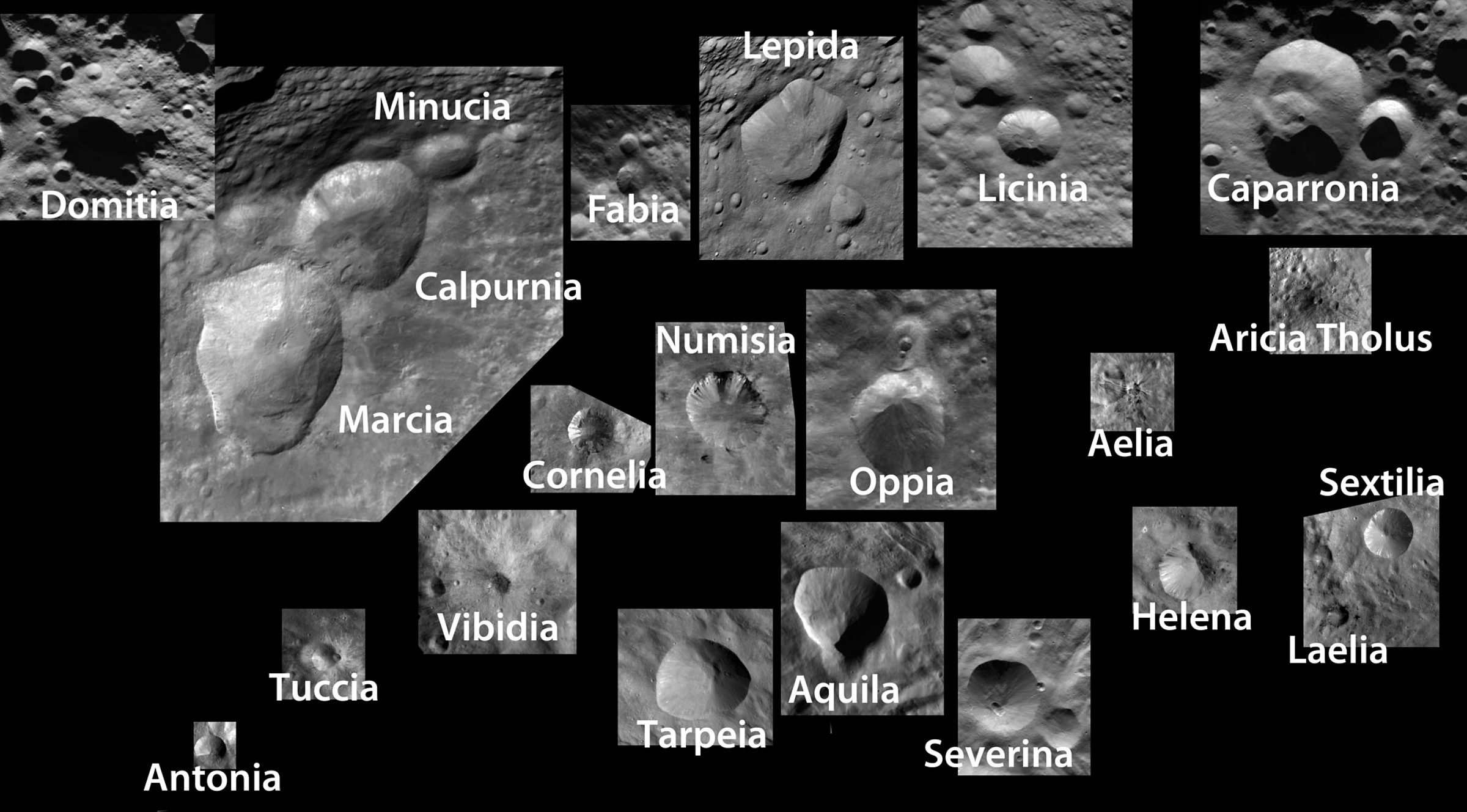
A great many of my "explainer" posts originate with me being annoyed at myself for not remembering something, and here's another example. This morning I've been moving Dawn images of Vesta into our new website's image library, and I've been continually irritated at myself for not being able to remember the names of Vesta's very distinctive-looking craters. So, I made myself a cheat sheet. These are not all of Vesta's named craters; to see a visual guide to all of them, you have to go to the USGS Planetary Nomenclature website and download the latest version of their PDF map of Vesta. These are just some of the biggest or most distinctive ones as shown in the mission's image releases. They're all shown to scale (I wouldn't do it any other way!) and are approximately oriented to have north up. They are kind of geographically arranged, somewhat ordered from north at top to south at bottom and west to east, but don't take the geometric relationships among these images very seriously. For actual geography, check the map.

Also, I couldn't find a handy guide that succinctly summarized when each phase of Dawn's mission began, so here's that summary. It includes the 40-day extension of the mission at Vesta that was announced yesterday.
- Launch: September 27, 2007
- Cruise phase began: December 17, 2007
- Mars flyby: February 17, 2009
- Approach phase began: May 3, 2011, at about 1.2 million km
- Initial orbit: July 16, 2011, at about 16,000 km
- Survey phase began: August 11, 2011, average altitude 2700 km
- High-Altitude Mapping Orbit began: September 27, 2011, average altitude 680 km
- Low-Altitude Mapping Orbit began: December 12, 2011, average altitude 210 km
- End Low-Altitude Mapping Orbit: planned for May 1, 2012
- End High-Altitude Mapping Orbit 2: planned for July 26, 2012, give or take a day
- Depart Vesta for Ceres: August 26
Support our core enterprises
Your support powers our mission to explore worlds, find life, and defend Earth. You make all the difference when you make a gift. Give today!
Donate

 Explore Worlds
 Find Life
 Defend Earth

