Emily Lakdawalla • Mar 02, 2011
Endeavour on Opportunity's horizon: Are we there yet?
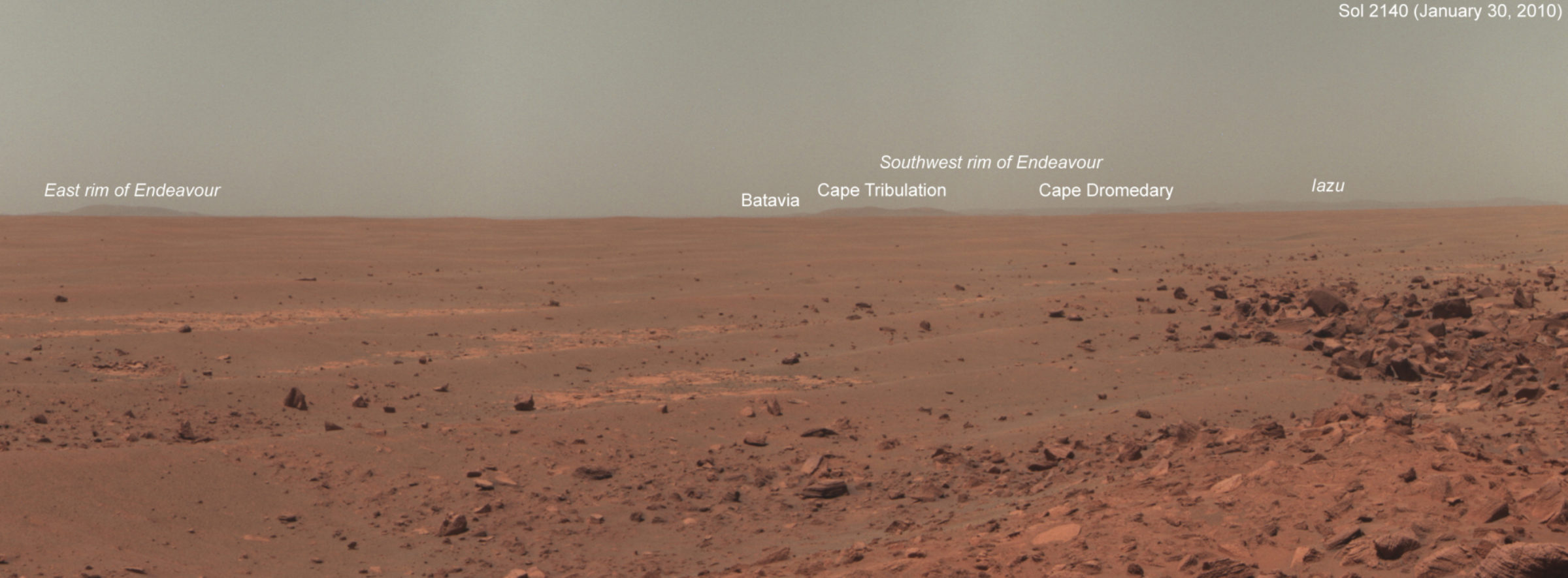
Last week the Mars Exploration Rover team dumped another 90 sols' worth of data from Mars into NASA's Planetary Data System, the national repository for space mission data. As I did once before, I dove into this fresh pile of data to pull out Opportunity's color views of the distant rim of Endeavour crater. What I wanted to see was those hills getting rapidly bigger and taller and more detailed, and I wanted to show that to you as an animation.
Ultimately, I was disappointed. From the time that Opportunity first spotted those hills around sol 2140 (January 30, 2010) to the last color view available in the data archive (which dates from July 2010), the view just didn't change all that much. Here's the sol 2140 view I posted before:

The view as of sol 2314 -- last July -- doesn't show a great deal more detail on the rim of Endeavour.

During that time Opportunity covered about 1.5 kilometers, as the crow flies, toward her goal on the rim of Endeavour, which is no small amount. So why didn't the perspective change very much?
There are a couple of reasons. For one thing, those hills on the horizon are very far away, so far that 1.5 kilometers' travel makes little difference in Opportunity's perspective. Cape Dromedary was more than 18 kilometers from the rover as of sol 2140, and about 17 as of sol 2314, which is not much of a change. For another thing, I keep on making the mental mistake of thinking that Opportunity is headed toward Cape Tribulation, the tallest visible peak; but in fact Opportunity's roving toward a spot considerably to the left of Cape Trib, a very low hill called Cape York that she probably won't even be able to see until she's nearly on top of it. Even when she has gotten to Cape York, she'll still be more than 2 kilometers away from the nearest hills of any real magnitude.

So in the end this exercise was more than a bit disappointing. It just goes to show how very long the journey is ahead of Opportunity, and how much patience is required when roving across Mars.
Support our core enterprises
Your support powers our mission to explore worlds, find life, and defend Earth. You make all the difference when you make a gift. Give today!
Donate

 Explore Worlds
 Find Life
 Defend Earth

