Emily Lakdawalla • Oct 28, 2008
Opportunity is really hitting the highway
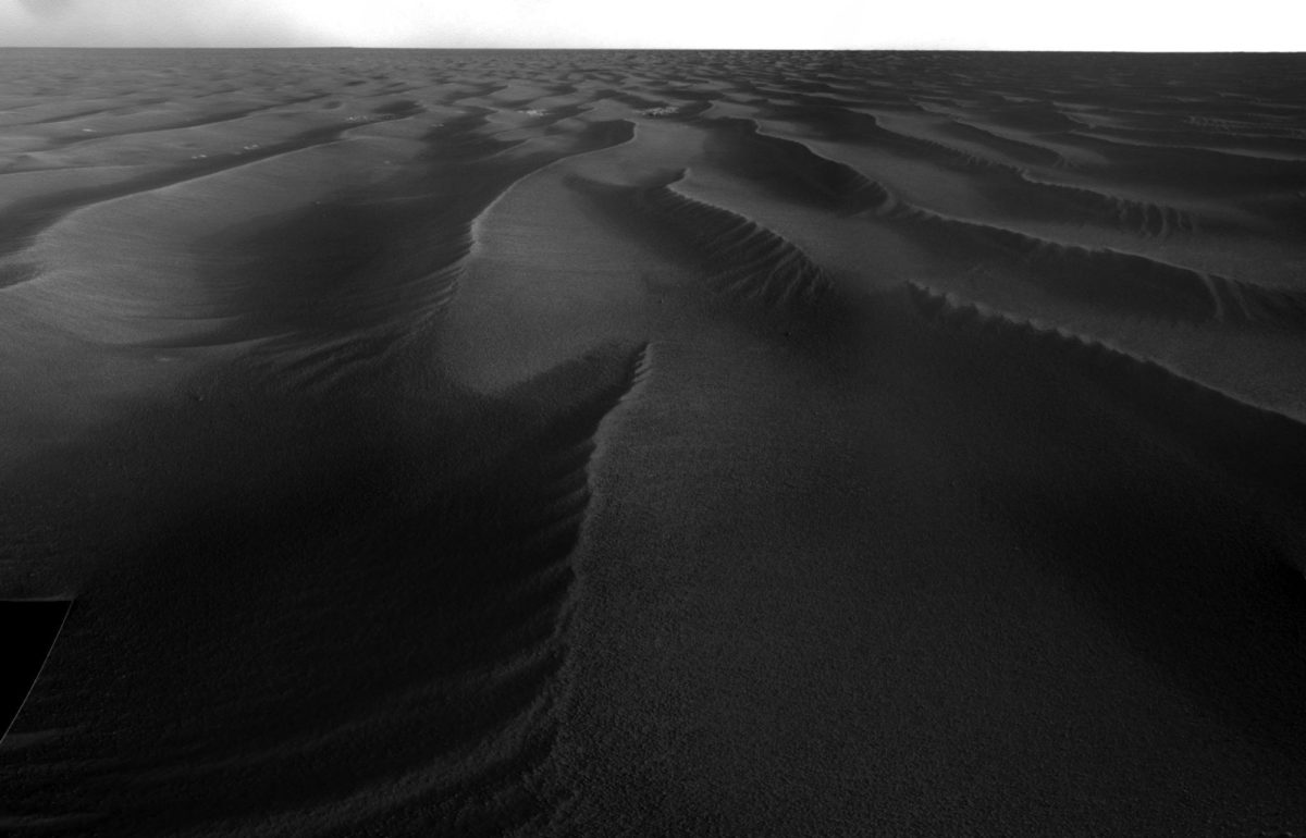
Opportunity's drivers are not messing around! Victoria crater, the site of a Mars year's worth of study, is now far over the horizon, as Opportunity has lately completed a series of very long drives. Opportunity is once again sailing the sand seas of Meridiani Planum. Here's the view as of sol 1,691.

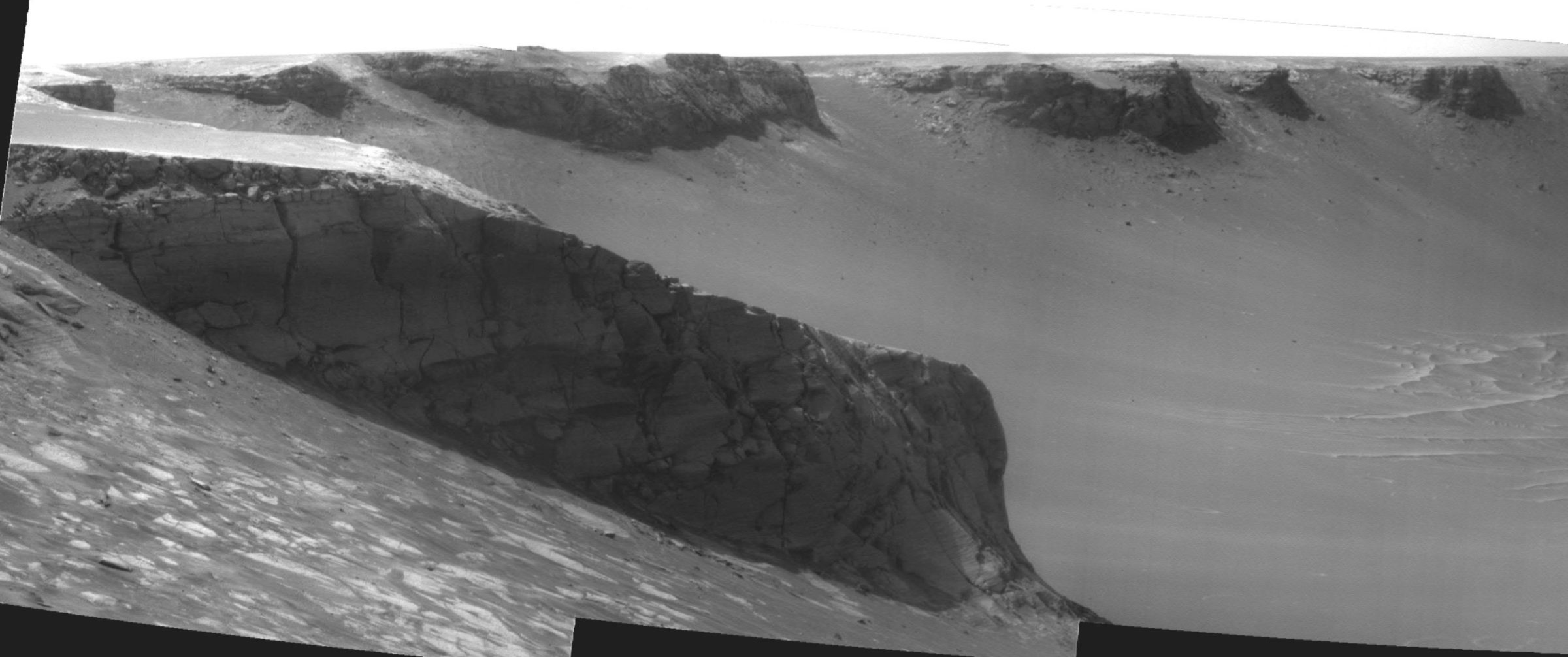
I last checked in with Opportunity on sol 1,666, as it was doing a few last sightseeing stops around the crater. Opportunity stopped in at Cape Victory for one view and then Cape Agulhas for its last postcard from Victoria. Cape Agulhas is the southernmost tip of South Africa, a fitting departure point for Opportunity. The view back into Victoria from there contained tantalizing, steeply exposed rock faces in Cape Victory.

It's tough for a geologist to tear herself away from such enticing-looking rock, to embark on a (possibly) years-long journey to an uncertain goal -- but to do just that is now Opportunity's mission; there is more potential scientific payoff in the journey than there would be in further months exploring Victoria. So off Opportunity went, departing Victoria on sol 1,683. A full Navcam panorama from that day contains Opportunity's last-ever view of Victoria crater.

Fittingly, on October 20 (sol 1,685) -- just before Opportunity left Victoria behind forever -- the United States Geological Survey announced that Opportunity's eventual goal had formally been named Endeavour crater. So Opportunity leaves a home behind, but has a name for its next destination.
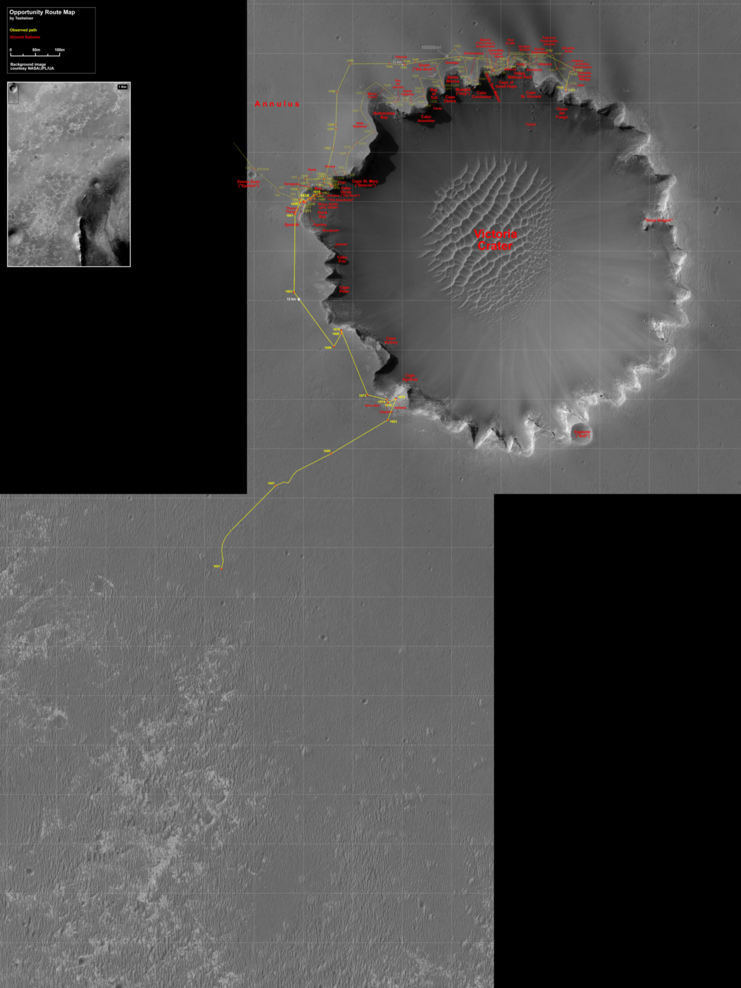
Drives on sols 1,686 and 1,687 took Opportunity well over 100 meters each time; the odometry on sol 1,691 was over the 200-meter mark. But Opportunity's made little progress toward Endeavour yet, because it's not driving south-southeast toward Endeavour, but instead southwest, which seems a little odd. But if you look at Eduardo Tesheiner's route map below, you'll see there's a method to their madness. Opportunity is aiming for an area in which the north-south-trending sand dunes are just a thin cover atop exposed bedrock, a much safer (not to mention faster) driving surface than trackless dunes. That area will become a nice highway on which Opportunity should be able to make good progress southward.

It's on the road again for Opportunity!
Support our core enterprises
Your support powers our mission to explore worlds, find life, and defend Earth. You make all the difference when you make a gift. Give today!
Donate

 Explore Worlds
 Find Life
 Defend Earth

