Emily Lakdawalla • Oct 09, 2014
What did Dawn learn at Vesta?
It's now been two years since Dawn wrapped up its work at the second-largest asteroid. There's no question that the Dawn mission changed our view of Vesta -- literally. Before we got there, this was our best understanding of Vesta, from Hubble:

The Vesta phase of the Dawn mission lasted from May 3, 2011 to September 4, 2012. Thanks to Dawn's Framing Camera (and some stellar image processing work by Bjorn Jonsson), this is how we see Vesta now:
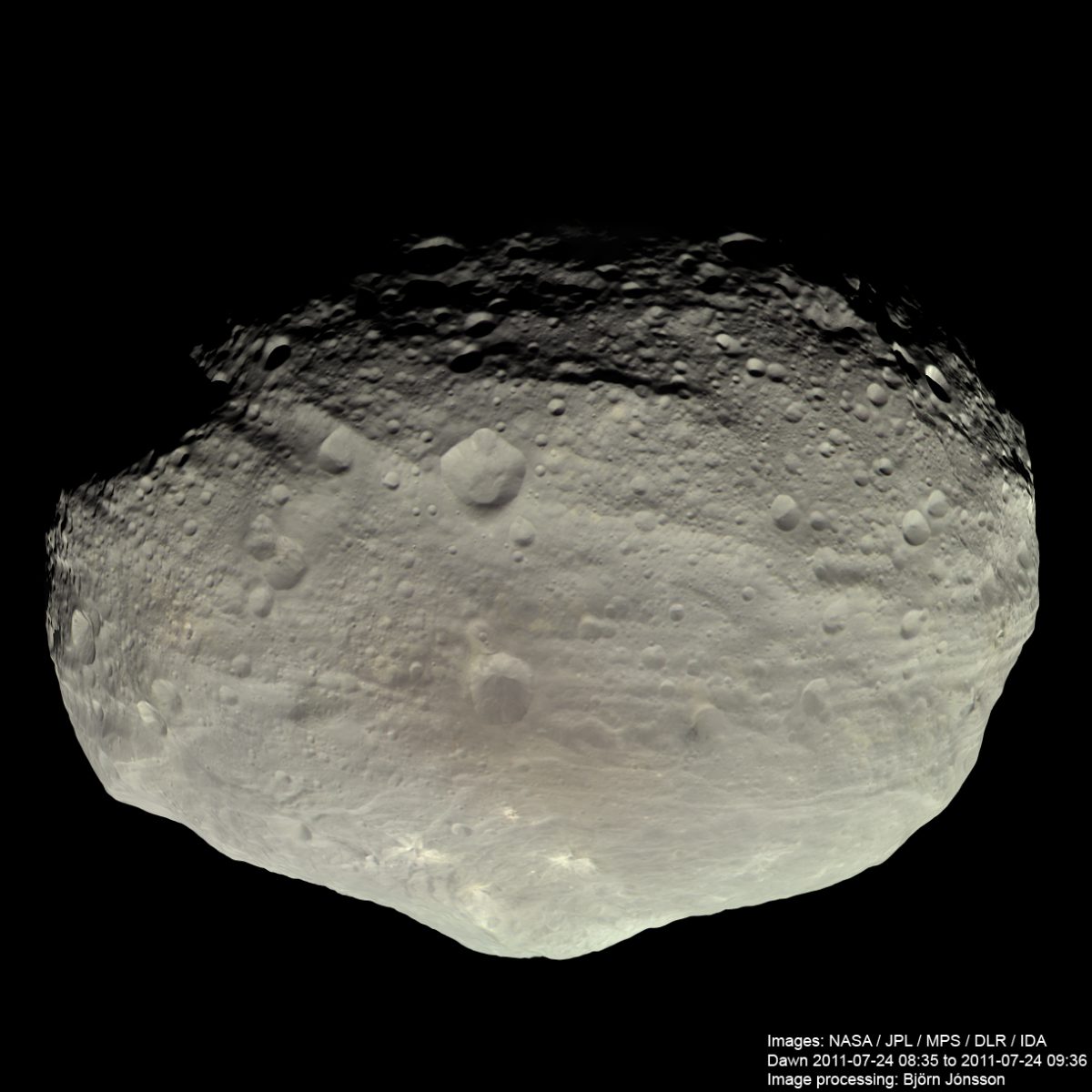
What else did we get from the Vesta encounter besides great photos? I realized, as I sat down to write an article for Sky & Telescope previewing Dawn's upcoming Ceres encounter, that I didn't know the answer to that question. After getting lost in a pile of Vesta-related academic papers recently published in Icarus, I finally asked Dawn's project scientist and deputy principal investigator, Carol Raymond, for help in summarizing a few of the big things Dawn taught us.
The first major result of the Dawn mission, Carol told me, was confirmation of the big-picture description of Vesta. One of the goals of the Dawn mission was to test the hypothesis that three specific classes of meteorites were related to Vesta. These three types of meteorites -- howardites, eucrites, and diogenites, collectively known as HED meteorites -- have spectral properties that make them a close match to the spectral properties of Vesta as observed from Earth. For a thorough introduction to the HED meteorites and waht makes them special, check out this detailed HED resource at the Johnson Space Center's website.
When the Hubble Space Telescope images suggested that Vesta's entire south pole was one gigantic impact crater, that suggested a mechanism for delivering the HED meteorites to Earth: that huge impact blasted away a huge amount of Vesta's crust, possibly digging into its mantle. It's a tidy story, because the eucrites look like a planetary crust, while the diogenites look like a planetary mantle, and the howardites are a mix of the two. The presence of different crust-like and mantle-like material meant that Vesta had differentiated -- separated by density into onion-like layers of different composition. Differentiation is one of the things that separates planet-like bodies with active internal geology from inactive asteroid-like bodies.
Carol said that the elemental data (from Dawn's GRaND neutron spectrometer instrument) and the spectral data (from its Visual and Infrared spectrometer, VIR) have confirmed the HED connection. In particular, most of Vesta's surface looks like howardites, which are the type that's a mixture of the other two. That isn't surprising; the impact that created Vesta's south polar basin (actually two overlapping impacts) happened a very long time ago, and more recent impacts have dug into the surface and mixed material around. And gravity data have also confirmed the fact that Vesta is denser toward its center, which is consistent with the differentiation story. There isn't unequivocal evidence for a metallic core and a rocky mantle, but it's quite likely, and consistent with the compositional story.
It's nice when your observations match your predictions. But, as is so often the story with planetary science, things get more interesting as you zoom into a planet and observe its features in more detail. The Dawn mission to Vesta had several distinct phases, conducted at different altitudes:
| Phase | Start date | Altitude (km, approx) |
|---|---|---|
| Vesta approach | May 3, 2011 | 1.2 million-3100 |
| Vesta survey | Aug 11, 2011 | 2735 |
| Transfer to High Altitude Mapping Orbit | Aug 31, 2011 | 2735-685 |
| High Altitude Mapping Orbit | Sep 29, 2011 | 685 |
| Transfer to Low Altitude Mapping Orbit | Nov 2, 2011 | 685-210 |
| Low Altitude Mapping Orbit | Dec 12, 2011 | 210 |
| Transfer to High Altitude Mapping Orbit 2 | May 1, 2012 | 210-685 |
| High Altitude Mapping Orbit 2 | Jun 15, 2012 | 685 |
Carol said that as they have looked at the higher-resolution data and improved their calibration and interpretation, they began to realize something surprising about Vesta's surface: a lot of what we see there didn't originate on Vesta. They were finding a lot of hydrated material on the surface -- that is, minerals that contain water molecules or hydroxyl groups inside their crystal structures. The hydrated materials were associated with older terrains (primarily eucrite-like material), and also with dark material. Vesta's dark material really stands out in the Framing Camera photos, and has been a major puzzle:
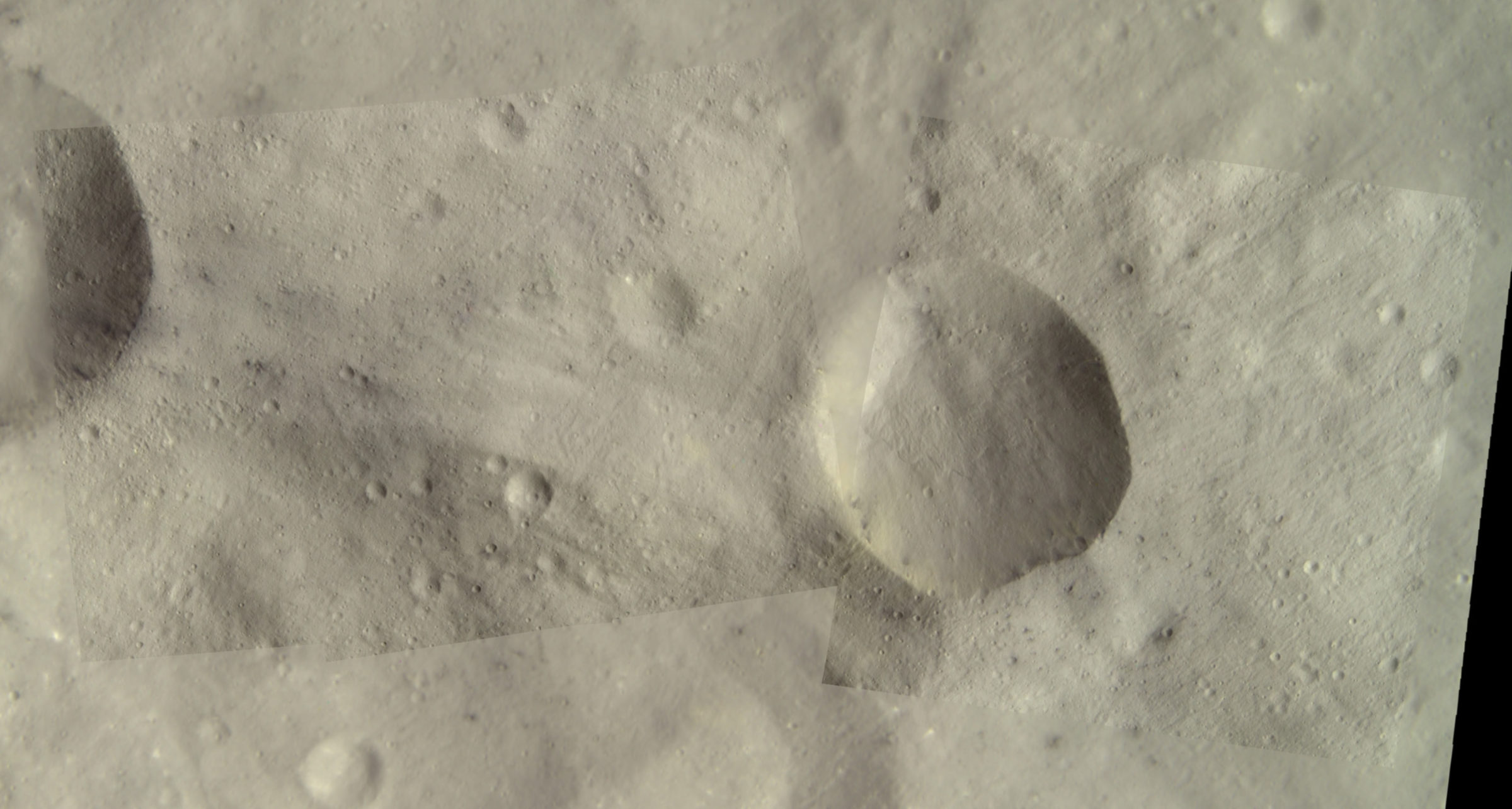
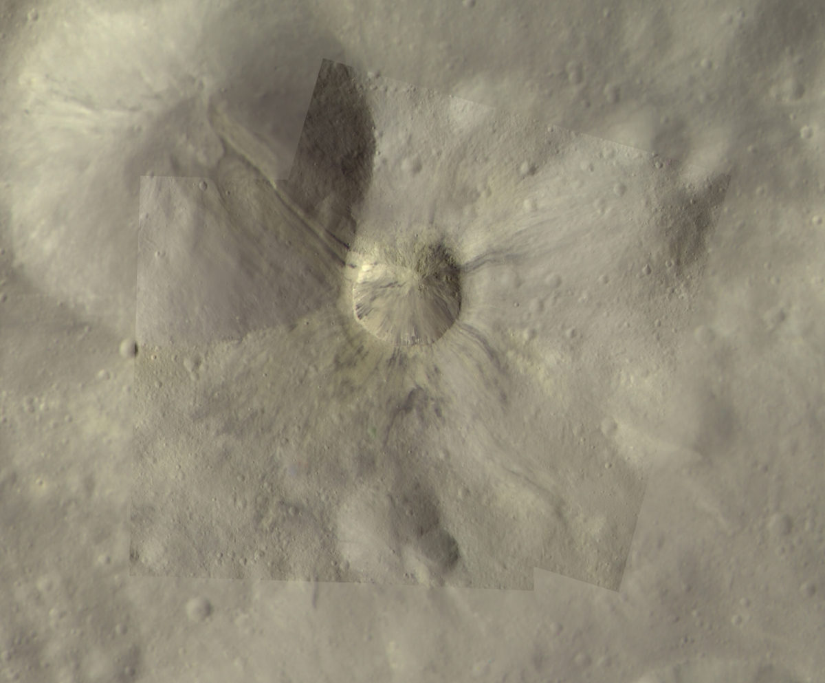
Hydrated materials are puzzling. To get them, you need water interacting with rocks. Vesta's too hot for water, or so we thought. But there's evidence, again, in meteorites, for what might have happened. Howardites aren't only a mixture of diogenites and eucrites. They also have some other interesting additives: carbonaceous chondrite material. The key word in there is carbonaceous -- carbon-rich -- that's stuff that you also wouldn't expect to find on Vesta. The carbon-rich material and the water or hydrated materials could have come in from outside Vesta, delivered by impacts of debris that came from much farther out in the solar system.
Carol referred to a 2012 paper by Vishnu Reddy and coauthors, which showed that the scattered deposits of dark material on Vesta are strongly associated with the rim and floor of the earlier of the two large south polar impacts, Veneneia. Reddy proposed an explanation: the object that crashed into Vesta to form the Veneneia impact basin was rich in carbonaceous and hydrated materials, and plastered Vesta's surface with them. It's possible that such an impact could've happened at a speed as slow as 2 kilometers per second, which would have preserved a lot of the original impactor's materials on the surface. Later, the big Rheasilvia impact wiped out half of the Veneneia impact basin and covered the rest of it with bright Rheasilvia ejecta. Since that time, other impact events have "gardened" the surface, exposing patches of dark Veneneia material here and there to make the pattern we see today. Reddy and coworkers admit that this scenario requires several low-probability events, however, and can't rule out the possibility that the dark material was delivered in many separate impact events over a long period of time. For her part, Carol told me she thinks both scenarios are partially correct. The highest concentrations of dark material are in places where old surface is exposed; these just happen to be places that have escaped the later large impacts that would've reset the record of dark material arriving on the surface over time. But it's also likely that the delivery of dark material has happened in a few large pulses, and one of those certainly could've been the Veneneia impact.
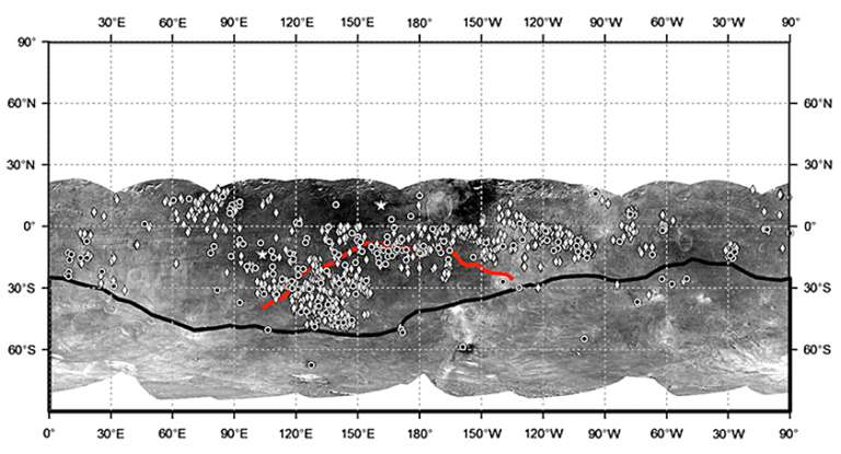
Another cool surprise at Vesta was the presence of parallel sets of troughs, which are pretty clearly related to those two enormous south polar impacts. Each set of troughs formed when one of the impacts rang Vesta like a bell. Carol told me that the presence of those troughs means that there is serious damage to Vesta's interior, not just the surface, as a result of the two impacts. She said that jibes with a bulk density for Vesta that's low relative to HED meteorites; there may be as much as 10% porosity in places on Vesta in the form of open cracks within a shattered crust.
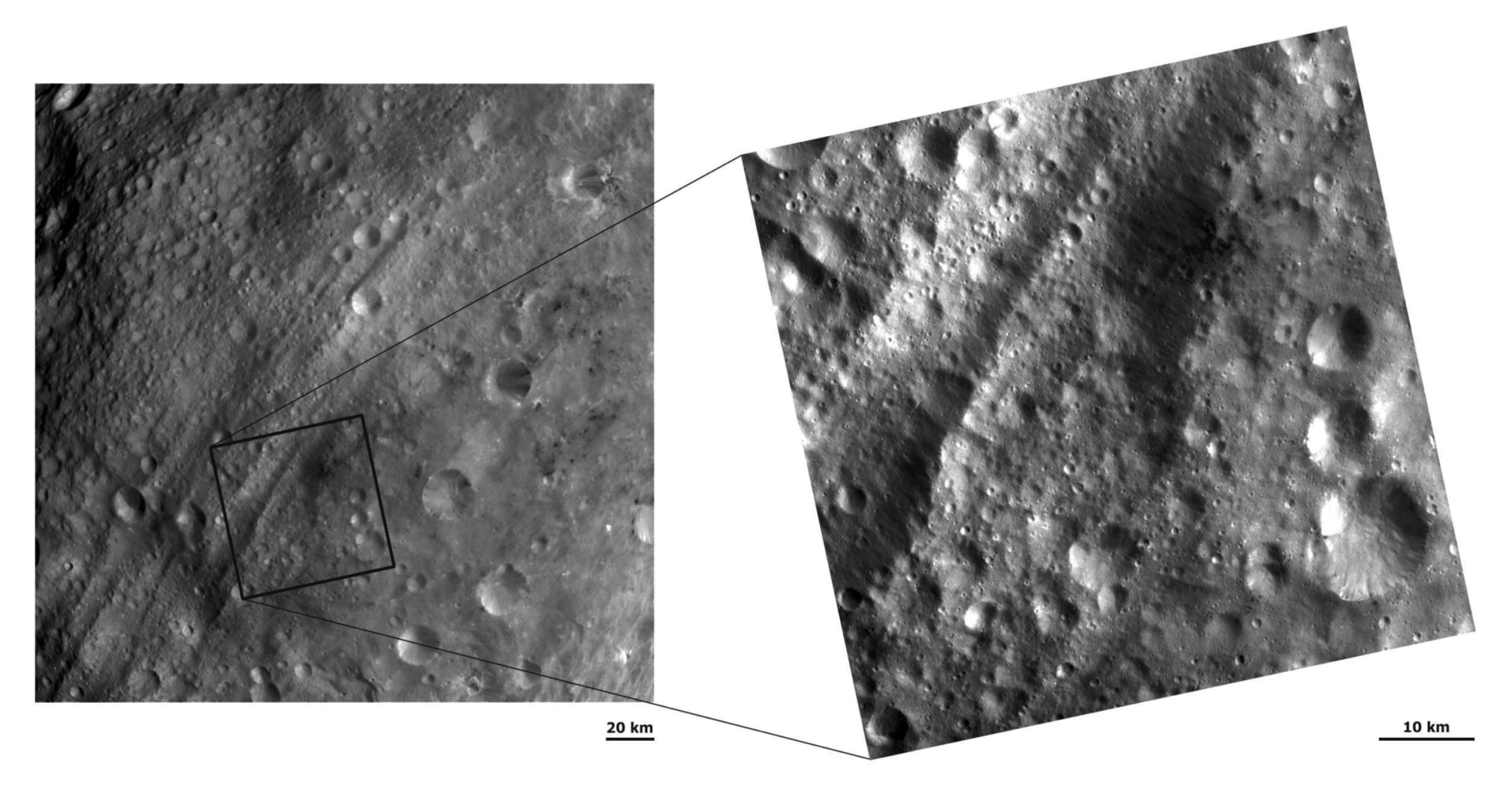
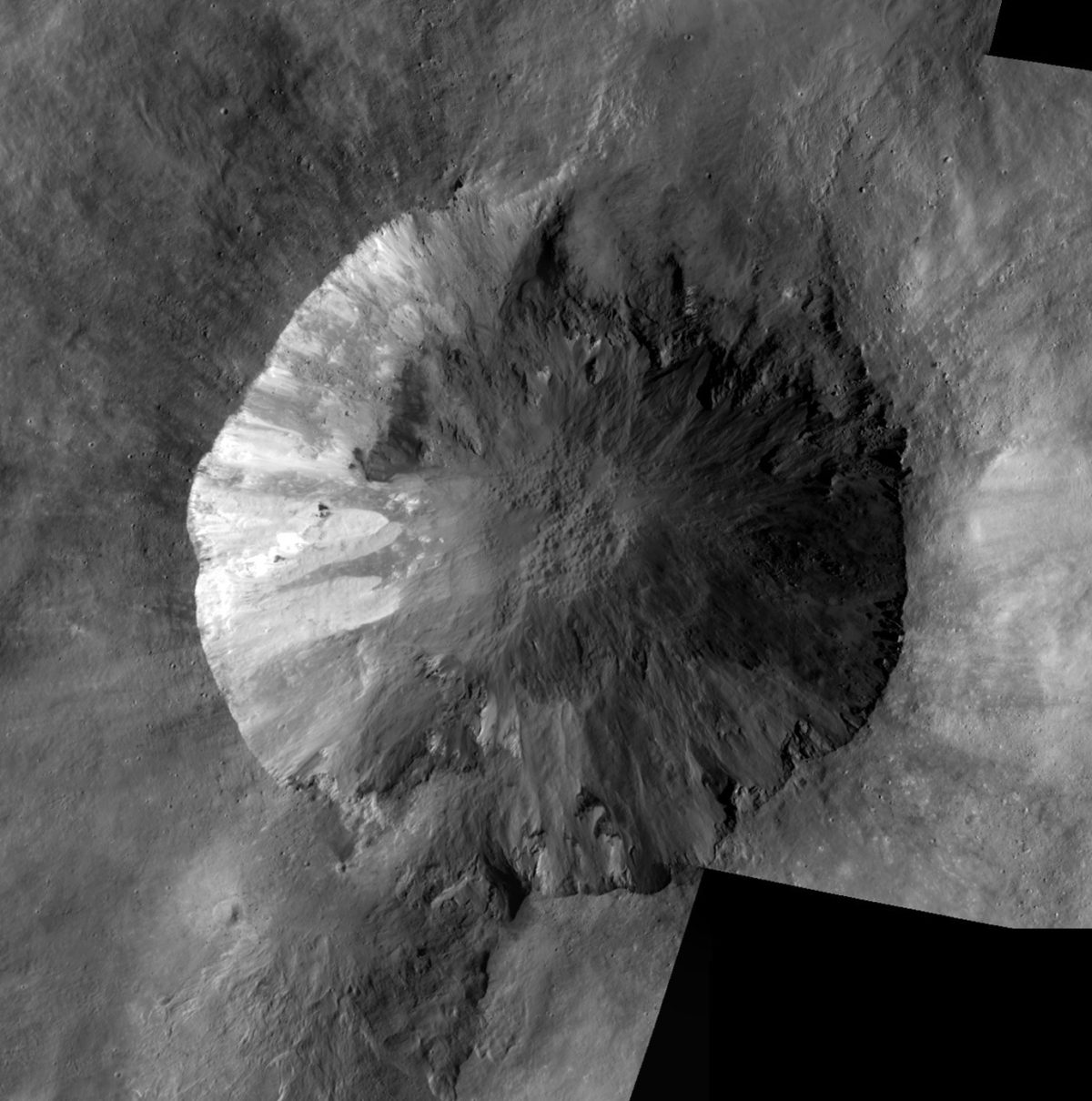
But Carol says that things got really good when Dawn dropped to its lowest altitude, the appropriately named Low Altitude Mapping Orbit. At low altitude, they saw "a tremendous amount of geology on the surface of Vesta, much more akin to what we see on Mars or even Earth." There was geomorphological variety -- lots of different landforms, evidence for dynamic events like landslides. They came to realize that Vesta has a "very slope-intensive environment." Like smaller asteroids, Vesta has very steep slopes; like planets, it has relatively high gravity. That sets up a world that will have lots and lots of mass movement of rock cascading down slopes. "That's created some interesting exposures of material, and very small-scale geology."
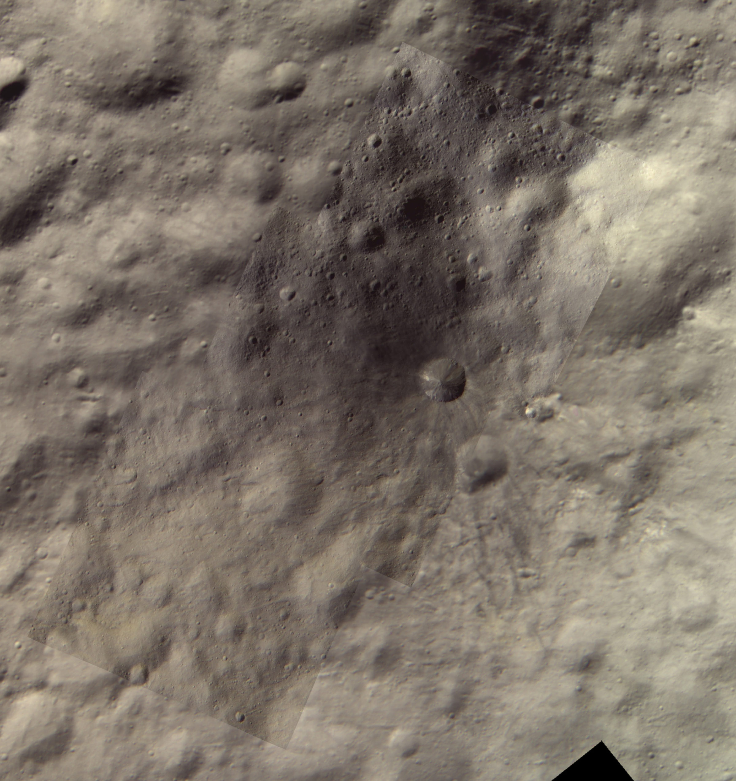
Dawn has also seen a lot of mineral variety, and also a lot of variety in how Vesta's bright and dark materials related to the rest of the surface.Carol also mentioned the pitted terrains inside some craters, which I wrote a long blog entry about after the Lunar and Planetary Science Conference. The short version: there are landforms that Jennifer Scully is interpreting to mean that Vesta has pockets of buried ice that can get exposed and melted during impacts, forming water-carved gullies and collapse pits on the otherwise totally dry and relatively hot surface of an asteroid. Carol seemed to be excited about the idea, but was also circumspect: "this is meeting a tremendous amount of resistance, for obvious reasons. Where does the water come from? No one wants to accept there could be lenses of ice in subsurface, or enough water that could be mobilized out of water bound in minerals that could cause these transient flooding events." Work continues.
Work continues in a lot of areas, actually. Carol talked about a very recent work, just published in Icarus, on Vesta's gravity. There are actually four gravity-related papers in Icarus, and I really tried to learn something from them but made little headway. Carol says that now that the gravity maps are out, she's working on trying to tie the present-day gravity to the geologic history of Vesta, and the story seems to be a complex one. There's more to come.
One final item Carol mentioned: Vesta has no moons. This wasn't very surprising, but they did search, and didn't find any. (On its approach to Ceres, Dawn will be searching for moons there, too.)
It's interesting that the highest-resolution images, both from the Framing Camera and VIR, have yielded some of the more surprising discoveries of the Dawn mission. Those highest-resolution images, taken from the lowest orbit, were not in Dawn's original plan or science requirements. Dawn is a survey mission whose goals are to completely map two of the biggest worlds in the asteroid belt. And they are huge worlds; they don't fit on my composite photo of asteroids visited by spacecraft. They really are planet-scale objects, more appropriately compared to places like Mercury, the Moon, and outer planet moons. In order to map such big worlds, you have to balance a desire for detailed photos against the goal of completing the whole globe. Dawn was designed to get global coverage of Vesta and Ceres at a medium survey resolution. Its lowest orbits were designed to benefit the gravity and neutron spectrometer mapping; the cameras only rode along, their images a bonus. As it turned out, though, the crafty Dawn planners not only were able to squeeze imaging in to the lowest orbit, they managed to image almost the entire world at that highest resolution. And the effort seriously paid off. Just look.
Support our core enterprises
Your support powers our mission to explore worlds, find life, and defend Earth. You make all the difference when you make a gift. Give today!
Donate

 Explore Worlds
 Find Life
 Defend Earth

