Emily Lakdawalla • Oct 02, 2017
A new year's worth of Mars Orbiter Mission data
India's Mars Orbiter Mission has now completed three years in orbit at Mars, and ISRO celebrated the anniversary by releasing the mission's second-year data to the public. Data from all instruments are available, but of course I am always most interested in cameras, and Mars Orbiter Mission has one: the Mars Colour Camera, MCC. MCC is a color camera with a detector 2048 pixels square, so it can take lovely photos of broad expanses of Mars suitable for printing.
I have spent a week downloading and examining the data. The website on which ISRO hosts the data is not very easy to use, so I have helped you out by downloading all the new images and posting them here along with metadata. (You may recall I did this a year ago, when ISRO issued the first year's worth of data.) Before you dive in to images, however, I encourage you to read on in order to learn a little more about what's in the data release.
I think I can safely say that the very best from the new data release is this full-globe view taken in northern Martian summer. It is the only non-truncated, full-globe view from the second year of the mission. Feast your eyes upon it. This camera produces such luscious color in a palette of ochre, sienna, and umber.
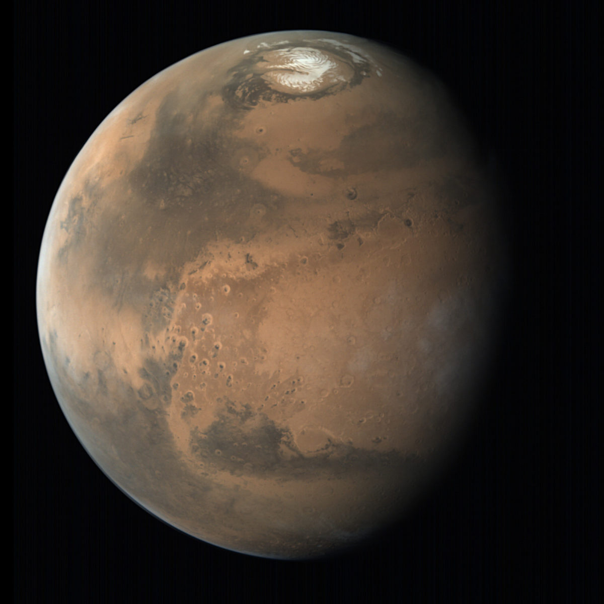
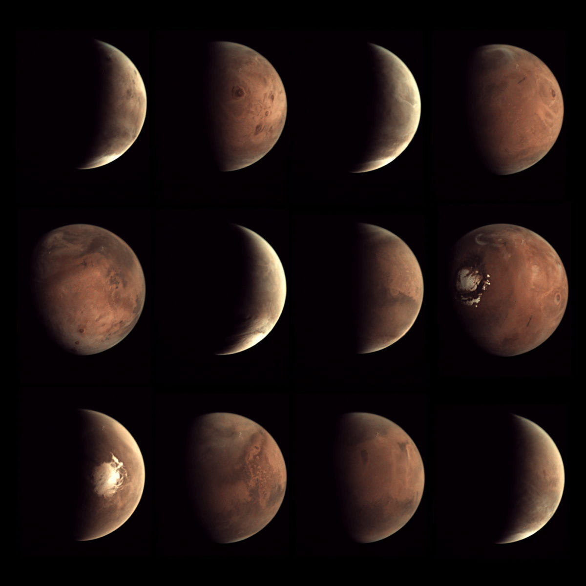
I'm disappointed that there aren't more global Mars views. There still aren't any shot from higher phases (half, crescent) -- these would be truly unique products, available from no other camera. Mars Express' VMC can and does take high-phase photos, but as much as I appreciate that camera, it doesn't produce magazine-cover-quality photos. How cool it would be if Mars Orbiter Mission produced some photos like these from Mars Express VMC, but with ten times the pixels and thicker, richer color!
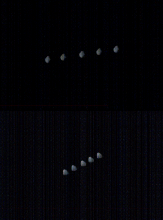
Another target of opportunity during the mission's second year was the tiny, distant moon Deimos. (At least, I think this is Deimos, but there is a nonzero chance it is Phobos; it's hard for me to tell.) I have been hoping that Mars Orbiter Mission would do more Deimos imaging, because they are the only spacecraft that is able to see sides of Deimos other than the face that points at Mars. Unfortunately, although they took two sequences on January 18 and February 19, 2016, neither was from a range close enough to reveal any details. It may be that the orbits of spacecraft and moon just don't conspire to provide very good imaging opportunities; I'm not sure.
So if there are no more global views, what is in the data set? It's taken me a week of work to answer that question. But after sorting and massaging the metadata in different ways, I've finally wrapped my head around the data set and produced a set of browse pages that will hopefully make it easier for everybody else. Please keep in mind that this organizational scheme is mine and so probably doesn't reflect the thinking of the MOM team, and there may be errors in categorization. Each link below goes to a page full of images from both data releases, images from 2014 to 2016.
Full-globe views. When Mars Orbiter Mission is near apoapsis, farther than about 65,000 kilometers away from the planet, it is able to encompass the whole globe in one field of view, with no truncation, at a resolution of about 4 kilometers per pixel. There have now been eight such unique views. On the browse page, I sorted them by longitude.
Near-global views. There is a heartbreaking number of photos of Mars that are very nearly global, truncated at one or more edges. Here, for example, is a view centered on Elysium Mons, which means that the landing sites of Curiosity, InSight, and Viking 2 are also central. (For help locating Mars landing sites, use this map.) I also sorted these by longitude.

Regional views. Between altitudes of about 10,000 and about 40,000 kilometers, the camera still observes very large swaths of the Martian surface, with resolutions around 1 or 2 kilometers per pixel. These images could be very interesting to combine with MOLA gridded topographic data, which has only slightly lower resolution, to make nice colorized regional maps. For instance, I'd love to see some people combine these regional views of giant Martian volcanoes with MOLA topography.
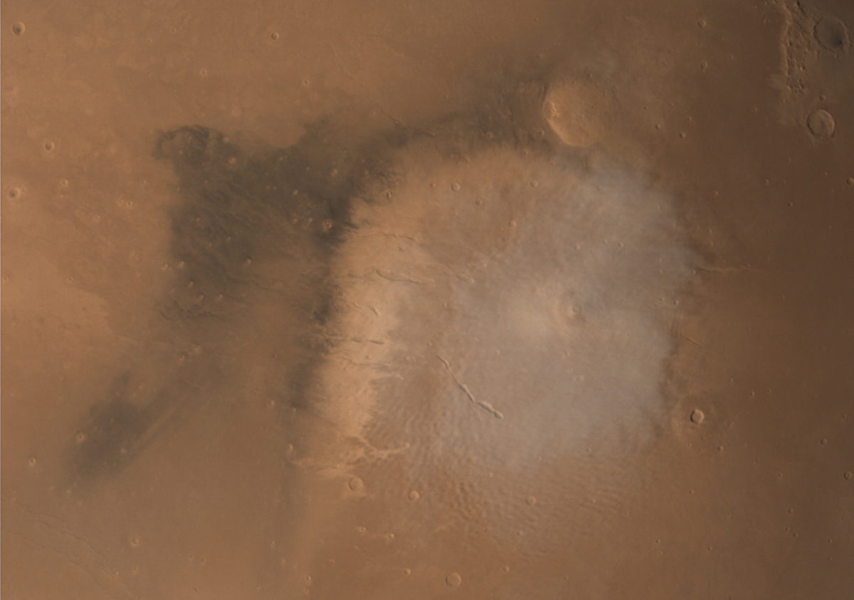

It would be really great to make a global color map at this resolution from Mars Orbiter Mission MCC data, because it would be better than the only similar product made from Viking color images, the Viking MDIM. Unfortunately, there isn't global MCC coverage at this resolution; continuous regional coverage only exists from about 0 to 60 degrees north. One could make do with lower-resolution data for the southern hemisphere though. Here's a map showing the regional-image coverage that has been released to date:

High-resolution mosaics. At altitudes lower than 10,000 kilometers, the Mars Orbiter Mission camera team seems to prefer shooting mosaics rather than repeated single footprints. I use "high-resolution" in a relative sense: these are still low-resolution by modern standards (20-600 meters per pixel). These are shot close to periapsis on Mars Orbiter Mission's equatorial orbit, so they cluster quite close to the equator. The high-resolution images split into two seasons: from orbits 21 to 103, they lay mostly on or just south of the equator. From orbit 132, they lay mostly north of the equator. I assume this has to do with the evolution of Mars Orbiter Mission's orbit over time. On the browse page, I split them into those two orbital phases (southern and northern) and then ordered them by longitude.
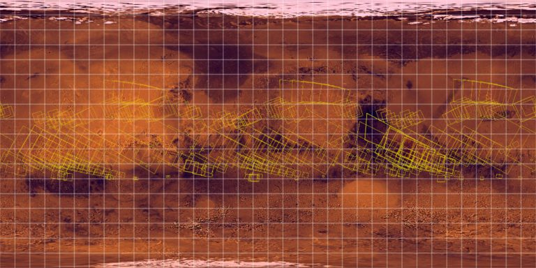
These high-resolution images don't seem to be deliberately targeted at features on the surface -- they seem to fall more or less where the orbiter's path took them. They could be useful to colorize crisper images from other data sets, like Viking or perhaps mosaics of Odyssey THEMIS daytime infrared images, to produce context maps. The latitude limitation is pretty severe, however, and the resolution pretty low. There is nothing at this resolution covering either of the potential locations for Mars 2020, and coverage over the Gale, Meridiani, and Gusev rover sites is on the lower-resolution end of the scale.
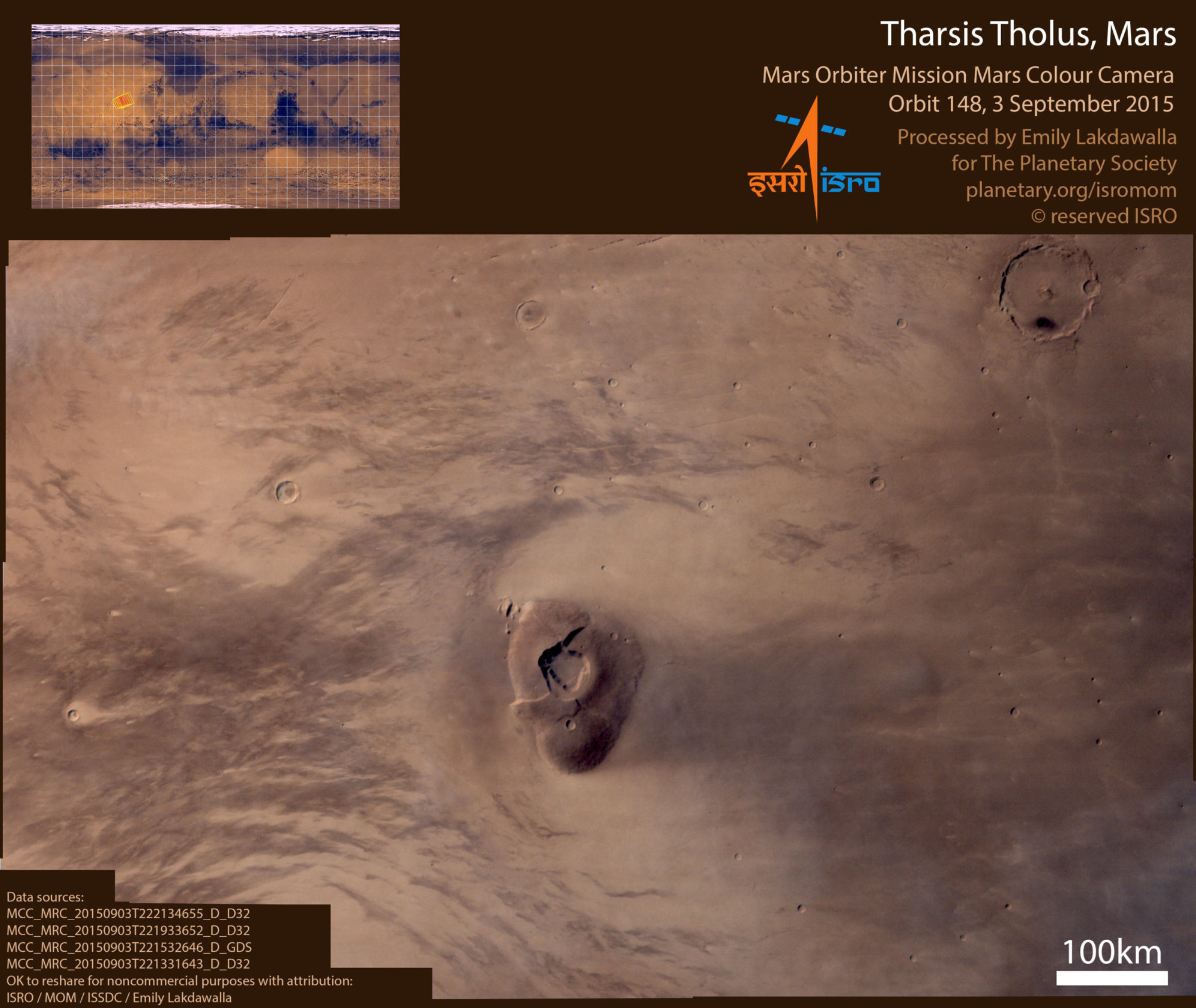
Still, despite all those limitations, the images are pretty in and of themselves. Here are a few examples of high-resolution mosaics. I've mosaicked them and stretched the color a bit to bring out the subtle variations. In reality the color is blander than this, but MCC captures the variety well.


I am greatly looking forward to seeing what amateurs do with these data. Go forth and have fun exploring the subtle Earth tones of Mars!
Support our core enterprises
Your support powers our mission to explore worlds, find life, and defend Earth. You make all the difference when you make a gift. Give today!
Donate

 Explore Worlds
 Find Life
 Defend Earth

