Emily Lakdawalla • May 23, 2014
New orbital images of Curiosity landing site from Mars Express and HiRISE
The High Resolution Stereo Camera (HRSC) on Mars Express produces color images covering large swaths of Mars. In July of last year, they obtained a very nicely framed color image that includes all of Gale crater and some of the terrain beyond. I tip my hat to Doug Ellison for noticing this image release and pulling it out of the data archives:
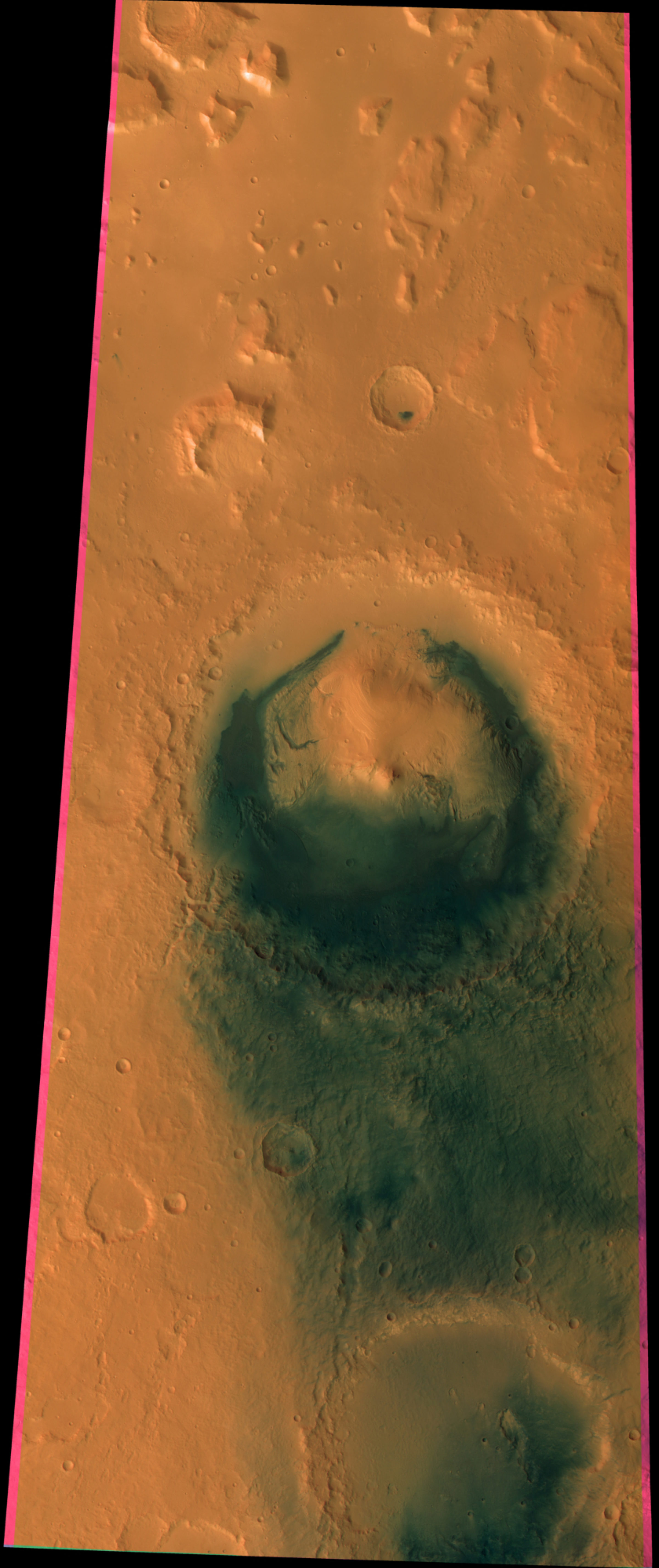
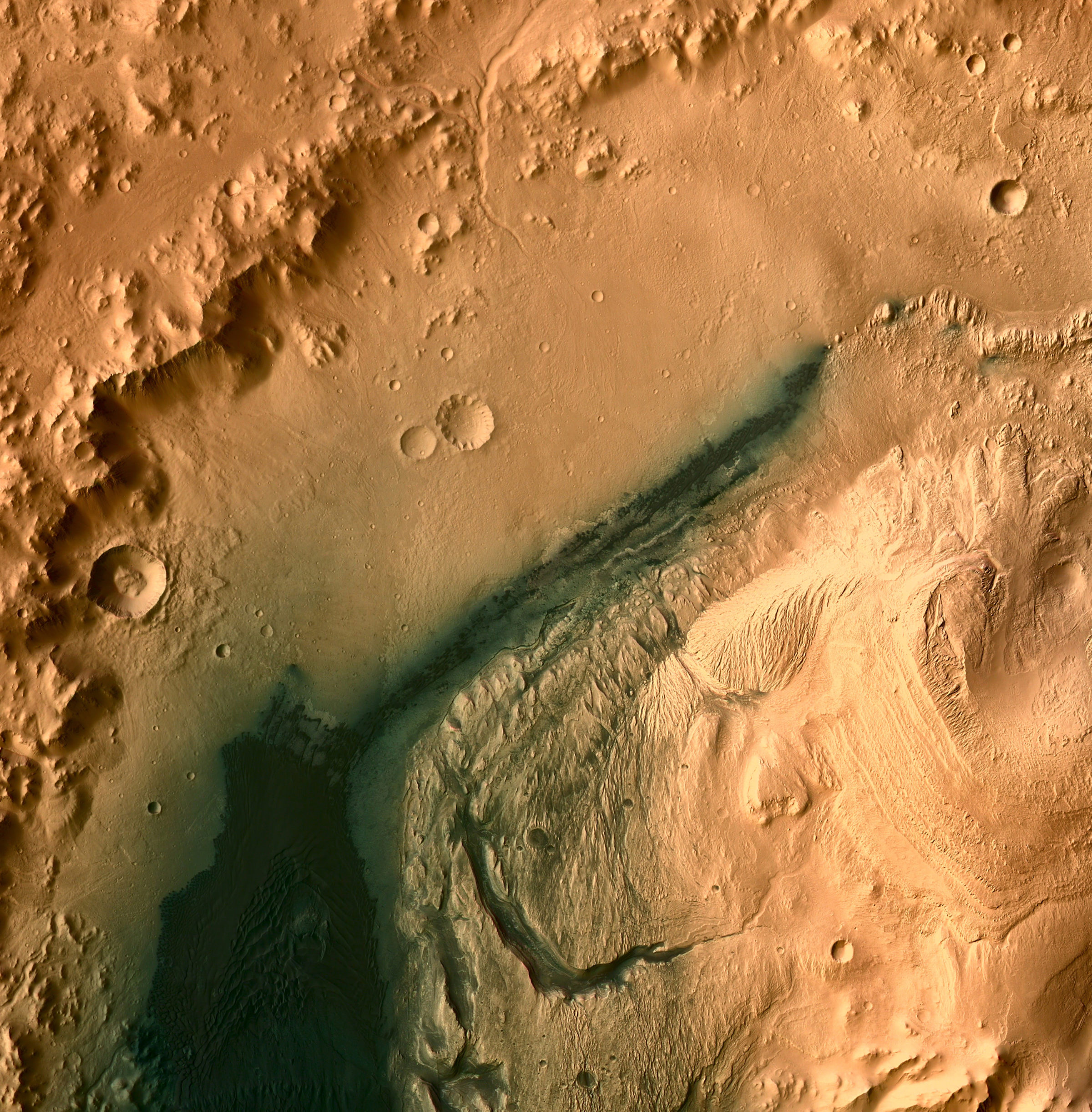
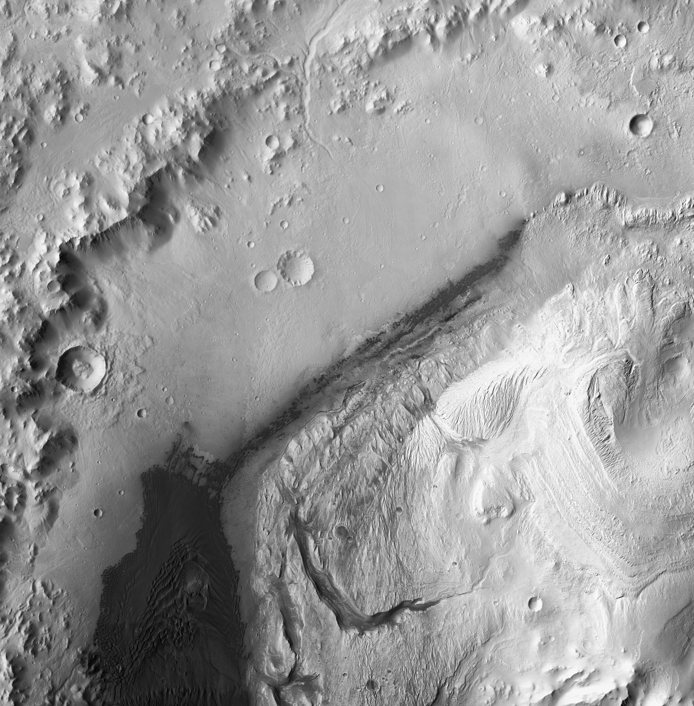
Curiosity's in the photo, but you can't see it; despite its name, the High-Resolution Stereo Camera can't achieve the resolution necessary to spot Curiosity or any of its (very slight) effects on Gale. At its full resolution, this image has 25-meter pixels. What's this image good for, then? My favorite thing to do with relatively low resolution color data is to use it to colorize high-resolution but monochrome data. The nicest camera for creating maps of regions on Mars is the Context Camera (CTX) on Mars Reconnaissance Orbiter. CTX produces beautiful, crisp photos at 6 meters per pixel. Here's what it looks like when you colorize the CTX data with the HRSC data, or just enjoy this before & after colorization comparison:
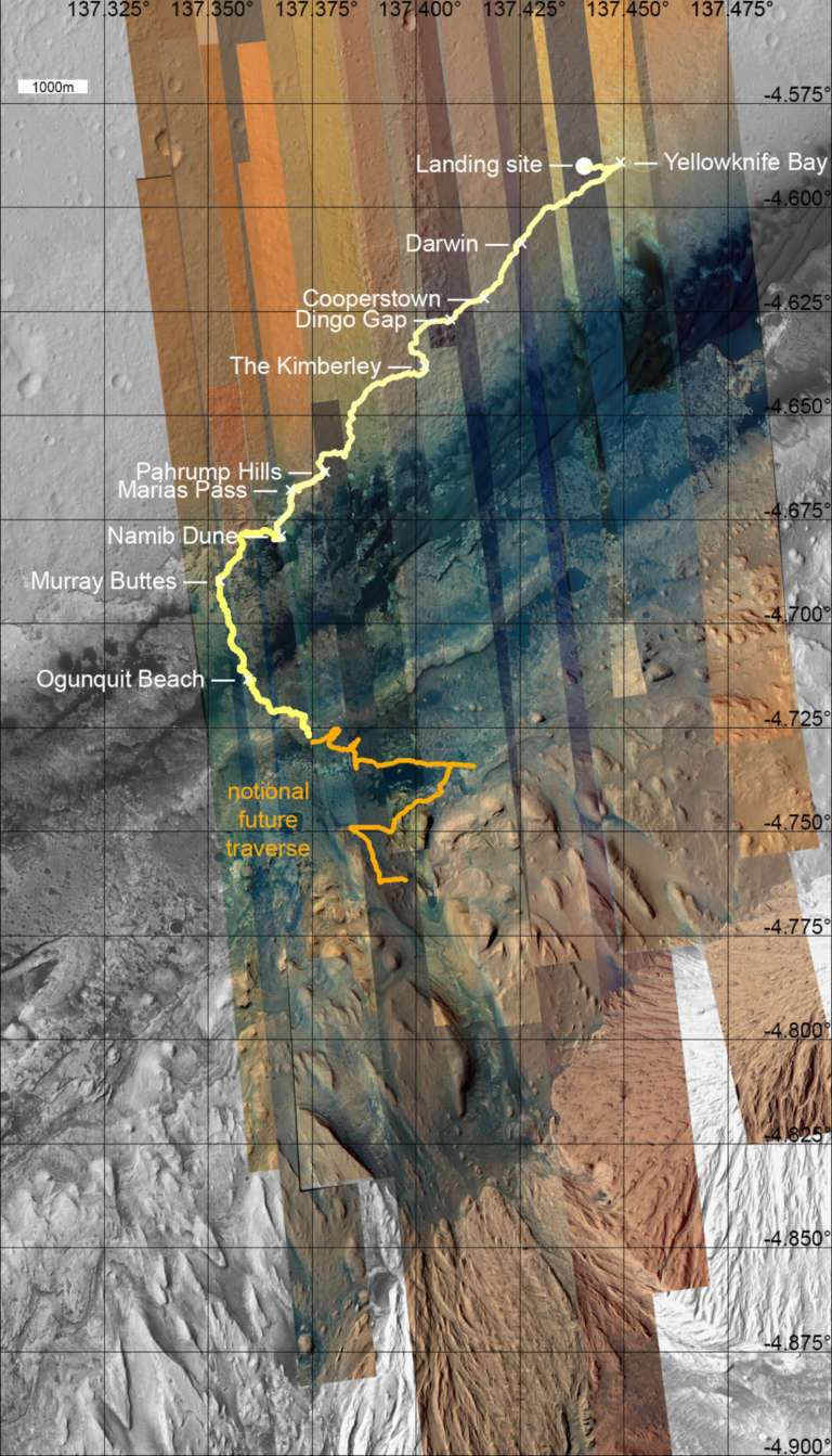
However, even CTX can't see fine enough details to see Curiosity. For that, we need HiRISE. I've catalogued the HiRISE images covering Gale crater before, and since my last update to that post there have been two new relevant images. One of the new HiRISE images has, for the first time, covered all of Murray Buttes in color. It does half the job of filling in what had been a big gap in HiRISE color coverage over the likely future Curiosity traverse; I can only assume there's another image request in the pipeline to finish the last gap in that coverage.
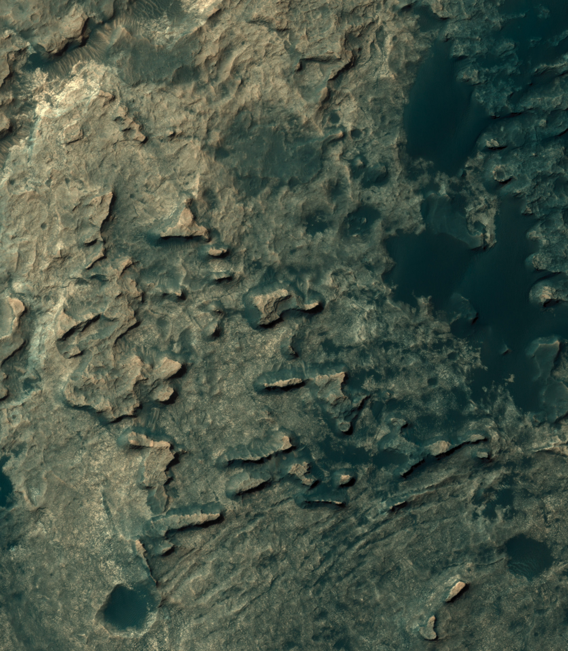
Here's the color part over Murray Buttes. It's fun to zoom way in on this one and look for rover-sized boulders at the bases of the buttes. It's going to be an interesting landscape to drive through, once we finally get there.
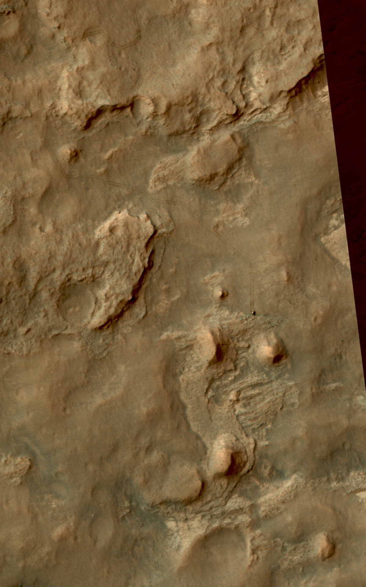
One of the two new photos also covered Curiosity just as she had driven to the north edge of the Kimberley. Curiosity and her tracks are located at the extreme right edge of the photo, far from the color strip at the center of the HiRISE image. But that's easy to fix, with the same trick I used above. I use my handy-dandy guide to HiRISE coverage of the Curiosity landing site to locate a HiRISE color image of the same area taken from just about the same angle -- this one works well -- and colorize the new photo. Et voilà!
For thoroughness' sake, here is my new map of color HiRISE coverage of the Curiosity landing site. There is now only one HiRISE image worth of the whole area that Curiosity is likely ever to traverse that has not yet been covered in color. Get on that, HiPlanners! :)
Support our core enterprises
Your support powers our mission to explore worlds, find life, and defend Earth. You make all the difference when you make a gift. Give today!
Donate

 Explore Worlds
 Find Life
 Defend Earth


