Justin Cowart • May 04, 2016
The Giant Volcanoes of Mars
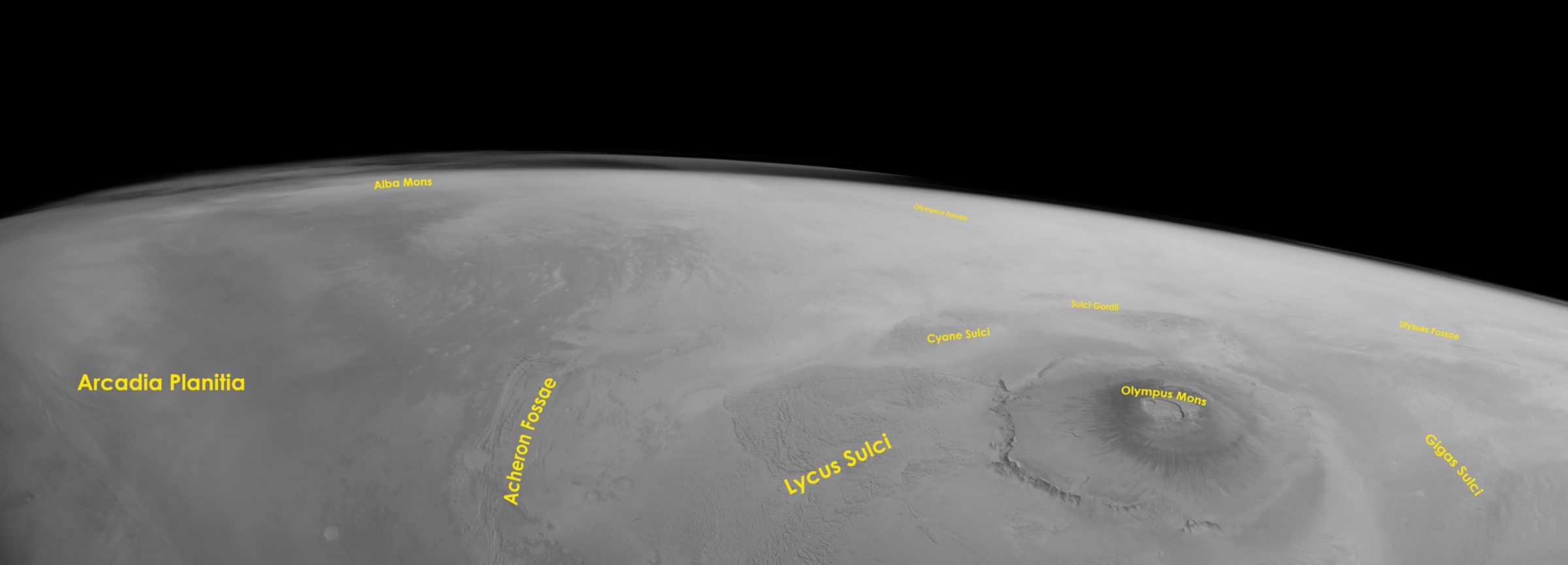
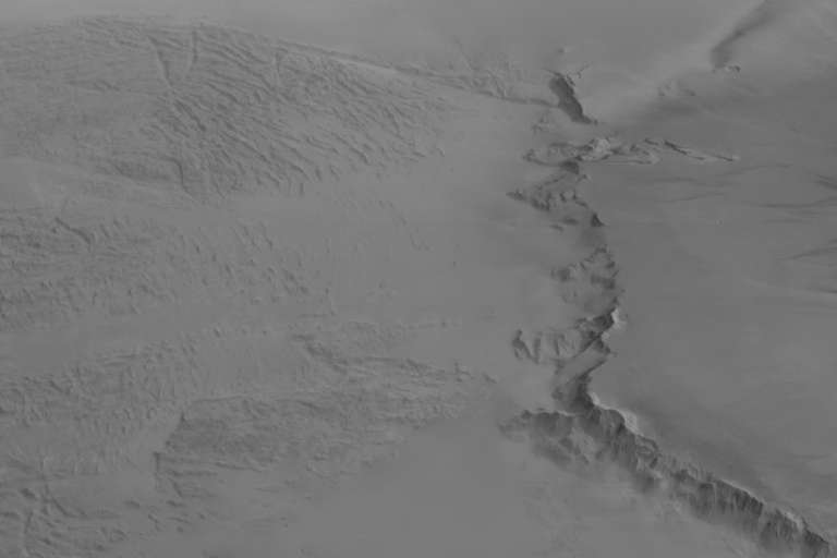
The ESA's Mars Express mission captured this amazing image of the northwestern Tharsis region on February 22, 2015 using its High/Super Resolution Stereo Channel Imager (HRSC) instrument. At the time, Mars Express was located over Amazonis Planitia, looking northwest.

There’s a lot to see in this image, so let’s take a tour! Here’s an image with the most of the visible named landmarks labeled:

The name “Olympus Mons” means “Mt. Olympus” in Latin, but surprisingly, the name wasn’t applied directly from the Greek Mt. Olympus. It comes to us in a slightly more roundabout way. The late 19th/early 20th century astronomer Giovanni Schiaparelli first noticed a feature in this area – a bright spot that remained present even during global dust storms. Even though he assumed it was a high altitude feature, he couldn’t be sure. He named it "Nix Olympica", meaning "Olympic snows". When it was confirmed to be a mountain by the Mariner 9 mission, scientists renamed it to Olympus Mons.
Olympus Mons is a hot spot volcano, much like the ones found in Hawaii. However, the size of volcanoes in Hawaii are limited by plate tectonics. The motion of the Pacific plate removes the Hawaiian volcanoes from the hot spots that formed them within a few million years. But Mars doesn't have plate tectonics. Instead, the volcanoes that form over hot spots remain in place, lava flows piling atop one another to the peaks ever higher.
In myth Mt. Olympus was the home and seat of power for the gods, making it an important site in Greek society. In much the same way, Olympus Mons rules over the surrounding landscape and exerts visible influence on its surroundings. A large region of terrain that looks like crumpled aluminum foil surrounds the mountain. This terrain, called the Olympus Mons aureole, was probably formed as the huge landslides that formed the scarps around the base of the mountain spread out around the surrounding plains. Some of the aureole has been buried by subsequent lava flows, mostly on the eastern side of the mountain. The largest area of this terrain was named Lycus Sulci, while portions isolated by lava flows received their own names.

At the northern edge of Lycus Sulci, the terrain changes dramatically. The elevation rises and the fissures are fewer but deeper. The landscape is different enough that it has received its own name – Acheron Fossae. Like Lycus Sulci, Acheron Fossae owes its existence to Olympus Mons, but the rugged terrain here formed through a different mechanism: isostasy.
A way to visualize isostasy is to try pushing an ice cube into a cup of water with your finger. When you push down on the ice, the water underneath has nowhere else to go, so the water level rises in response. The combined weight of all the lava flows that make up Olympus Mons pushes the underlying crust down into the mantle. The displaced mantle flows outwards and pushes up on the crust further away from the mountain. This upwards force buckled the crust along a zone of weakness, forming Acheron Fossae.

The area to the north of Acheron Fossae (the left side of this image) are the vast Arcadia Planitia lowlands. The relative lack of craters in the lowlands suggests resurfacing sometime in the last 3 billion years. The likely causes of resurfacing are probably a mix of ashfall from explosive eruptions to the southeast, periglacial activity, and windstorms filling in low areas with dust.
The volcano Alba Mons sits near the horizon at center-left. Although it is only one-third the height of Olympus Mons, Alba Mons is the largest volcano on Mars in terms of area. Its footprint is nearly the same area the contiguous United States. The reason Alba Mons sits lower is due to differences in the lava erupted. Some individual lava flows extend more than 300 km. This means that the flows were very runny, spreading out across the surface instead of piling upwards.

A region of high-altitude clouds in the Martian atmosphere appears on the horizon just to the left of Alba Mons. Those clouds are on the lee side of the mountain with respect to the prevailing winds in this region. They may be the result of air flowing up the side of the mountain, creating density waves that initiate water ice condensation in the upper atmosphere.
With that, our tour of this image is complete!
A quick note on image processing: HRSC is a pushbroom imager, and in normal mapping operations, the camera simply looks at the ground and records what’s passing underneath it. This produces images with a known geometry, which makes it possible to easily create scientifically accurate map projected images.
This particular image wasn’t taken in a normal mapping mode. Instead, it was designed to study seasonal changes in Mars’ upper atmosphere. To get the kind of images needed, Mars Express points towards the horizon and slowly spins the spacecraft in order to produce an image scan. This stretches the aspect ratio of the image (in this case about 15:1), as well as distorts the geometry of the image.
To correct this, I first had to figure out the aspect ratio of the image. From other images, I’ve figured out that circular craters near the horizon have an approximate 4:3 aspect ratio. With that information in hand, I can figure out how much I need to “destretch” the image. Once destretched, I can work out the geometric distortions by fine-tuning the stretch at different locations at the image.
This method isn’t great for qualitative analysis, but it does produce some pretty pictures that give you an idea of what Mars Express was seeing as it sailed over Mars!
Support our core enterprises
Your support powers our mission to explore worlds, find life, and defend Earth. You make all the difference when you make a gift. Give today!
Donate

 Explore Worlds
 Find Life
 Defend Earth

