Emily Lakdawalla • Mar 04, 2014
A new map of Mars from some pretty old data
I have often mentioned that the best global color map of Mars that we have is, surprisingly enough, based on Viking Orbiter data from the 1970s. Well, that best global color map has recently been improved. Last month I discovered that the United States Geological Survey had released a new digital map product: the Colorized Viking Mars Digital Image Model (MDIM) version 2.1. It's better than the previous version in two ways: positions of individual features are more accurate, and the color has been corrected. Both corrections were made with the help of the Mars Orbiter Laser Altimeter's terrific topographic maps of Mars. So now the registration between the best topographic map and the best color map is perfect. Here's the map, at reduced resolution.
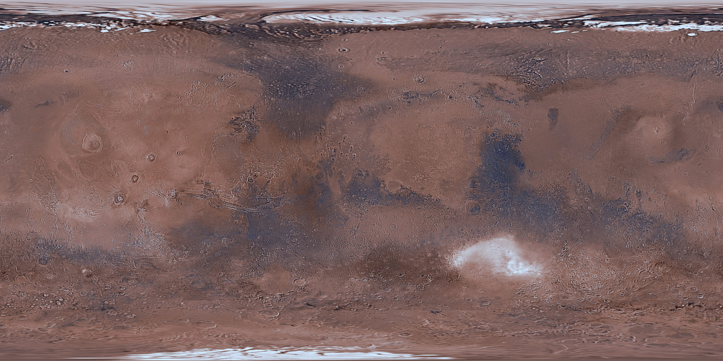
Thanks to Fred Calef for downloading the original 12-GB data set and producing this lower-resolution but still-awesome version for me. The USGS posted it in .cub format, which is the native format of their own geographic-reprojection software called ISIS.
It's gorgeous, although not perfect. For instance, there are clouds in Hellas basin (the white smudge south of the equator), and when you zoom way in to it, you do find some obvious seams. This is a product processed in a mathematically rigorous way, for scientific purposes, of a planet whose appearance changes over time, so seams are impossible to avoid. But it's still lovely when used for the right purposes.
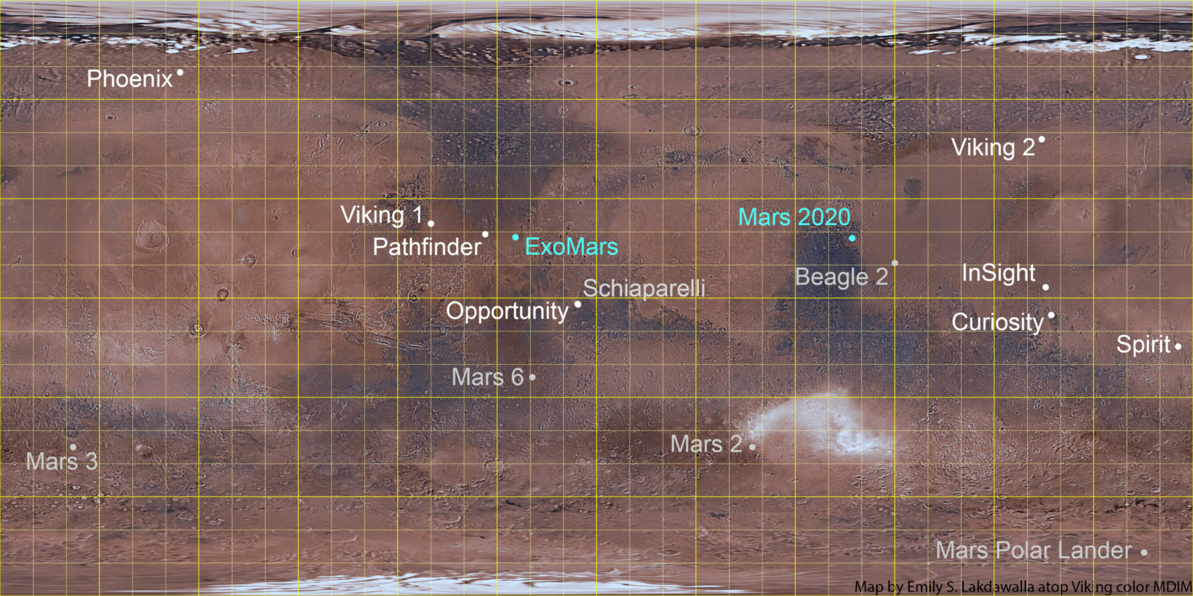
So, what is this new map product good for? One thing is serving as a base for global maps. So I've updated my map of Mars landing sites with this new base map:
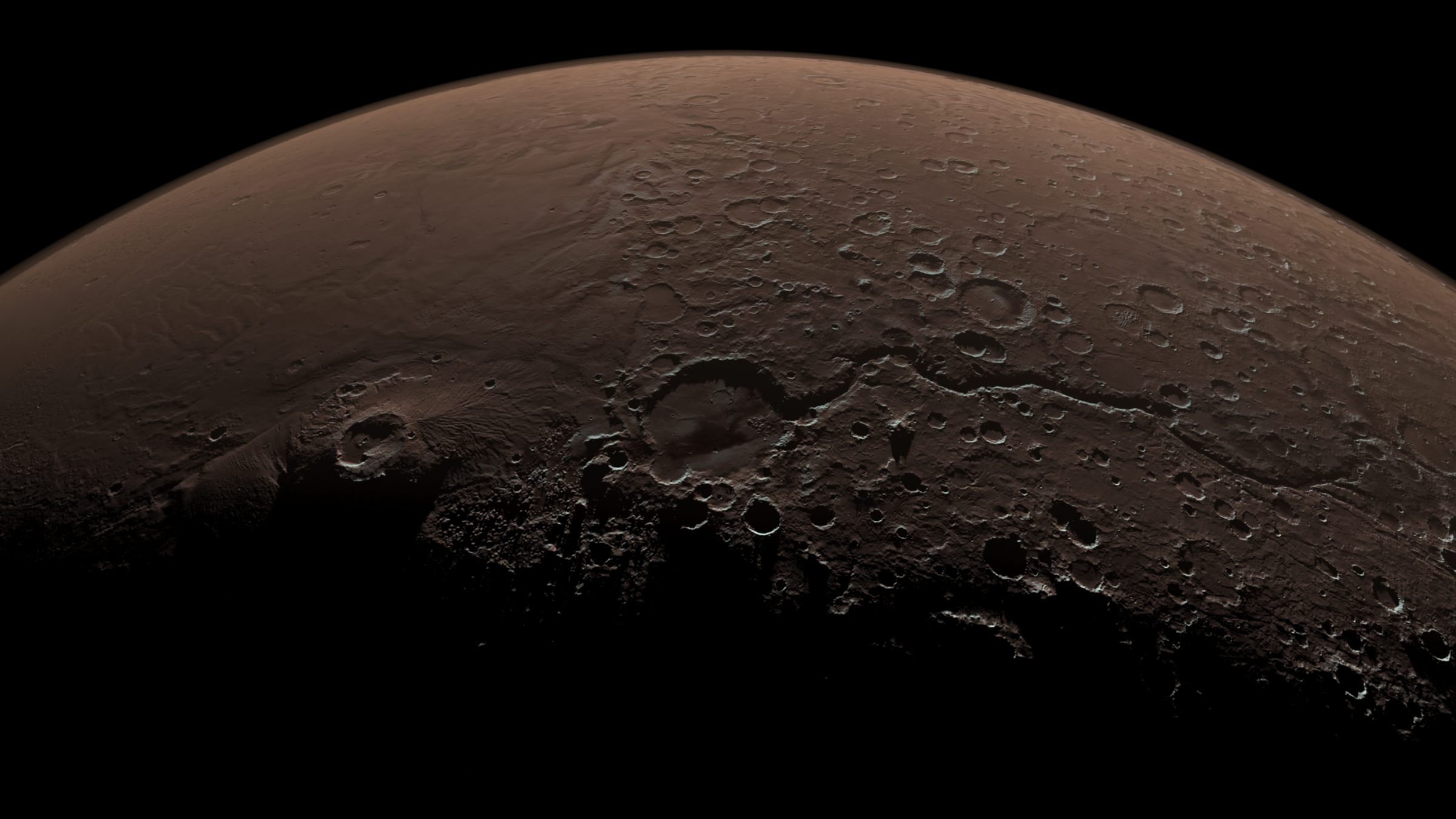
It's also super for producing simulated views of Mars from many perspectives, especially when used in combination with the global topographic data set. This is not work I can do myself, so I asked Doug Ellison at JPL if he'd seen the new map yet, and if he wanted to try playing with creating oblique global views like the "Daybreak at Gale crater" one that I have seen at the beginning of a gazillion slide presentations. To my delight, he thought that was a good idea, and made some really awesome new perspective views of different spots on Mars, so hopefully we will now see more variety in the opening slides of Mars sceince presentations!
My personal favorite is this view on Gusev Crater -- erstwhile home to Spirit's mission -- and the neighboring Apollinaris Mons:
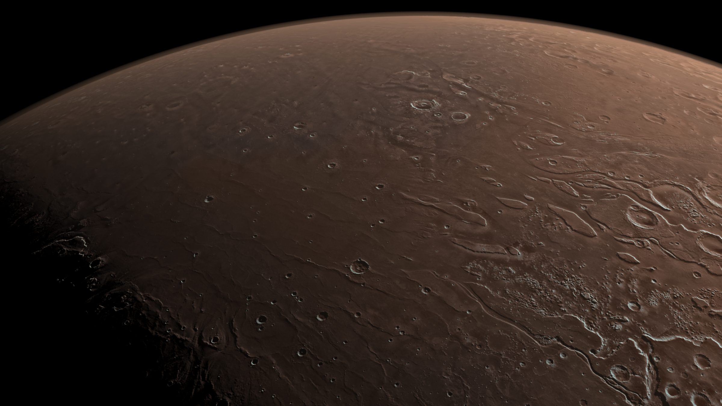
Here's a nice view onto some of Mars' outflow channels, which also happens to include the landing sites of Viking 1 and Pathfinder:
But we keep coming back to Gale; its central mound makes it so easy to spot from space, and let's face it, there are going to be lots of slide presentations about Gale in the years to come, so let's make them some more variety in title slides:
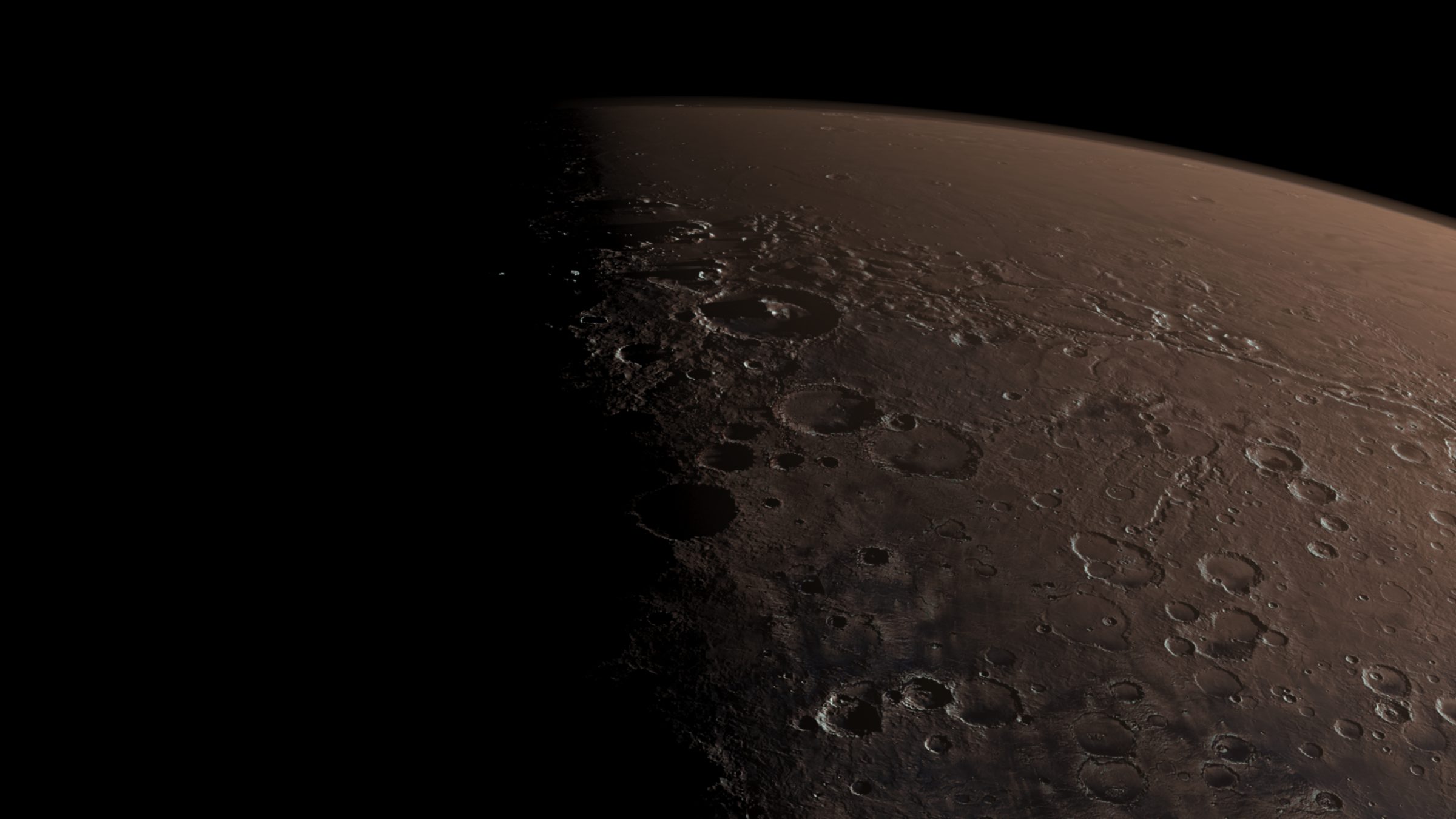
It's wonderful that, 40 years later, the data returned from the Viking mission is still valuable to scientists. Doug thought the same thing: "The data from older instruments doesn't become redundant, it becomes the backbone upon which each new instrument is targeted and its data correlated to." The same will be true for other missions that established the first complete surveys of neighboring worlds: like MESSENGER at Mercury, or Magellan at Venus.
Support our core enterprises
Your support powers our mission to explore worlds, find life, and defend Earth. You make all the difference when you make a gift. Give today!
Donate

 Explore Worlds
 Find Life
 Defend Earth

