Emily Lakdawalla • May 15, 2015
Unseen latitudes of comet Churyumov-Gerasimenko -- revealed!
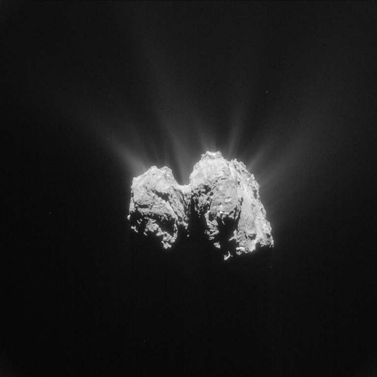
Every thing in the solar system spins, from the biggest planets to the smallest asteroids. And nearly everything that spins, spins at an angle to its orbit. Therefore, nearly everything in the solar system has seasons. Comet Churyumov-Gerasimenko is no exception. When Rosetta arrived there last year, it was summer in the comet's north. (I'd usually say "summer at the north pole," but with 67P's weird shape, does it have two north poles!?) Winter darkness covered the comet's south, leaving a large chunk of it invisible to Rosetta's cameras. The season has shifted since then, bringing sunlight to more and more of the southern hemisphere. As Mattias Malmer pointed out on Twitter, a recent Rosetta image has revealed a good part of that southern terrain to the public for the first time.

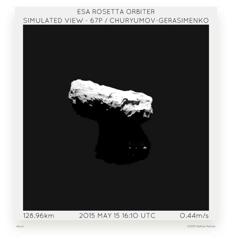
Mattias has been in the process of creating and improving a 3D model of the comet nucleus for some time, making a version available in his cool Rosetta Now website. I checked it just now, and look what an odd view of the comet Rosetta has at the moment!

Anyway, the new image fills in a gap in Mattias' model, which shows up as a smooth area in the left image below.
The last blanks on my model. Uncharted terrain revealed. Exploration at its finest! GO @ESA_Rosetta !! pic.twitter.com/23oLDv46Ej
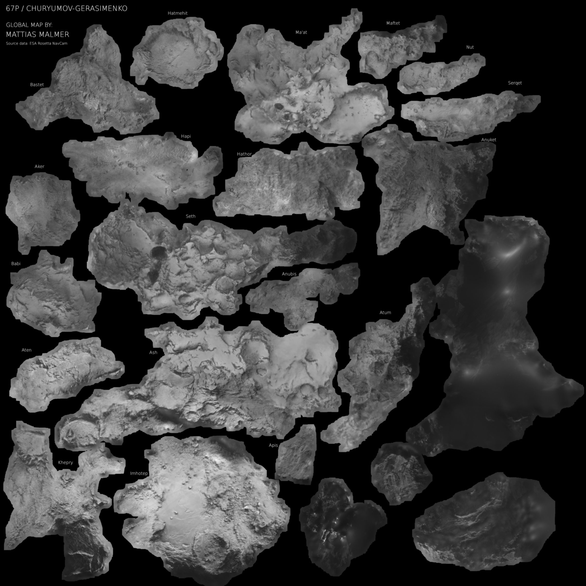
— Mattias Malmer (@3Dmattias) May 13, 2015Mattias recently published a new version of his shape model, much improved thanks to the bonanza of newly released Navcam images. His new model includes a global map of the surface to add to its realism. I thought the map alone was very cool; he has cut it along the boundaries that the OSIRIS image team drew among different cometary regions. I want to have this printed on fabric and try to assemble it into a soft model of the comet!

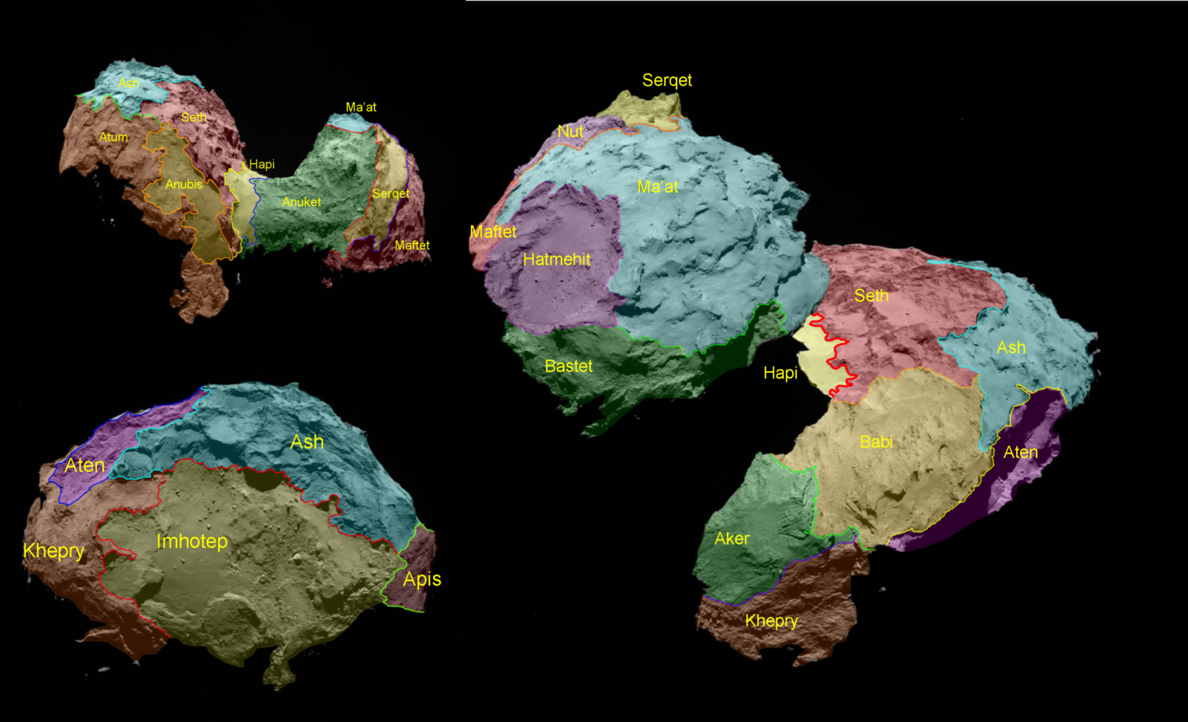
Here's a guide to those named regions. Keep up the good work, Mattias! And keep sending us great photos, Rosetta!

Support our core enterprises
Your support powers our mission to explore worlds, find life, and defend Earth. You make all the difference when you make a gift. Give today!
Donate

 Explore Worlds
 Find Life
 Defend Earth

