Emily Lakdawalla • May 15, 2014
Curiosity update, sols 610-630: Drilling work at Windjana
Finally, a new drill site! For the first time in nearly a year, Curiosity has put drill bit to rock and acquired a new sample of Martian material for her analytical instruments to chew on. The full-depth drill was achieved on sol 621. The new sample site is called Windjana, and is the fourth location from which Curiosity has sampled Mars, after Rocknest (sol 69), John Klein (182), and Cumberland (279). It's clearly a different rock from John Klein; the powdered tailings from the drill hole are substantially darker. It's amazing how well a thin coating of Martian dust obscures these color differences.
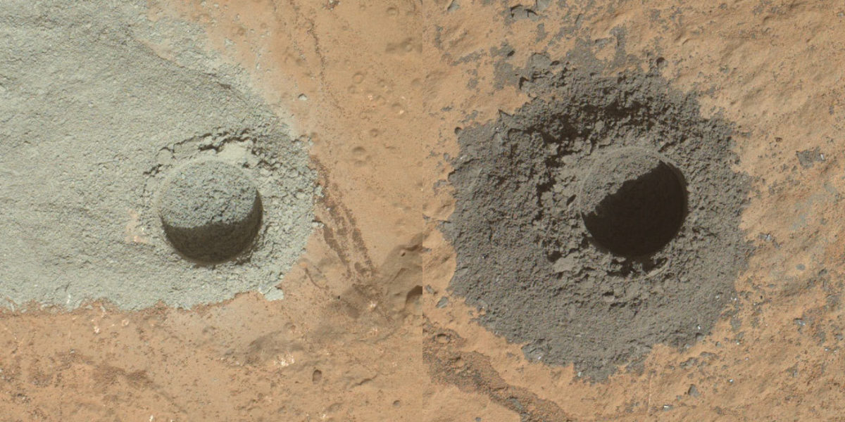
Here's how the drill site looked on sol 627. This is a mosaic of MAHLI images. They were taken in such a way that they can be swapped in for pictures taken as part of the massive self-portrait mosaic from sol 613.
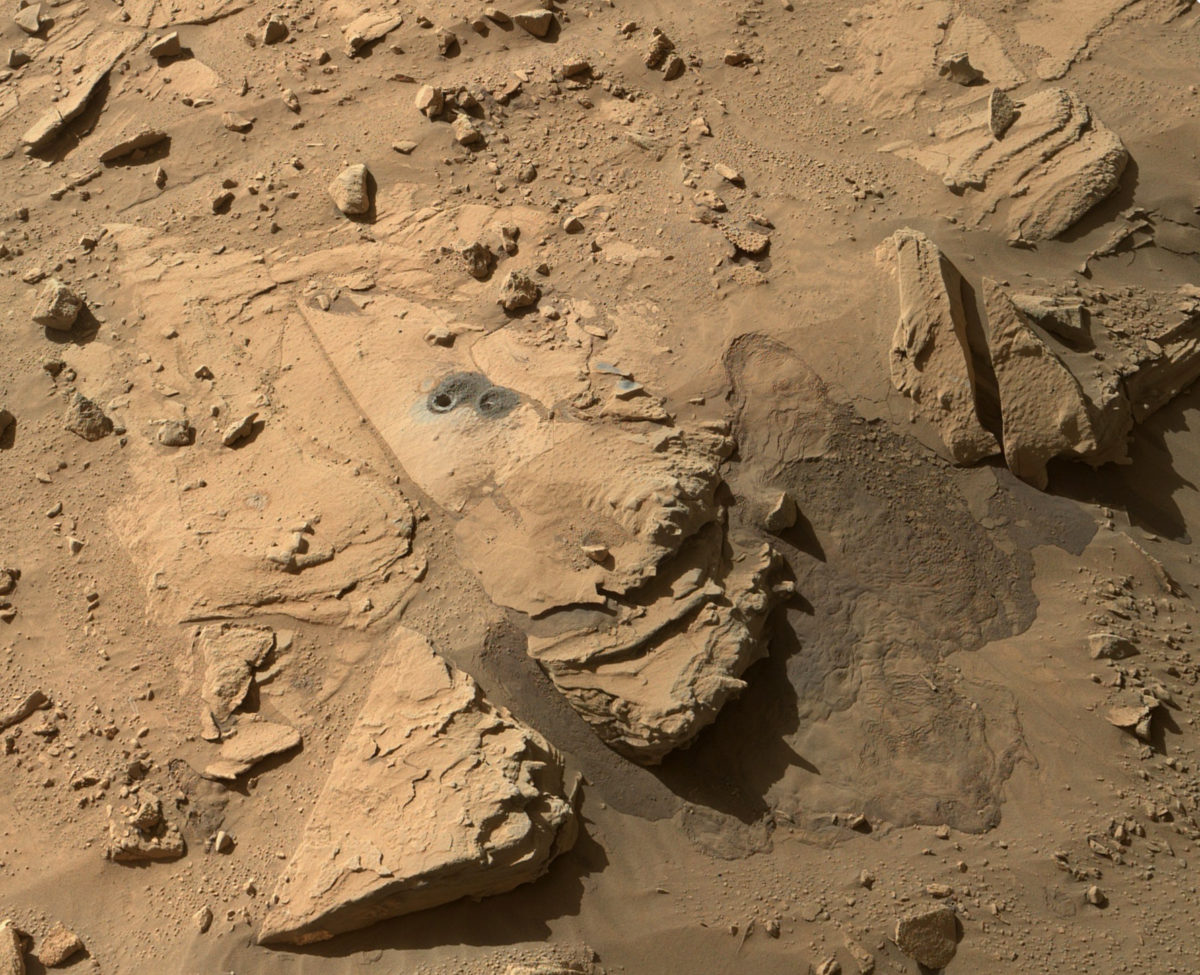
Here's a zoom view on the drill site, taken by MAHLI after sunset on sol 628; MAHLI has LED flashlights for such nighttime imaging. You can see the scorch marks from the Chemcam analyses down the drill hole. Pew pew!
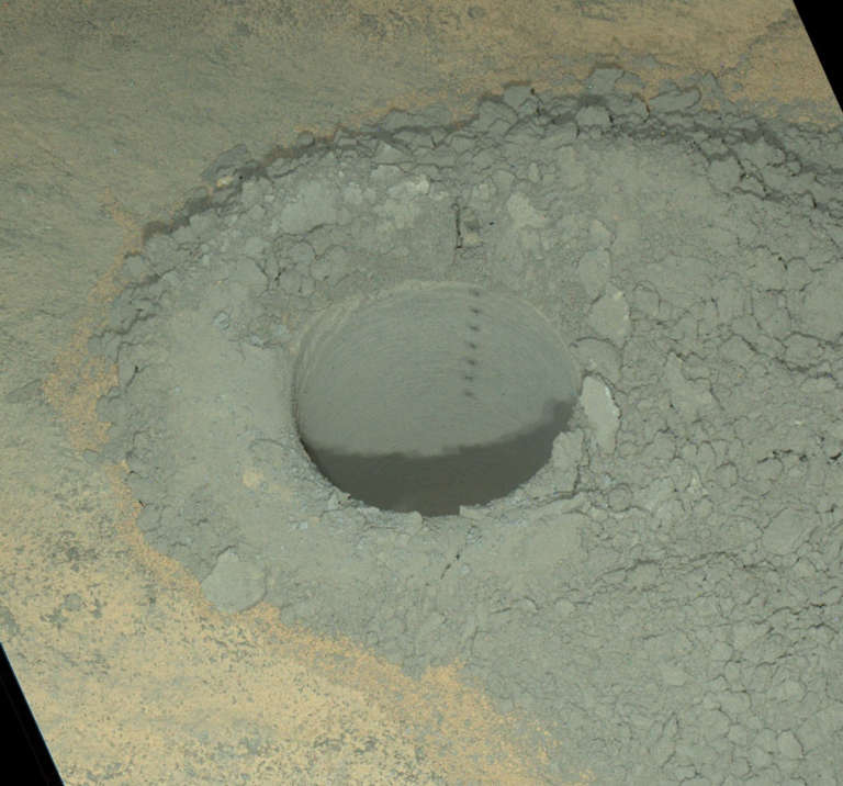
This was how I'd learned they successfully obtained a sample from Windjana:
Nice drill hole on#mars. @MarsCuriosity has.... pic.twitter.com/VAsQDkmC0d
— nagin (@nasa_nagin) May 6, 2014The sign taped to a cubicle in mission operations is only sort of a joke. Now that they have sample inside the CHIMRA sample handling system in the turret, it's a lot more complicated for the rover engineers to plan arm operations, because they have to manage how the powdered sample moves inside the turret as they rotate it to place the turret-mounted instruments in position. They will keep the Windjana sample in CHIMRA until they're sure they've performed all the analyses on it with SAM and CheMin that they want to -- unless, of course, they drill at the Kimberley a second time, in which case they'll have to spit the remaining Windjana sample out first.
From the time that they selected the drill location, to the time that they wrapped up work, took, in total, about three weeks. Here's how the whole process unfolded, as documented in Hazcam images. There are two things I love about this animation. First, before drilling, there is a "preload" step, where the arm pushes down on the drill site in order to brace the two prongs on either side of the drill against the rock and prevent slipping. This downward push exerts an upward force on the rover, so the rover lifts. But because the Hazcams are bolted to the rover, the camera lifts too. In the animation, it winds up looking like Curiosity is pushing Mars down! The other thing I enjoy is the cascading of loose sand during the two drilling activities. That stuff is near its angle of repose, and the powerful percussion of the drilling activity shakes it downhill. I made the animation small in order to keep its file size manageable; click to enlarge.
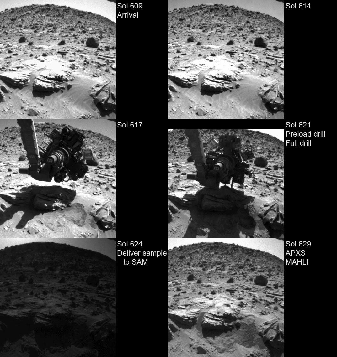
Here's a list of all the activities. For the most part, this list is based upon what I could deduce from looking at the raw images, because unfortunately Ken Herkenhoff has taken a break from blogging and there is only one very brief update from him covering this entire time period. Ken represents the public's only connection inside mission operations apart from rare JPL press releases; it's a big loss to public understanding of mission operations when he's too busy. (I'm begging you, Ken, please keep writing!!)
- Sol 609: Bump to the drill site
- Sol 610: Navcam and Mastcam imaging, including a full 360-degree Mastcam panorama.
- Sol 611: Concern about rover stability led them to postpone arm activities pending the receipt of further data, but they were okay to proceed the next day
- Sol 612: APXS Windjana, then brush, then MAHLI brushed site, then examine brush, then perform overnight APXS integration
- Sol 613: MAHLI self-portrait; pre-load test of arm on drill target
- Sol 614: Lots of targeted Mastcam and Chemcam observations of drill site
- Sol 615: MAHLI of mini-drill location, then mini-drill, then MAHLI of drill location, followed by Mastcam/Chemcam remote sensing work
- Sol 616: Nothing(??)
- Sol 617: Imaging of instrument turret, remote sensing (including massive 3D Mastcam mosaic)
- Sol 618: Imaging of instrument turret, remote sensing (including massive 3D Mastcam mosaic)
- Sol 619: Remote sensing (including massive 3D Mastcam mosaic)
- Sol 620: Remote sensing (including massive 3D Mastcam mosaic)
- Sol 621: Full drill at Windjana
- Sol 622: APXS of drill tailings; Chemcam drill tailings; APXS drill tailings overnight
- Sol 623: Sieve sample & deliver to CheMin (note: you can tell when there's been a delivery because they take photos of the inlet port before and after a delivery)
- Sol 624: Deliver sample to SAM
- Sol 625: Nothing(??) (Though I would venture a guess that this was a SAM cooking sol)
- Sol 626: Remote sensing, including ChemCam zaps down drill hole
- Sol 627: Thorough MAHLI characterization of drill hole & site; also MAHLI and APXS on "Stephen" site
- Sol 628: Remote sensing; MAHLI nighttime imaging
- Sol 629: APXS and MAHLI on "Stephen" site
- Sol 630: Depart
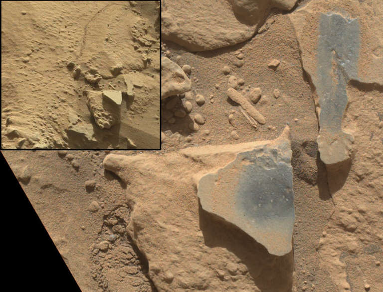
There's a funny sort of gap in the middle of the action, almost a week between the mini-drill on sol 615 and the full drill on sol 621, beginning with a skipped sol (which is sometimes an indicator of activity with SAM), and then checkouts of the turret combined with four solid sols of remote sensing, acquiring what will be a truly awesome 3D Mastcam mosaic of the site (I haven't checked, but it seems big enough to be the full 360 degrees). But once they drilled last Monday, they've worked pretty rapidly at sample deliveries and initial analysis, taking a little extra time to analyze a second spot next to Windjana that Ashwin Vasavada told me is named "Stephen." This photo shows you how effective the ChemCam laser can be as a dust removal tool. It looks a lot like Stephen has been brushed, but if you look through all the photos you'll see they never put the brush on Stephen, only MAHLI and APXS. It's been dusted off by the blast of vapor that spreads outward from the ChemCam laser shot points. It makes me wonder if you could do analysis of rock colors and how they relate to composition by using ChemCam as a remote rock duster and taking multispectral Mastcam-100 images after ChemCam shots....
Last night, Curiosity left Windjana.
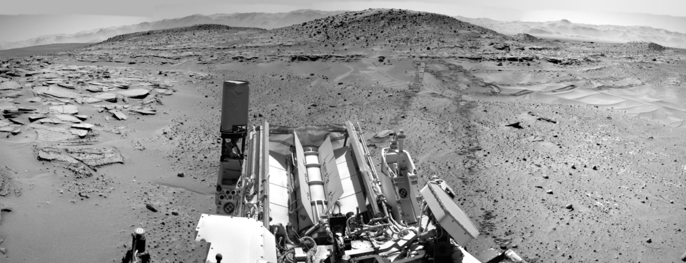
I can't say whether this means they're done at the Kimberley or not. They could still drill one of the other two rock units in this location. On the other hand, they are under a lot of pressure to keep driving toward Mount Sharp. I suppose it depends upon what the team sees in the early CheMin and SAM analyses.
EDIT: JPL has now announced that "The rover team has decided not to drill any other rock target at this waypoint. In coming days, Curiosity will resume driving toward Mount Sharp, the layered mountain at the middle of Mars' Gale Crater. The rover is carrying with it some of the powdered sample material from Windjana that can be delivered for additional internal laboratory analysis during pauses in the drive."
Some of you may be wondering when we are going to get the science results from the Kimberley: what is in the stuff that they drilled out of Windjana? I counsel patience. There are two things that control when we hear about the science from the Curiosity mission: the timing of scientific meetings where they present the results to their peers, and the timing of public release of Curiosity data. In general, the Curiosity science team is forbidden from sharing and discussing scientific data from the mission until after the data are publicly available. Of course, JPEG versions of images are available instantly, but they're not science data; the science data from all instruments are released roughly 4 to 8 months after they're acquired, in batches three times a year. This has caused very awkward conversations between me and mission scientists at science meetings. Because I know what the rover has been doing (because I can see what it has been doing in the released raw images), and the scientists know that I know, they know they can discuss rover actions that are obvious in photos, but they can't discuss science, and there are lots of pauses in conversation and there is much staring off into space as they think about what they're allowed to say.
So far, data have been released through sol 449; Curiosity was at Cooperstown then. Drilling at Windjana happened on sol 621, and the first CheMin and SAM analyses happened on sols 623 and 624. SAM analysis will likely continue for weeks, as Curiosity continues chewing on samples while on the road. Here are the upcoming dates of meetings and data releases. As you can see, the next data release covers up to just before they got to Windjana. So the science team is not allowed to discuss the results from the drilling campaign at the Kimberley until December unless the mission leadership chooses to discuss it earlier. But the good thing about that is that the next data release will cover enough time after Windjana that it should cover all the SAM analyses that will be done on the newly drilled sample. So although we could hear some science results from Windjana earlier, we'll definitely hear about them at the American Geophysical Union meeting.
- July 14-18: Eighth International Conference on Mars, Pasadena, CA, USA
- August 1: MSL data release 6: sols 450-583 (up to the north edge of the Kimberley)
- August 2-10: COSPAR, Moscow, Russia
- September 7-12: European Planetary Science Congress, Cascais, Portugal
- October 19-22: Geological Society of America Annual Meeting, Vancouver, Canada
- December 5: MSL data release 7: sols 584-707
- December 15-19: American Geophysical Union Fall Meeting, San Francisco, CA, USA
Support our core enterprises
Your support powers our mission to explore worlds, find life, and defend Earth. You make all the difference when you make a gift. Give today!
Donate

 Explore Worlds
 Find Life
 Defend Earth

