Emily LakdawallaSep 03, 2013

Looking back at Mariner images of Mars

Bruce Murray was an early advocate for the inclusion of cameras on planetary spacecraft. As a tribute to him, I thought I'd take a look at a few of the images from the early Mariner missions to Mars. Like many other gnarly old data sets, the Mariner images are being revisited by the community of amateur -- and professional -- space image processors; a lot of work has been done on Mariner data by amateurs Ted Stryk and Piotr Masek as well as planetary cartographer Phil Stooke.

A couple of years ago I wrote a blog post about pre-Space-Age photographs of Mars. Here is some of the best photographic data available on Mars before the Mariners got there, a page from Earl C. Slipher's Mars: The Photographic Story.
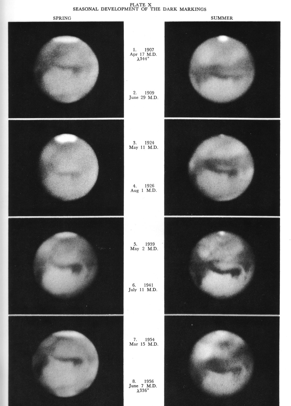
Seasonal developments of the dark markings on Mars, 1907-1956
Seasonal developments of the dark markings on Mars, 1907-1956 Slipher's caption to this image: Undoubtedly the outstanding revelation of the photographs is the undeniable record of seasonal darkening of vast blue-green regions in Martian summer. In 1907 we see Sabaeus Sinus standing alone in the Martian spring, but in the summer of 1909, it is seen darkly flanked by the great Pandorae Fretum in the form of a broad, dark band covering millions of square miles. Obviously if such a development occurred only once, it might be considered merely a strange coincidence. However, in 1924, with the planet again in its early spring, we note that the dark band has completely vanished into ochre desert, leaving the weak Sabaeus Sinus standing quite alone again. Also in the summer of 1926 we note that the great dark band has returned once more as a complete replica of what it was in 1909. In 1939, the dark Pandorae Fretum has disappeared again and Sabaeus Sinus stands alone, but in 1941 the summer darkening is shown returning over the Pandorae, although not to the full extent of the previous examples. In 1954, the customary winter-spring aspect is also evident. In 1956, during late Martian spring, save for a partial veiling due to haze and clouds from the widespread dust storm over most of Mars at the time, we see the customary darkening of the Pandorae Fretum region just as it has appeared in the other summer photographs. Although not described in connection with the foregoing series of seasonal changes, the Hellespontus, Mare Ionium, Mary Tyrrhenum also were partly involved. In a similar manner the series of dark regions in the southern hemisphere of the planet undergo a summer darkening. However, the Pandorae Fretum stands so completely alone on the planet that its appearance and disappearance with the seasons is most obvious and the fact that it completely vanishes into the ochre desert in winter makes it by far the easiest seasonal change to recognize.Image: Earl C. Slipher

Here's another somewhat astonishing pre-Mariner view of Mars. This map, composed from photographic data by the U. S. Air Force, was the base map used to plan the Mariner 4 Mars imaging sequence.
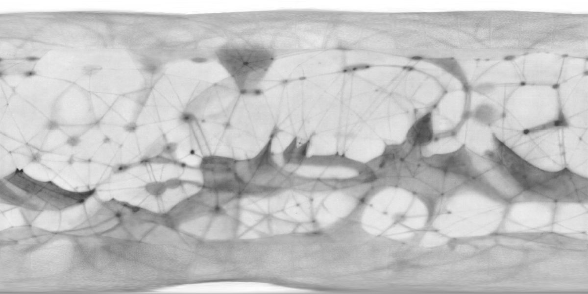
United States Air Force map of Mars from 1962
United States Air Force map of Mars from 1962 This map of Mars, produced from telescopic observations by the United States Air Force, was used for planning the Mariner 4 flyby mission, the first successful Mars flyby. The original map has been processed to remove grids and names and reprojected into a simple cylindrical map projection, making it easier to compare to modern maps. The dark albedo markings on this map are linked by straight lines, the famous "canals," the idea of which had generally been abandoned by most planetary astronomers by 1962 but which remained in this map as something of an anachronism.Image: USAF / Phil Stooke

Compare that to the view of Mars that we had achieved after the Mariner 6 and 7 flybys in 1969. The maps above and below were assembled by Phil Stooke; for more Mars map fun, read this 2009 blog entry about Phil's work on global Mars maps from many different spacecraft.
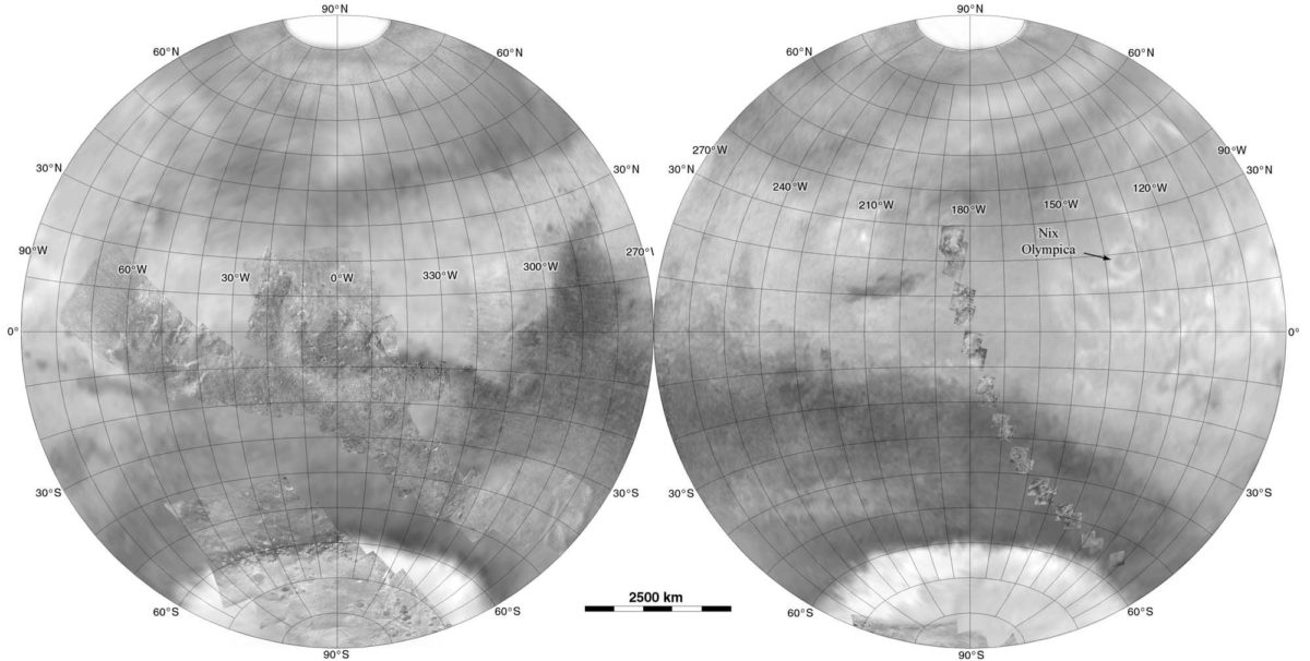
Mars as it was known after the Mariner 7 flyby
Mars as it was known after the Mariner 7 flyby This map represents the best extant imagery of Mars following the 1969 flybys of Mariner 6 and 7. Most of the globe was covered with low-resolution images taken by Mariner 7 as it approached Mars, with the exception of a small area surrounding the north pole (which was in winter darkness during the flybys), so has been filled in here with data from a 1962 U.S. Air Force map based on telescopic observations. Superimposed on the far-encounter data are the many small frames captured by Mariner 4 (right side) and the near-encounter images captured by Mariner 6 and 7 (left side).Image: NASA / JPL / Phil Stooke

Here's the Mariner 4 image catalog, which I posted last year. The most obvious features in these images are craters -- Mars was clearly old, perhaps more Moon-like than had been expected. Bruce Murray talked about that in an interview printed in a 2001 issue of The Planetary Report.
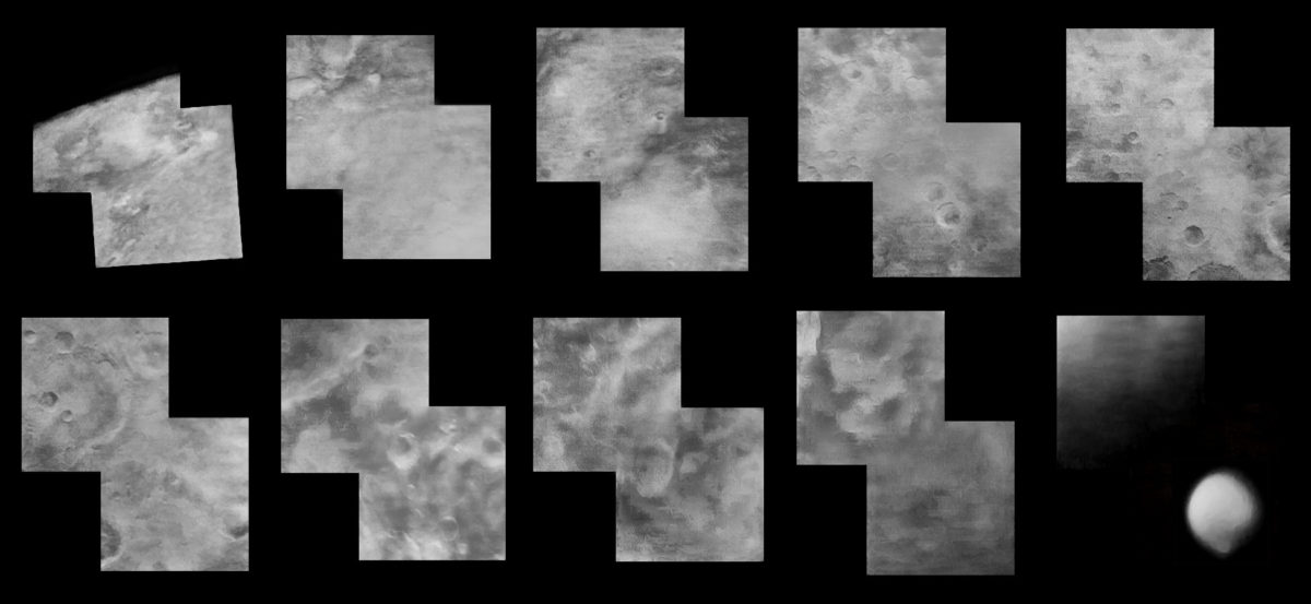
The Mariner 4 image catalog
The Mariner 4 image catalog A little commemorative compilation of the Mariner 4 images, along with the nearest decent context image of the correct hemisphere in the International Mars Patrol collection in the lower right hand corner.Image: NASA / JPL / Ted Stryk

Here is a neat set of Mariner 6 images, captured over about two days as the spacecraft approached Mars. It must have been pretty great to see these photos come in, one at a time, transmitted in real time as the spacecraft drew closer.
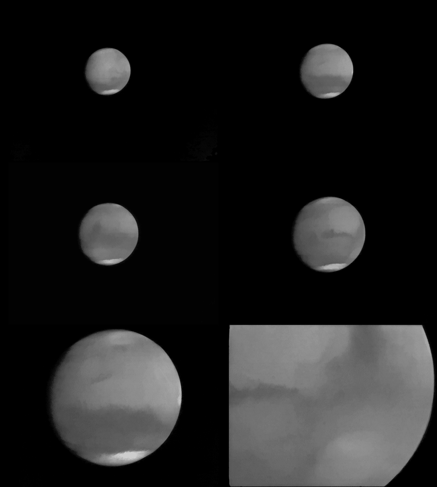
Mariner 6 approaches Mars: "far-encounter" images
Mariner 6 approaches Mars: "far-encounter" images As Mariner 6 approached for its Mars flyby, it captured 49 frames of the planet swelling in its forward view. The animation covers a 41-hour period before closest approach on July 29 to 31, 1969.Image: NASA / JPL / processed by Ted Stryk / animated by Emily Lakdawalla

Mariner 6 near-encounter images covered some maddening-looking terrain that the scientists called "chaotic terrain," a term that has more or less stuck (it's called "chaos terrain" now). "They realized there was something else there, but they couldn't figure out what," Ted Stryk said.
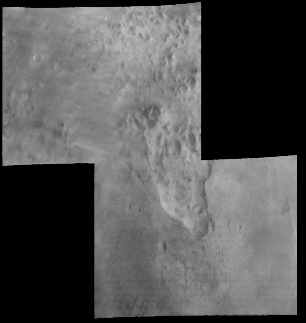
Mariner 6 view of chaos terrain on Mars
Mariner 6 view of chaos terrain on Mars This two-frame mosaic covers a type of terrain not seen before on another planet.Image: NASA / JPL / Ted Stryk

There are a lot more great Mariner images of Mars on Ted Stryk's website and at unmannedspaceflight.com. There's untapped potential to see some really lovely views of Mars -- ultimately made possible by Bruce Murray's stubborn insistence that it would be ludicrous to send a spacecraft to Mars and not include a camera.
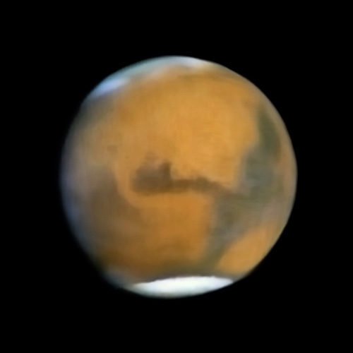
Mariner 7 approach image of Mars (reconstructed)
Mariner 7 approach image of Mars (reconstructed) Mariner 7 had a color camera, but its image data is sparse; only one in every 7 data columns was transmitted. This global view was made by stacking images and interpolating missing data.Image: NASA / JPL / Ted Stryk

Take action for space exploration!

Give today to have your gift matched up to $75,000.

Donate